
|
|
Mountain/Rock |
|---|---|
|
|
43.78020°N / 71.5297°W |
|
|
1289 ft / 393 m |
|
|
Overview
These classic two peaks (not to be confused with Rattlesnake Mountain in Rumney) just north of Squam Lake in central New Hampshire are one of the biggest destinations in southern New Hampshire. The two peaks are loaded with trails, most of which are class 1 and are less than two miles round trip. This is another of a number of New Hampshire mountains, which has killer views with little effort.
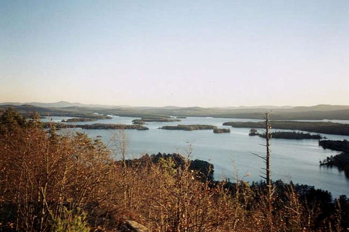
West Rattlesnake is the more popular mountain of the two because it is ascended form the very easy and extremely popular Old Bridle Path. This easy class 1 trail, which stays at gradual to moderate grade throughout, is famous for having hundreds of people on it at one time. It can be also accessed by the shorter and steeper class 1 Ramsey Trail, which has a completely different feel from the Old Bridle Path. The views from the cliff top of Squam Lake are amazing though and a camera on this trail is an absolute necessity.
East Rattlesnake, the higher mountain of the two is not as popular due to the fact that it is a little less easy to summit and the views are not as impressive. Out of the two mountains though East Rattlesnake is the better mountain for solitude. It can be summit via the moderate grade class 1 Butterworth Trail. Best views from the summit are actual just a few hundred yards to the west of the actual summit.
Getting There
VIA OLD BRIDLE PATH: From I-93 get of Exit 24 and head east through the town of Ashland. Stay on the road and take 26 east to Holderness. At about 2 miles you will at the town center of Holderness. Make a left onto Route 113 and head roughly 10 minute on the road. there will be parking 5 miles on your left. The Old Bridle Path will be across the the street.
VIA RAMSEY TRAIL: From I-93 get of Exit 24 and head east through the town of Ashland. Stay on the road and take 26 east to Holderness. At about 2 miles you will at the town center of Holderness. Make a left onto Route 113 and head roughly 10 minutes on the road. Make a right on Pinehurst Road. The Ramsey Trail will be 0.7 miles on the left.
VIA COL TRAIL: From I-93 get of Exit 24 and head east through the town of Ashland. Stay on the road and take 26 east to Holderness. At about 2 miles you will at the town center of Holderness. Make a left onto Route 113 and head roughly 10 minutes on the road. Make a right on Pinehurst Road. The Col Trail will be 0.9 miles on the left.
VIA BUTTERWORTH TRAIL:From I-93 get of Exit 24 and head east through the town of Ashland. Stay on the road and take 26 east to Holderness. At about 2 miles you will at the town center of Holderness. Make a left onto Route 113 and head roughly 12 minutes on the road. Make a right on Melcalf Road. The Butterworth Trail will be 0.7 miles on the left.
Red Tape
There are no fees on any of the trails.
When To Climb
You can hike this mountain at any time of the year. I would recommend though snowshoeing it in winter because this mountain is jammed with people during summer. Also this mountain is incredible easy to snowshoe if you are taking the Old Bridle Path. The Ramsey Trail is much steeper and crampons are highly recommended. All the other trail can be accessed by either.
Camping
Camping is not prermitted on this mountain.
Mountain Conditions
Here are two websites that will provided you the best information on conditions in the White Mountains.
Appalachian Mountain Club
Current Trail Conditions
Summit Picture Log
Post your summit mugshot here.