

|
|
Mountain/Rock |
|---|---|
|
|
40.77000°N / 111.798°W |
|
|
7143 ft / 2177 m |
|
|
Overview
Although the USGS maps label this peak as Mount Wire, the name Big Beacon is the more commonly known name for this mountain. The name Mount Wire comes from the Salt Lake City Policeman Lester Wire, who invented the traffic light back in 1912.
Mount Wire is one of the prominent foothill peaks due east of downtown Salt Lake City. The peak was easily recognized by the two large reflector panels just south of the summit, used for transmitting telephone signals between Salt Lake and Park City, but they were removed in 2013. Atop Mount Wire is an old airway beacon, which you can climb should you desire an extra 25 feet of elevation.
While Mt. Wire is a relatively low elevation peak, it is an outstanding spring hike of over 2,000 vertical feet with incredible views in every direction, rampant wildflowers, and wildlife that includes the occasional rattlesnake or mountain lion. In most years the peak can be hiked free of snow in April, and is an excellent “tune up” for the bigger mountains.
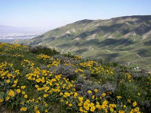 Mt. Wire (Big Beacon) from Dale/Perkins Ridge in late May.
Getting There
The two most popular trailheads for Mt. Wire are Georges Hollow, and This is the Place Heritage Park.
Georges Hollow Trailhead
Take I-15 4th south exit and continue east through downtown, up past the University of Utah, and turn left (east) on Wakara Avenue. Follow this up past several buildings to the end of the road. Turn right on Colorow Road and go south. There is almost immediately a trailhead that accesses the Bonneville Shoreline Trail, but the better trailhead is a little further down the road (marked with a sign), just before the Huntsman building. Park along either side of the road.
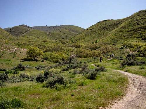 Near the Georges Hollow Trailhead.
This is the Place Heritage Park Trailhead
Take I-15 4th south exit and continue east through downtown, up past the University of Utah, and turn left (east) on Sunnyside Avenue. Continue past Hogle Zoo and This is the Place Heritage Park, and park at the trailhead immediately east of the Park, there is a large trail sign here, and parking for about 10-15 cars.
 Near the Heritage Park Trailhead.
Routes Overview
The routes from Georges Hollow and This is the Place Heritage Park are the only two routes commonly used.
Georges Hollow
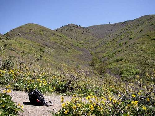
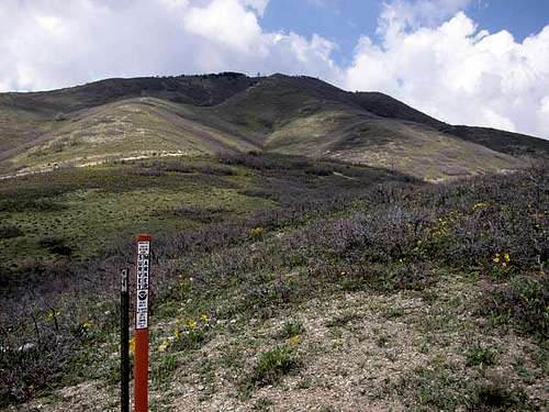
This is the most scenic route on the mountain. There is some route finding involved. The trail is about 2 miles each way with 2140 feet elevation gain. See the route page for details.
 The Georges Hollow Route.
This is the Place Heritage Park
This is the shortest route on the mountain. It is exposed to full sun for the entire distance. This is also the route most likely to be snow free in early spring. There are a few variations, all the approximate same length. The trail is about 1.5 miles each way with 2140 feet elevation gain. See the route page for details.
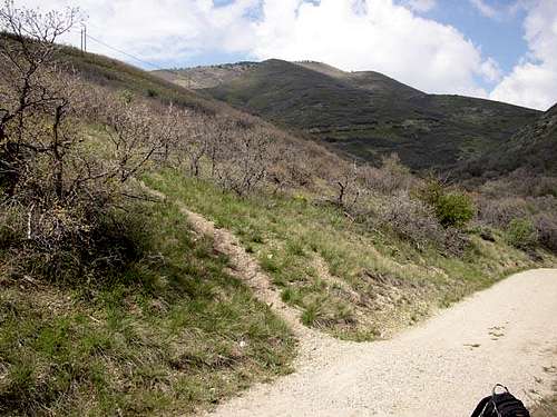
 The south ridge from near the trailhead.
There is also an old 4wd road that accesses the ridge east of Mount Wire, but it starts on private land.
Red Tape
There are no permit requirements for either route. Be careful not to trespass at This is the Place Heritage Park. As with most foothill peaks in the Wasatch, and Salt Lake City in particular, trails are rampant, and you can expect to do some back-tracking the first time you do these hikes.
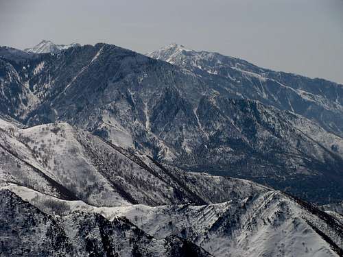 Thunder Mountain, Mount Olympus, and Lone Peak from the summit of Mount Wire.
When To Climb
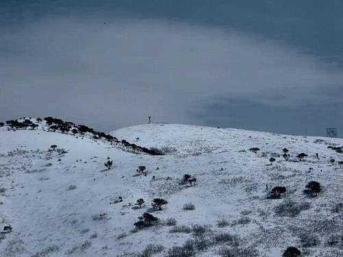
Spring and Fall are best, as the low elevation and southern/western exposure makes a summer hike very hot. Dry spells in winter also make the hike possible in some years. Only for part of the winter and after snowstorms is there usually enough snow for skiing and snowshoeing.
 Mount Wire in late May.
Camping
Camping is allowed in the backcountry, but the routes up Mount Wire are short and there is no water unless there is still snow around. For the most part, this is a day use mountain, though at night there would be a good view of the city lights from the summit.
Mountain Conditions
CLICK HERE FOR MOUNT WIRE WEATHER FORECAST
Weather and climate data for Parleys Summit at 7585 feet elevation is below. *SNOTEL Data 1985-2017. Expect similar conditions on the summit of Mount Wire.
| MONTH | AVE HIGH | AVE LOW | REC HIGH | REC LOW | AVE PRECIP (in) |
| JAN | 35 | 19 | 58 | -14 | 3.6 |
| FEB | 38 | 20 | 62 | -19 | 3.4 |
| MAR | 45 | 25 | 69 | -6 | 4.0 |
| APR | 50 | 30 | 74 | 4 | 3.6 |
| MAY | 58 | 38 | 83 | 15 | 2.9 |
| JUN | 69 | 47 | 94 | 24 | 1.7 |
| JUL | 77 | 55 | 96 | 35 | 1.0 |
| AUG | 76 | 53 | 95 | 33 | 1.3 |
| SEP | 67 | 45 | 91 | 21 | 2.3 |
| OCT | 54 | 36 | 78 | 3 | 3.1 |
| NOV | 42 | 25 | 68 | -9 | 3.8 |
| DEC | 34 | 18 | 61 | -12 | 3.7 |
Fleshj27 - Apr 3, 2017 2:06 am - Voted 10/10
Relectors goneLast time I climbed mt wire they had removed the reflectors...now the only thing up top is a fire watch chair atop a 20 foot ladder.
Scott - Apr 3, 2017 11:29 am - Hasn't voted
Re: Relectors goneYes, it was mentioned on the page. They were removed in 2013.
Fleshj27 - Apr 10, 2017 4:43 pm - Voted 10/10
Re: Relectors goneDidn't see that, Need to check my reading glasses! Again.