

-
 34080 Hits
-
 78.66% Score
-
 11 Votes
|
|
Mountain/Rock |
|---|---|
|
|
48.91200°N / 122.221°W |
|
|
3430 ft / 1045 m |
|
|
Overview
Sumas Mountain is a broad and prominent landmark near Bellingham, WA. The mountain serves mainly as a good training climb, or a little more obscure hiking experience. Though only a 1,000 meter peak the hike is surprisingly strentuous* but highly rewarding. Close proximity, year-round access, beautiful veiws, and lonely trails make Sumas Mountain one of the best kept secrets in Whatcom County.
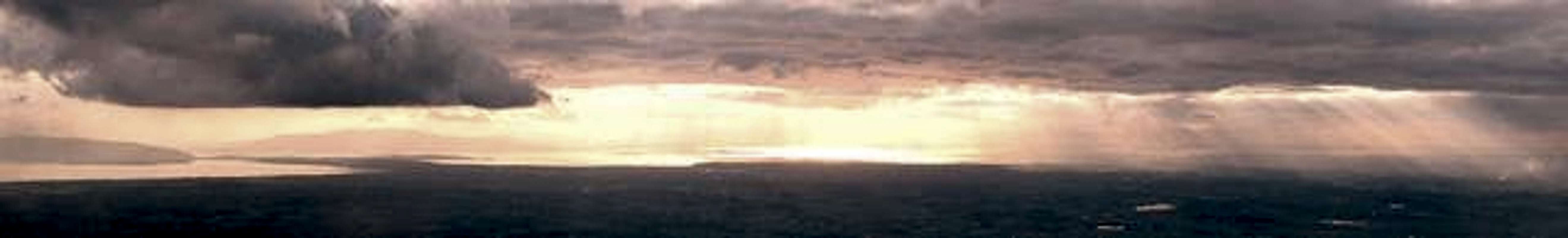
The summit is a truly expansive vista, it ranks 57th in WA with 2881 ft of prominence. Views of the lowlands are spectacular including the Vancouver and the San Juan Islands, the Coast Range in Canada, Mt. Baker and the Mount Baker Byway Mountains, the Fraser River Valley, Bellingham Bay, Bellingham proper, and Ferndale.
Sumas mountain is a maze of trails. Some lead to private property, some are simply game trails, a couple lead to the summit, and others lead to nowhere. It is easy to get lost, but not difficult to find the right trail, please be respectfull of private property. The correct route (with one variation) can be found in the route section.
Sumas Mountain is owned by the Department of Natural Resources and is under constant threat of logging. It has been logged several times in the past. Small sections are also owned privately. Give thanks to the hard work of volunteers, mostly local landowners, who maintain public trails and provide us with this receation opportunity. Still Sumas Mountain needs protecting, come enjoy this local gem while it lasts and voice your opinion about its future.
*With the right vehicle it is possible to drive to the top of Sumas Mountain. The road is regulated by the DNR and is in poor shape in some sections.
 |  |  |  |
Getting There
- Take exit 255 off I-5. Head East on Hwy 542 (Sunset Drive)
- After 5 miles, turn LEFT onto Everson-Goshen Road
- Follow this road into Everson (through 2-3 stop signs)
- Take a RIGHT on South Pass Rd. (which is also hwy 9) and follow for about two miles. Look up, see the big hill? That's where you're going.
- Just before South Pass Rd. curves left turn RIGHT onto Sealund Rd. (it's a dead end)
- The trailhead is located at the end of the road on the left, you'll see a sign that says "Gold Mine Trail"park directly accross from the trailhead
Please be respectfull of private property, and don't be afraid of the dog, he's a total softy.
Red Tape
- No Permits
- No Fees
***Be carefull where you park, please respect private property!***
When To Climb
All year but best March-November
In winter you may encounter a considerable amount of snow, Check Snow Level to get an idea of conditions, snowshoes may be helpfull. No avalanche hazard, but route finding could be difficult.
Camping
You could camp at Friendly Cabin (which has a large horse pen as well), but it's mainly a dayhike.
Gold Mine Info
The Gold Mine is not much to look at. I wouldn't dare go inside, but it's up to you. The Mine was built in the early 20's and was "salted" with gold dust in an apparent real estate scheme.
John Friendly helped build the Friendly Cabin and it is occasionally used for horse-back riders in the area.
Save Sumas Mountain!
This land really should be set aside for conservation. It is owned by the Department of Natural Resources, they are constantly batting around with the idea of logging it (aka the clearcut on top). This is truly spectacular land, please contact your congressman/woman and tell them how you feel.