
|
|
Mountain/Rock |
|---|---|
|
|
46.80700°N / 121.811°W |
|
|
6937 ft / 2114 m |
|
|
Overview
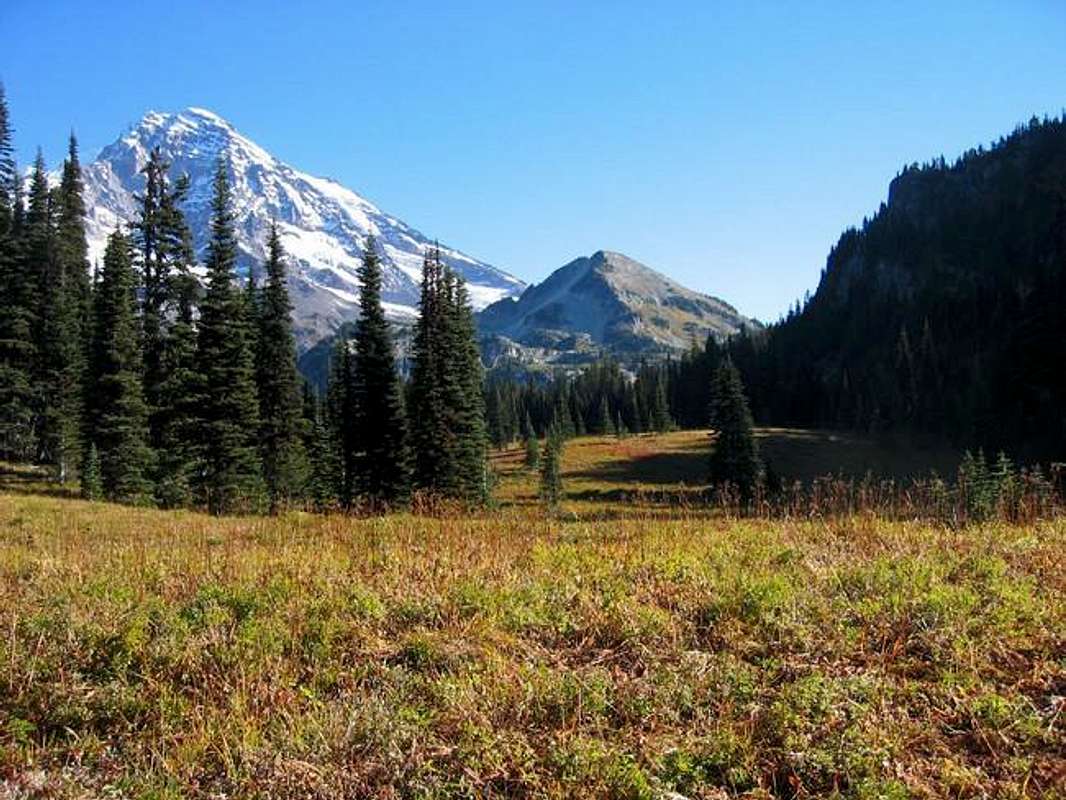
Pyramid is a prominent satellite peak located at the base of the Success Cleaver on the south side of Mt. Rainier. Pyramid has great unobstructed 360-degree views from the summit: you can practically reach out and touch Mt. Rainier. On a good day St. Helens, Mt. Hood and Mt. Adams are all visible. It is very obvious how Pyramid arrived at its name in approaching from the south or from the road over on Paradise.
Pyramid makes for a fun easy scramble hike/climb (class 2 with perhaps the odd class 3 move or two). It can be accomplished car-to-car in one day either from the end of the Westside Rd (easiest) or via the Kautz Creek trail (longer and more gain). Pyramid seems to have some popularity and is climbed relatively frequently - although would likely be a much more popular destination if it had closer road access.
 |  |  |  |  |
Getting There
The best approach to Pyramid is from the southwest entrance of Mt. Rainier National Park. If the Westside Road is open and the bridges are in, the best approach is to hike in via the "unmaintained" Tahoma Creek trail which does not appear on park maps. Check at the park's Wilderness Information Center on trail conditions. A longer option would be approaching from the Kautz Creek trailhead (~3mi east from the Nisqually entrance) or via the Wonderland Trail from Longmire.Red Tape
A fee must be paid on entering Mt. Rainier National Park.When To Climb
Pyramid Peak can likely be climbed all year round - although it's probably best done in late-spring, summer, and fall. The alpine colors are outstanding in the late season. Winter may require a longer approach (the Westside Rd often being closed) - although snow may make the final push to the summit easier. There may be avalanche danger on Pyramid in the early season.Before a trip it's probably a good idea to check the trail conditions on Mt. Rainier's website for updates and to be sure the bridges are in. The Westside Road approach has two bridges across Tahoma Creek; the Kautz Creek has one bridge a mile in from the trailhead.
Camping
Camping is permitted within Mt. Rainier National Park. The closest car-campground is at Cougar Rock just north of Longmire.The closest established campsite is at "Devil's Dream" about 1mi south of Indian Henry's along the Wonderland Trail. Devil's Dream is located about 5mi from Longmire.
Backcountry (i.e. off-trail) camping is also permitted beginning just north of the Mirror Lakes. A backcountry permit is required. These are available through advance reservation and also via walk-in at the Wilderness Information Center in Longmire.
Mountain Conditions
Mt. Rainier Trail ConditionsThis site details the current reported trail conditions for the Mt. Rainier National Park as well as information about the current status established campsites and the Westside Road.
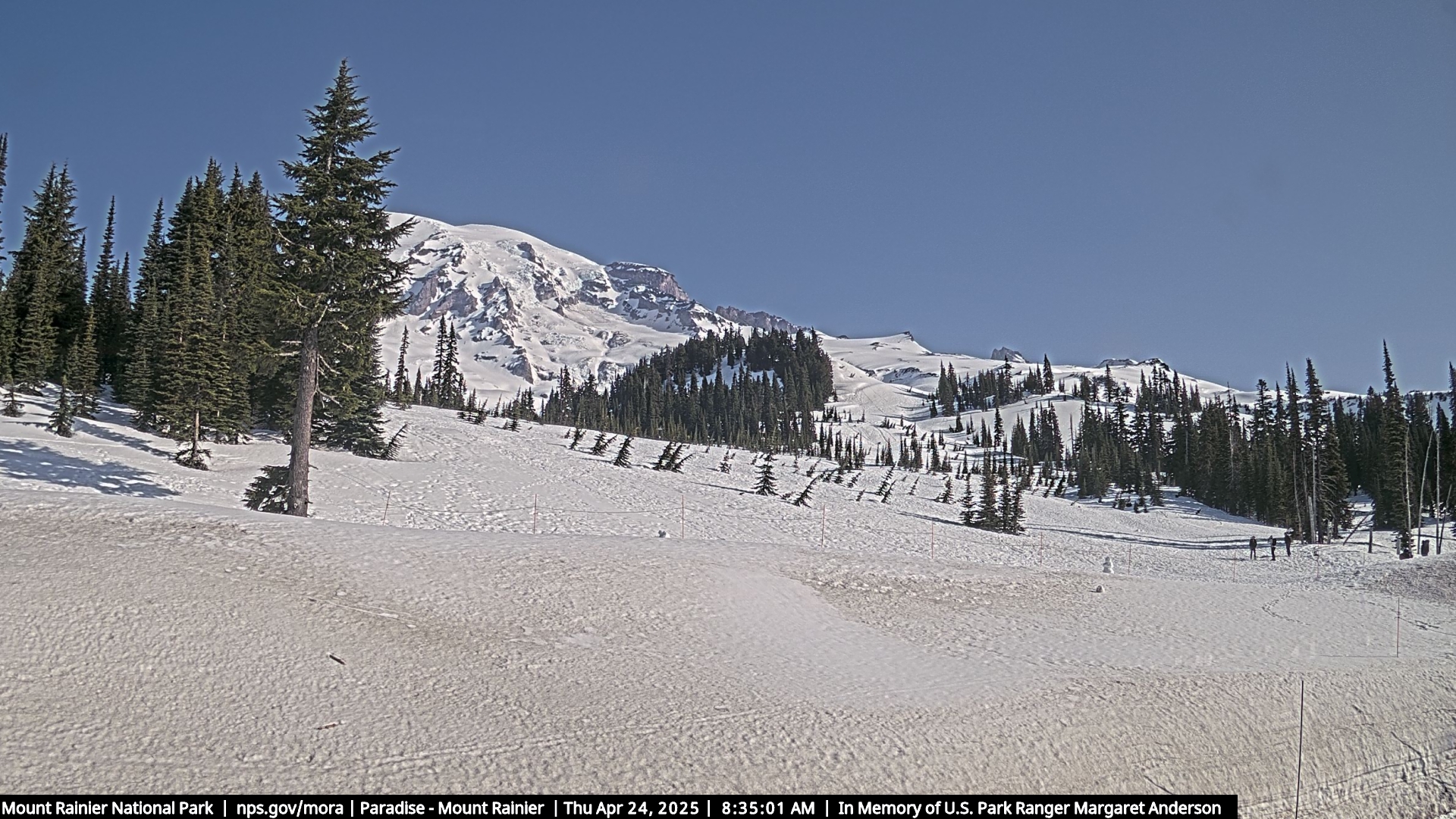
Paradise WebCam
Mt. Rainier webcam at Paraidse. This can be a good resource for assessing current conditions on the mountain.
Mt. Rainier Recreational Forecast