
|
|
Mountain/Rock |
|---|---|
|
|
39.69950°N / 106.2774°W |
|
|
13057 ft / 3980 m |
|
|
Gore Range Overview
”In my opinion, the two most rugged mountain ranges in Colorado are the Gore Range northwest of Dillon Reservoir and the Needles Range in the remote San Juan Mountains.” -John Fielder-famous Colorado Landscape photographer.
The Gores are more of a range consisting of 12-13,000-ft ridges, rather than separated peaks. A few of the more prominent ridges actually have names like, Zodiac Spires, Rockinghorse Ridge, Ripsaw Ridge and the Grand Traverse. With 50 peaks over 12,000-ft, none attain the magic 14,000-ft mark, which is the primary reason for the Gores obscurity. This is one of Colorado’ most rugged mountain ranges and the rock quality is generally good.
Only 60 miles from Denver, Colorado the Gore Range as a whole is relatively inaccessible due to the lack of mining roads that normally criss-cross other Colorado mountain ranges. The Gores also have a rep for a lot of trailhead access red tape, due in large part to private property. Hikers and climbers not interested in long approaches and heavy vertical might want to look elsewhere for their adventure. Overall, the west side of the Gore Range is more accessible than the east. Approaches that start from the east are few because of private property, in return, expect even longer approaches and expect a poor network of trail systems. Precise planning and execution are of paramount importance when selecting routes in this range. Armed with a loaded backpack and good maps, many of these quiet summits can be climbed without a rope. Major faces and long jagged ridges provide unlimited technical climbing opportunities as well. An ice axe is highly recommended on any early season climbs.
Officially named peaks in the Gore Range are hard to come by, only a few of the Gore highpoints have official names. Differentiating the highpoints on a map or while hiking has challenged all of us at some point. Thankfully we have the CMC to make sense of all of that rugged terrain. In 1932, CMC members Carl Erickson and Edmund Cooper used letters to assign summits in the obscure Black Creek Basin and the CMC subsequently tended and expanded the system (Jacobs & Ormes- Guide to Colorado Mountains.) The lettering system for naming peaks has frustrated many casual visitors over the years, however Gore Range enthusiasts seem embrace the system. It won’t be going away anytime soon.
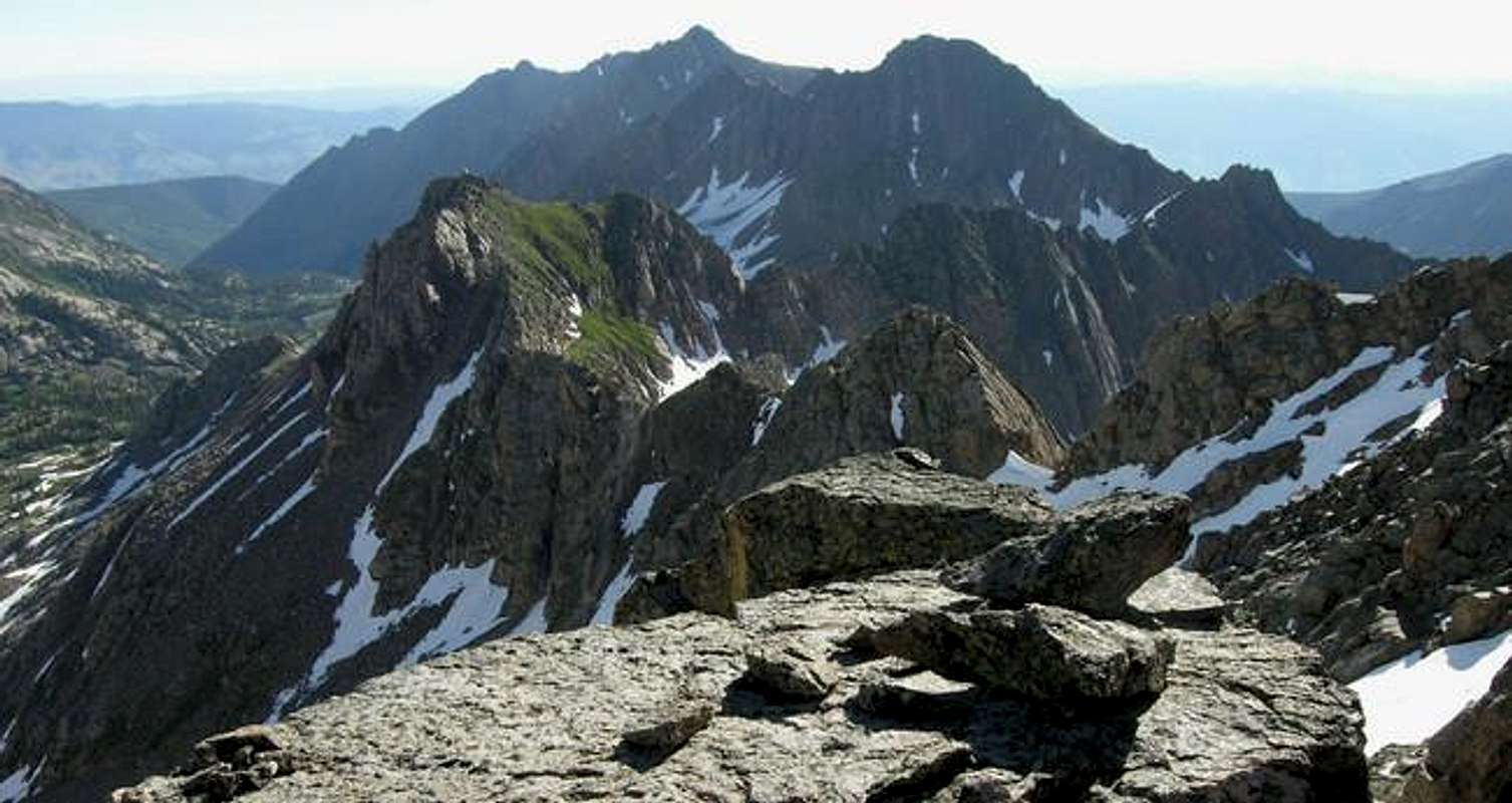
Peak V "East Partner Peak" Overview
Peak V or the unofficially named “East Partner Peak” (13,057-ft) is undoubtedly the trophy peak of the Pitkin Creek Drainage, a popular hiking area near Vail, Colorado. It’s classic pyramidal shape and fierce southwest face pack a serious punch in the “scenery” category. From any perspective "East Partner" shows like a perfect pyramid; and combined with Peak U “West Partner Peak,” (13,047-ft) and one rugged connecting ridge, the two “Partners” form the awesome backdrop to the picturesque Pitkin Lake Basin. Even if you’re not a climber, the high Pitkin Lake Basin makes for a perfect place to visit in the cool months of spring and summer.
“East Partner Peak” resides within typical central Gore Range terrain, which includes some of Colorado’s most beautiful mountains. Its summit is part of the main, and central spine of the Gore Range which runs from Eagles Nest Mountain southeast to Red Buffalo Pass, just north of Demming Mouuntain. Geologically, "East Partner” is mostly made of gneiss which accounts for the fractured and slabby nature of the summit pyramid. Other notable nearby summits include Peak W, Peak X, the Solitude Massif, and “Outpost
Peak.”
"East Partner Peak" has a reputation for being a tough climb in part because of the lack of current route beta. "East Partners" story says something about exposed class 4 climbing. However, with proper route finding the easiest route is more like steep and solid class 3. So, maybe “East Partner” isn’t as tough as advertised, but don’t be fooled by my report, the mountain is relentlessly steep. Be prepared to for 2000 vertical-ft of climbing in the last mile!
 |  |  |  |  |
Pitkin Lake Trailhead
Locating the Pitkin Lake Trailhead is easy. From Denver, take I-70 west, past the Eisenhower Tunnel and on to the popular ski towns of Dillon and Silverthorne. Continue past Copper Mountain Ski Resort and on to Vail Pass. From Vail Pass, descend down to the city of Vail, Colorado and take exit 180, your first Vail exit on the right. Turn right and quickly make another right and drive about .2 mile east. Look for the trailhead on the left next to some private condos.Eagles Nest Wilderness-Red Tape
“Red Tape” per attmNo permits or fees are required. Like all wilderness areas no mechanized or motorized vehicles are permitted within the Eagles Nest boundaries.
Wilderness is land set aside as part of wild America, where man can be a visitor. The natural environment has not been disturbed. Travel is restricted to foot or horseback. No mechanized equipment is allowed.
For more information, contact the U.S. Forest Service at the # below:
Additional Resources:
Eastern Portion of the Wilderness:
Dillon Ranger District
680 River Parkway
Silverthorne, CO 80498
970-468-5400
or
Western Portion of the Wilderness:
Holy Cross Ranger District
P.O. Box 190, 24747 US HWY 24
Minturn, CO, 81645, Phone: 970-827-5715
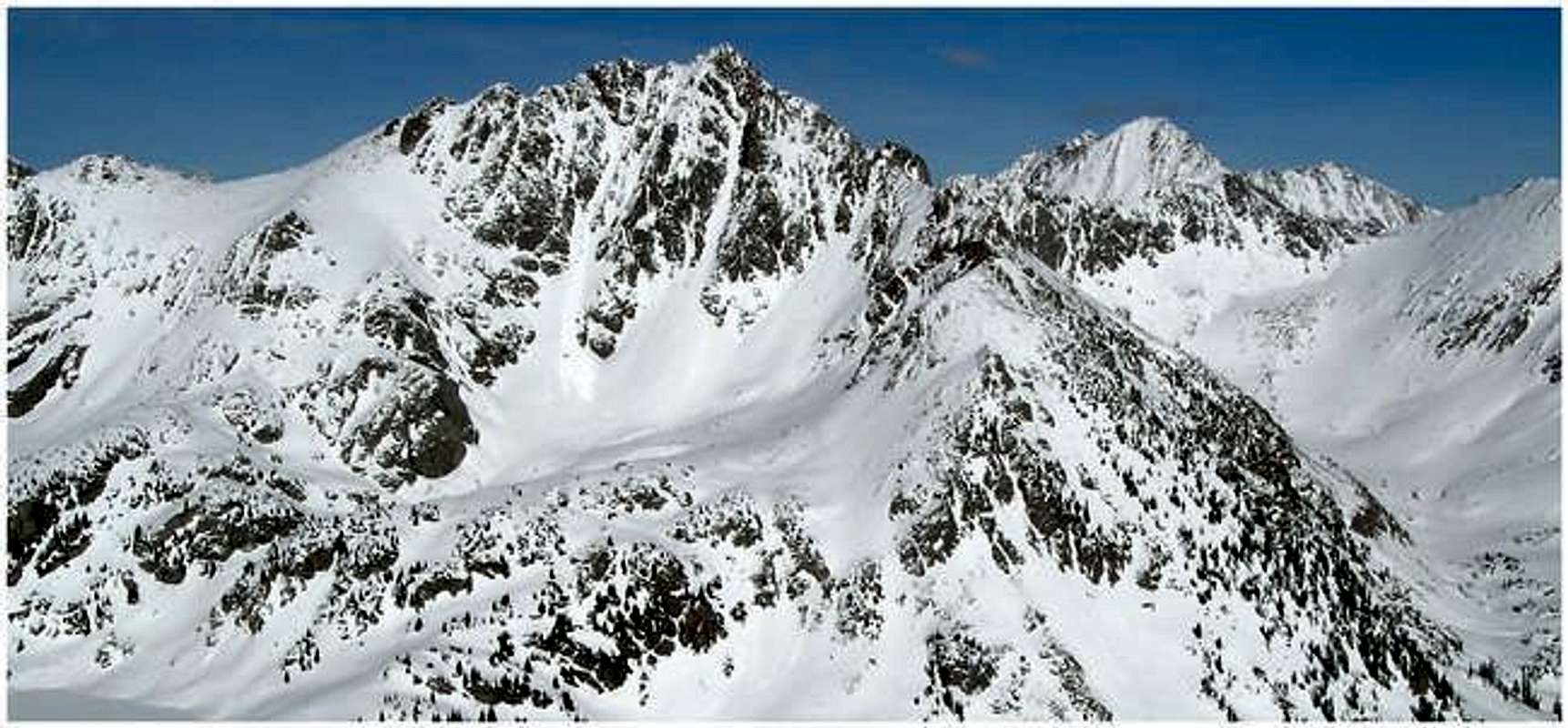
Mountain Conditions
Click image to enlarge
Click here to view a 7-day forecast for Pitkin Lake Basin at 11,400-ft
