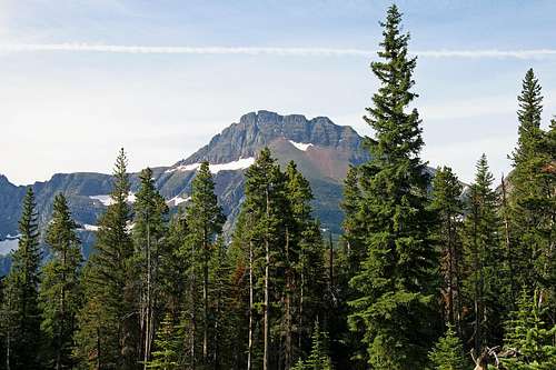
Approaching Two Medicine Pass, Grizzly Mountain dominates Chief Lodgepole Peak —still a mile-and-a-half (air miles) to the mountain
Grizzly Mountain, from Spot Mountain
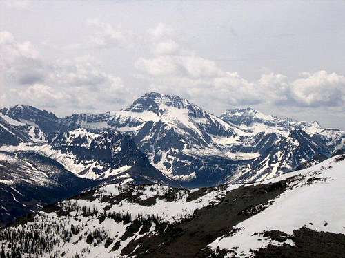
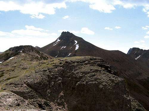
Unusual perspective: Grizzly Mtn from Red Crow Mtn.
Montana's entry in the seemingly omnipresent name-a-mountain-after-the-great-bear sweepstakes is Grizzly Mountain (the original Kootenai name was Big Grizzly Mountain). The state has only one so named, although there is a Grizzly Peak in the Custer National Forest (not far from Red Lodge); also, GNP does have one other peak making use of the word "grizzly"—Medicine Grizzly Peak, in the Cut Bank Area of the park. Grizzly Mountain, the subject of this page, is located in the park's Two Medicine area, is reached via a good trail, and even though it is necessary to leave that trail for the final almost mile-and-a-half ascent, is by no means a difficult climb [see "Route" section below]. It is a true scamble, with the only drawback being that of length—eleven miles from trailhead to summit—but that happenstance becomes secondary to the rewards, which, simply put, is that the trek winds through mountain wilderness at its best and after approximately eight miles, upon reaching Two Medicine Pass the views become...spectacular.
Two Medicine Pass, Grizzly Mountain, and the Edge of Civilization
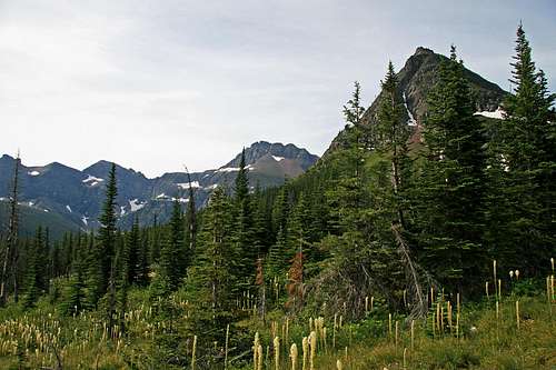
While crossing the 1.6 miles of Two Medicine Pass, this is the unfolding view west (no real sense of scale in the picture, but these mountains are big!).
Two Medicine Pass, Grizzly Mountain
From Two Medicine Pass, Grizzly Mtn. towers over Chief Lodgepole Peak
While far from unknown, the Two Medicine area of Glacier National Park is not as heavily trafficked as those areas along the Sun Road, is not as popular as Many Glacier. It has a nice campground, the obligatory Ranger Station, a surprisingly good general store, is the jumping off point for boating excursions on Two Medicine Lake, and—of course—has the omnipresent GNP scenery in spades. Four major trails have their origin here: Two Medicine Pass, Dawson Pass, the practically side by side Pitamakan and Cut Bank Passes (the two being on the same trail, separated by a scant three-quarters of a mile), and Scenic Point—no, this area is not unknown!
Both these Grizzly Mountain summit views are looking north.
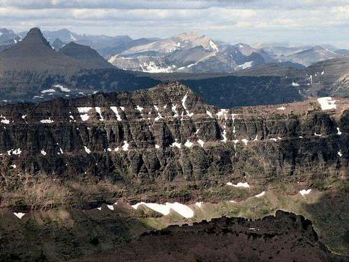
Rockwell, Phillips, and Stimson run Northwest from Grizzly Mountain
Mount Ellsworth, Appistoki Peak, Mount Henry
All trails are well maintained, so initial entry into the back country is not difficult, with the aforementioned three trails heading more or less west, to passes seven or eight miles distant. It is possible to make an exhilarating, full-day loop out of the Dawson Pass/Cut Bank-Pitamakan Pass Trails, as there is a connecting trail running between the Dawson and Cut Bank Passes which skirts the western flanks of Flinsch Peak and Mount Morgan. The Two Medicine Pass Trail, however, offers up only the option of either returning via the way you came, or descending into the Nyack,* eventually reaching the remote Park Creek Trail. (The Scenic Point Trail—which is not a pass, but climbs to a marvelous visual vantage point—runs the opposite direction out of Two Medicine, reaching Scenic Point in 3.5 miles, then, if one so chooses, continues on into the community of East Glacier Park—a total distance, start to finish, of approximately ten miles.)
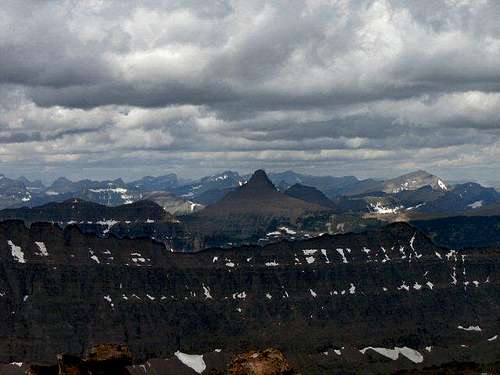
Southwest from the summit: Eagle Ribs Mountain (R), Mount Despair (L
Each of the three passes sits on the Continental Divide, and each offers up a kind of titilating visual and mental supposition, that as though having gone as far as possible one has come face to face with nothing less than the unknown and wild far edge of civilization! Gone are the amenities of Two Medicine; these passes present a face to face confrontation with such as Mounts Stimson (GNP's second highest), Saint Nicholas (the park's most difficult ascent), Phillips, and Pinchot; Battlement Mountain; Vigil Peak, the Cloudcroft Peaks...wild and monstrous all, difficult to reach, then as if to make up for that inaccessibility, are not easy to climb!
Grizzly Mountain over Two Medicine Lake
Climbing Grizzly Mountain shows its nearest neighbors in in-your-face relief: There is the opposite "anchor" of Two Medicine Pass, that being the memorable Mount Rockwell, and, upon reaching the Grizzly summit, the (relatively) near by, colorfully named, and rugged (and remote!) Mount Despair and Eagle Ribs Mountain rise from the wilds to tantalizingly expand one's thinking along the lines of access into a remote area. This is the Nyack, Glacier's great and far-flung South and Southwest wilderness. Nothing here done in less than several days of solitude and whatever kind of communing-desire brought you to this wild outpouring in the first place. The well-maintained Two Medicine trails are but memory; what trails there are, are subject to blow-down and washouts, are isolated enough to not always be well cleared, and always, always lead to serious bushwhacking, because no goals in the Nyack ever escape that "price-of-admission" effort.
In other words, this Grizzly Mountain climb is astounding! Two Medicine Pass is magnificent, and from that singular traverse—and on to the summit—the view is of an unfolding panorama of peaks not nearly as easy to embrace as where you are, and some (actually, many) of which enhance their remoteness by being, in fact, more than a little challenging—but enjoyable!—to summit. In climbs such as this it is easy to dream, and plan of days and weeks lost in the sea of peaks around you! Edge of civilization, indeed!—pressing at your back are the comforts of Two Medicine; the siren call expanding before you is another world, is not at all the same.
(*Nyack = "But the name Nyack is an old one...in use here before 1910, and it is applied to the 'flats' across the river from the park as well as to a prominent peak in the Flathead Range of the Great Bear Wilderness. The word is a Delaware Indian term meaning 'point' or 'corner' (perhaps 'in the corner').... It was the name of Delaware villages on Long Island and on the Hudson River, at present Nyack, New York." —quote from Place Names of Glacier National Park, by Jack Holterman)
Route—From Two Medicine to the Summit
Two views of Grizzly Mountain from the trail.
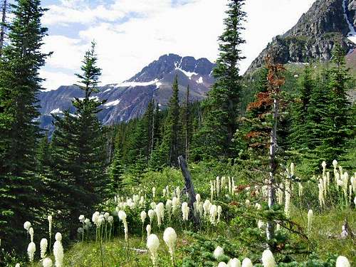
Bear Grass, Grizzly Mountain
From parking lot to summit is 11 miles, of which nine-and-a-half are on a good trail, with the remaining distance on the mountain being a not difficult scramble over mostly loose (but not so loose as to cause difficulty) rock. Total elevation gain is slightly less than 4000'. The trail also has the advantage of the first 3 miles being level, so by the time it begins climbing you are well warmed up—something not all that common an occurrence in my mountaineering experience! I'd not classify the trail as anything more than moderately steep (although it is that), and in early July of this, an unusually dry year, there was still plenty of water from springs and melting snow, enough that carrying extra would be unnecessary.
For the first 3.3 miles the trail is the same route taken as for climbing Sinopah Mountain. The trailhead is at the southwest end of the (large) parking area, beginning immediately beyond the fee booth for the Two Medicine Lake boat rides. It is well marked, well maintained, and presents no problems. There are a couple of junctions, both signed; stay left at each, at one point crossing a suspension bridge (this is the place where, upon starting across the bridge, Grizzly Mountain shows itself for the first time); after those 3.3 easy miles you reach the picturesque Rockwell Falls (and where, were the goal to have been Sinopah Mountain, you'd leave the trail and head off to the right). Stay the course, however, and once across the creek your level meandering is over; the trail immediately begins climbing steadily, and, basically, doesn't level out until it reaches Two Medicine Pass, and even then is not really level—you'll both gain and lose elevation while crossing the pass.
Two Medicine Pass, Chief Lodgepole Peak, Grizzly Mountain
A couple miles past the falls a large basin is entered, and at this point the Two Medicine Pass ridge is quite obvious in the distance. It is, however, still a ways—it is not as close as it looks!—but eventually you do, indeed, reach it. Two Medicine is a long pass, about 1.6 miles across via a rounded ridge—rounded, I'm convinced, by the eternally infernally wildly blowing winds that haunt the area pretty much all the time. Anyway, when you get to the pass, face up to the wind fact, then continue onward, and, eventually, upward.
The trail takes you the 1.6 miles across the pass, then heads down the other side to points unknown (well...actually, that's not quite true; you will join up with the Park Creek Trail and find yourself heading into some of the remotest country in Glacier, some of which is almost unknown). To continue: where you go is never less than obvious; as the trail heads down off the pass keep going straight ahead, and up the mountain. While climbing angle slightly to the right so as to wrap around, because upon reaching the summit block there are some cliffs you have to pick your way through—not difficult, and a welcome change from that of the constant climb—and it is easier if your initial approach is from the right. The actual summit is (of course) the furthest of three sets of cliffs you must traverse. Then you are there, and the view makes it worth it. And the country you've experienced along the way makes it worth it. You could have done a LOT worse than climb this particular long, but easy, mountain!
Volume Two of Climb Glacier National Park has more details on Grizzly Mountain and suggested routes. It can be ordered at Climb Glacier National Park.
Getting There—Finding Two Medicine
From the north, take Hwy 89 south from Saint Mary, turning on Hwy 49—a very winding, paved road; slow going, but with wonderful views!—for approximately eight miles until the Two Medicine turnoff, then it is seven easy miles to the campground, ranger station, store, boat dock, and ample parking. From the south, take Hwy 2 to East Glacier, and in town turn on Hwy 49, heading north out of town for four miles to the Two Medicine road.
Standard Precautionary Note: All GNP roads are closed in winter, with Going-to-the-Sun Road (the major route through the park; its eastern terminus is at Saint Mary) sometimes not opening until July (average opening is second week in June; earliest opening ever is May 16, 1987, with the second earliest being May 22, 2005). Don't head out early in the year (i.e., June/early July) without checking the status of these roads—it is not unusual to have repeated, sometimes lengthy, road closures due to storms, avalanches, rock slides, or all three! The same holds true for late in the year; weather changes dramatically in Glacier, beginning usually around the end of August, with road closures normally becoming more and more frequent throughout the month of September (although don't shy away from going, there can also be very nice—albeit cool or cold—days of Indian Summer throughout this time frame; plus the park is relatively free of people after Labor Day). The following links are relatively self-explanatory, and provide all sorts of useful information:
And finally, click here for current information, as well as easy access to some interesting photos showing the Plowing of Going-to-the-Sun Road.
The Red Tape, Wildlife, & Cautions Section
In case you need it: A couple reminders that this GNP/Northern Rockies area has a LOT of wildlife.
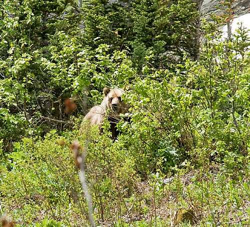
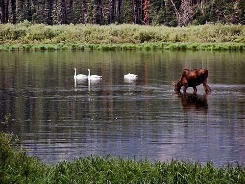
No permits required, but you must pay a park entry fee, which is $25 for one week, or $35 for an annual pass. Registration for day climbs in Glacier National Park is recommended, but not mandatory. Probably anyone prone to climbing in this part of the country already knows this, but the Northern Rockies are full of wildlife. Always be aware, and don't do anything stupid, like—for example—feed the bears, think that a mountain lion is even remotely related to your pet cat, or run up to a moose (moose are quite unpredictable, irritable, and very dangerous). And never, ever, EVER forget you're in grizzly country; they insist on being left alone—disagreement on that point is not an argument you'll win! Bear spray and noise should be part of every GNP foray you make into the back country. Black bears will be found in the forests, grizzlies commonly venture onto the above-timberline tundra, sometimes, when in pursuit of such delicacies as ladybugs or cutworm moth larva, even to the summits! Also note that improperly stored food in park campgrounds (i.e., scraps left around the table or campfire, or edibles in your tent rather than your car) will subject you to a $50 fine. If you wander off, leaving your pack unattended, and there is food in it which attracts the attention of, for example, a bear, it is also a fine. Folks, the Park Service is serious about not providing human food access to the critters!
When To Climb, & Climbing Considerations
From late June/early July (during this time frame expect LOTS of snow in the high elevations) to early fall, depending on snow conditions. Traditional climbing season in the Northern Rockies is July, August, and September—with September weather becoming progressively colder and more unstable (sometimes dramatically so: PAY ATTENTION!) as the month progresses—but does of course vary from year to year. There are occasional winter climbs in the park, but not often, and then only by well-equipped, area-wise, extremely competent individuals. Basically, most of GNP is inaccessable through the winter, and avalanche danger, to put it mildly, is extreme almost everywhere.
CLIMBING CONSIDERATIONS
Because of the nature of the rock, there are special considerations regarding climbing in Glacier National Park, and grading systems unique to the Park have been developed by both J. Gordon Edwards and the Glacier Mountaineering Society. Anyone doing more than just "trail" hiking in this part of the Rockies should read the excellent and important information put together by Fred and Moni Spicker. Much—if not most—of the rock in GNP is sedimentary and rotten, and you need to know about it: Glacier National Park Rock & Grading Systems.
Camping
There are numerous campgrounds available within Glacier National Park, of which only Fish Creek and Saint Mary take reservations (not required, but probably a good idea during the peak summer tourist period, especially on weekends). There are also many campgrounds as well as motels just outside the park on both the west and east sides. Grizzly Mountain is in the Two Medicine area (which has a good campground; see link below on current campground information), just a short drive from East Glacier Park, and not much further from Browning. The town of Saint Mary (about a 45 minute drive) has a KOA. Lodging, whether camping or indoors, should be no problem. There are also several restaurants in all three communities.
The communities of East Glacier Park, Browning, Babb, and Saint Mary, are all on the Blackfeet Indian Reservation, where there a great many additional services available.
Also, for those so inclined...GNP does have Backcountry Campsites throughout the park. Some of these sites can be reserved; others are on a first come basis. Anyone doing extensive, several day, remote hiking/climbing would be well advised to check this out.
There is a campsite at Cobalt Lake (exact location shown via the "Backcountry Campsites" link), which is in the basin just before Two Medicine Pass; check at the Two Medicine Ranger Station for availability.
Mountain Conditions/Web Cams
Weather page—an overview, plus current conditions and forecast
Glacier National Park Chat—a great source for friendly conversation and information concerning all things GNP related!
In Tribute
On March 1, 2011, Vernon Garner, Saintgrizzly, left us after losing a bold, inspiring fight against pancreatic cancer. Or maybe he won, for he is at last free of his pain and has "shuffle[d] off this mortal coil."
Vernon was an important contributor on SummitPost, but beyond merely making good, informative pages, he actually inspired many who read his work. No one put more work into his or her pages than Vernon did, and many of those pages, especially those related to Glacier National Park, the place he loved above all others, are works of art in both the writing and layout. More than one person has wanted to visit Glacier or go back to Glacier largely due to what he shared about that magnificent place.
Many people on SP counted Vernon among their friends, and many more saw him as one of the best, one of those who exemplified the spirit of this site. He was one of the best of us, he will be missed, and he will not be forgotten.
As a tribute to him, Vernon's pages will remain in his name. Any member who sees a need for an addition or correction should please contact site management via the "Send PM to the Elves" feature.
Vernon if I were to do this as you recommend I would end up on the Aster Falls Trail. Remember that there is the short scenic trail to the point (spur trail goes off to the right), the trail to Aster Falls (spur trail leads to the left) and then the junction with the Two Medicine Pass trail where the route turns to the left.
Children refers to the set of objects that logically fall under a given object. For example, the
Aconcagua mountain page is a child of the 'Aconcagua Group' and the 'Seven Summits.' The
Aconcagua mountain itself has many routes, photos, and trip reports as children.
Parents refers to a larger category under which an object falls. For example, theAconcagua mountain page has the 'Aconcagua Group' and the 'Seven Summits' asparents and is a parent itself to many routes, photos, and Trip Reports.

 30270 Hits
 92.99% Score
 41 Votes
 Unusual perspective: Grizzly Mtn from Red Crow Mtn.
 While crossing the 1.6 miles of Two Medicine Pass, this is the unfolding view west
 Two Medicine Pass, Grizzly Mountain
 From Two Medicine Pass, Grizzly Mtn. towers over Chief Lodgepole Peak
 Rockwell, Phillips, and Stimson run Northwest from Grizzly Mountain
 Mount Ellsworth, Appistoki Peak, Mount Henry
 Southwest from the summit: Eagle Ribs Mountain (R), Mount Despair (L
 Grizzly Mountain over Two Medicine Lake
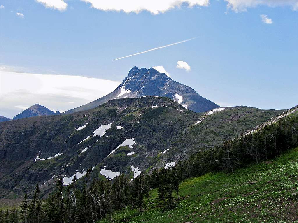
FlatheadNative - Jan 13, 2011 1:15 am - Voted 10/10
Turn left at the first two junctions?Vernon if I were to do this as you recommend I would end up on the Aster Falls Trail. Remember that there is the short scenic trail to the point (spur trail goes off to the right), the trail to Aster Falls (spur trail leads to the left) and then the junction with the Two Medicine Pass trail where the route turns to the left.