
-
 17667 Hits
-
 74.88% Score
-
 6 Votes
|
|
Mountain/Rock |
|---|---|
|
|
39.76500°N / 105.255°W |
|
|
7260 ft / 2213 m |
|
|
Overview
Mount Galbraith is located in Mount Galbraith Jefferson County Open Space Park just northwest of the town Golden, Colorado. The summit offers good views of North Table Mountain, Golden and the metro area. Clear Creek Canyon and Golden Gate Canyon on Mount Galbraith's south and north sides, respectivey, provided gateways into the Rockies for Euro-American settlers and Native Americans. The California gold rush miners crossed Mount Galbraith because travel was easier than through drainages.A well-maintained trail loops around the summit.
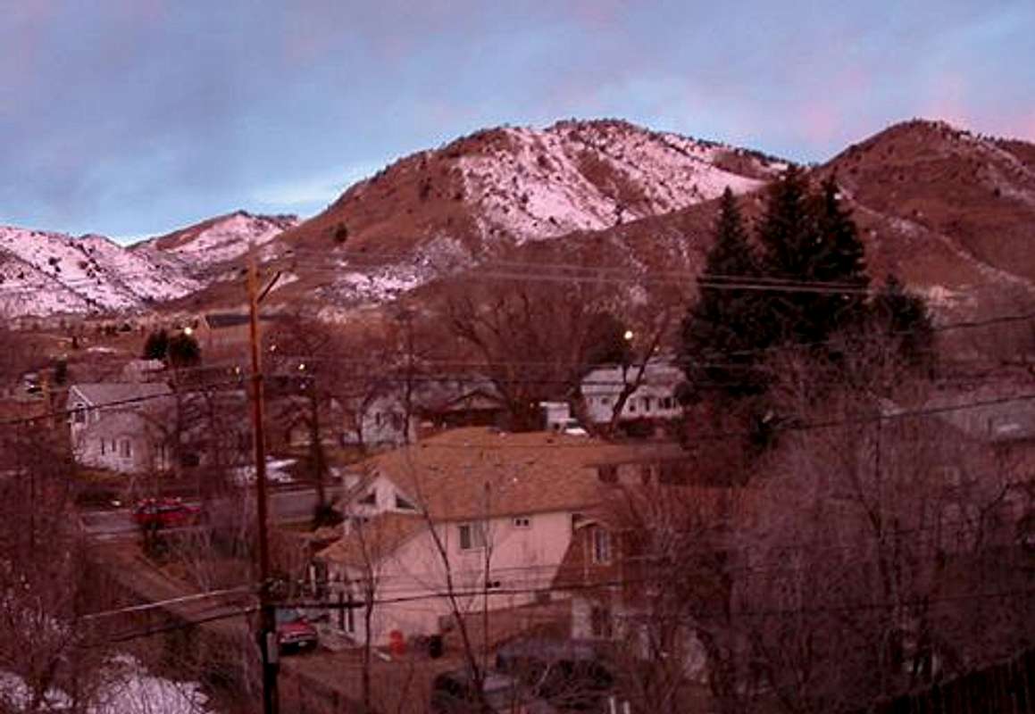
Mount Galbraith from Golden, CO at sunset. Sumbitted by kcmule
Getting There
Proceed north on 93 1.3 miles from highway 58 and turn left onto Golden Gate Canyon Road. Drive west for 1.4 miles to the Mount Galbraith State Park parking area. Restroom facilities are available at the parking area. Hike the Cedar Gulch Trail 1.3 miles to the Mount Galbraith Loop (1.6 miles back to Cedar Gulch Trail).Round Trip Distance: 4.2 miles
Round Trip Elevation Gain: 1100'
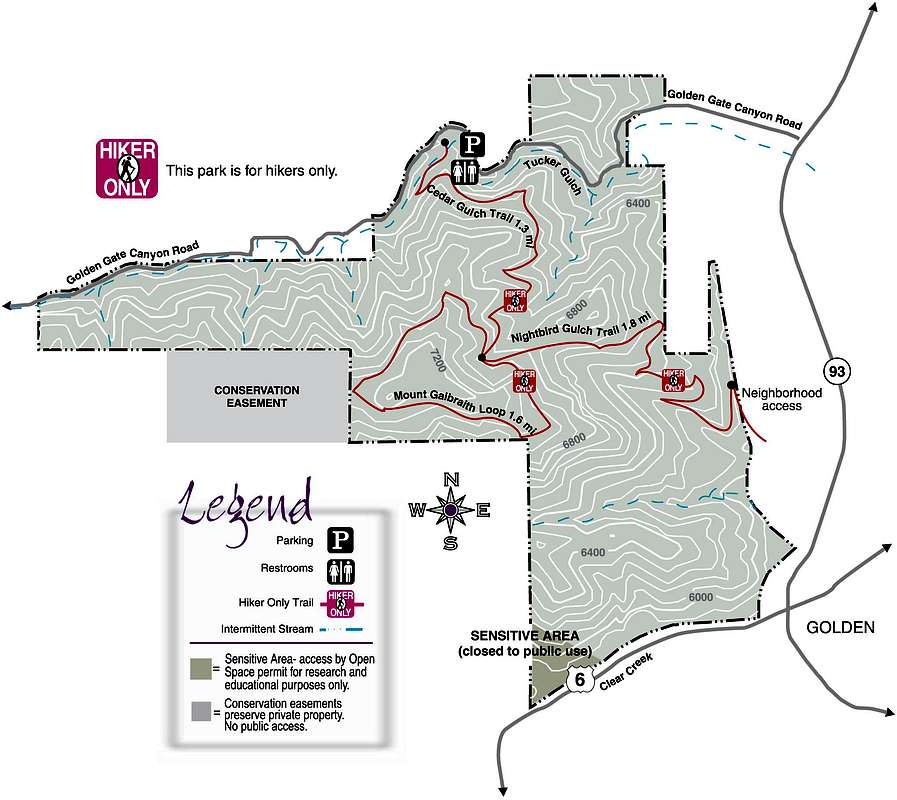
Mount Galbraith's hiking routes. Click to enlarge.
Red Tape
Foot traffic only.The unamed summit to the west of Galbraith's summit is closed to the public.
No permits required.
No use fees or summit fees.
No seasonal closures.