
|
|
Mountain/Rock |
|---|---|
|
|
48.63930°N / 121.807°W |
|
|
5239 ft / 1597 m |
|
|
Overview
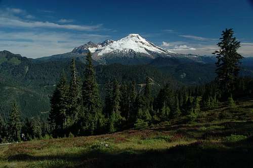
Mt. Baker from the Docke Butte trail, American Border Peak, Mt. Larabee visible to the right of Mt. Baker. Colfax and Lincoln peak visible to the left of Mt. Baker. The Sherman crater is not visible but is behind Sherman Peak on the upper right portion of Mt. Baker. August 2005.
Dock Butte is an easy climb offering truly spectacular 360 degree views of the Baker lake region. In summer this summit can be done as an easy walk up. It is especially good during the late summer for beginning hikers and mountaineers or people who have recovered from injuries who are looking for a great hike without all the hard effort. many hikers tend to take their sons and daughters up this mountain for one of their first great experiences in the mountain. The views seen from this summit are incredible on a clear day. The vista includes views of: Baker (Easton glacier), American Border Peak, Mt. Larabee, the Plieades, Mt. Shuksan, North Cascades National Park, Baker Lake, Glacier Peak, Mt. Rainier, The Olympics, Mt. Vernon and the Puget Sound, Twin Sisters Range, and more.
Glacier Peak from Dock Butte on September 26th, 2013
In summer you gain 1,350 on a nicely graded trail and in winter the scariest part is the drive up the road. Many times though this road will be closed off in winter to driving and can only be navigated in snowshoes or skies. The road though as of 2013 is in excellent shape with barely any potholes. These roads can change in an instant so continuously check for updates before you head up to Dock Butte. The car does most of the climbing as the road climbs over 3,000 vertical feet. From there one can make the summit of Dock Butte in 3.7 miles roundtrip and 1400 feet of elevation. Views come and go along the route up the mountain but become more dominant the higher you go. The last .5 mile is moderately exposed in sections and some beginners might have a little problems with some of the exposed section on the end. Still though this is basically a Class 1 walk up and most in shape hikers will have no problems going up Dock Butte.
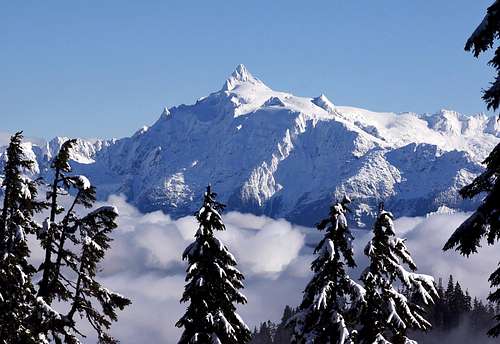
Mount Shuksan (9131 feet) seen from the summit of Dock Butte (5239 feet), October 3, 2013. This picture was taken one week after the picture above.
The summit is small but comfortable the south face is very precipitous dropping 500+ feet. There is more than enough space for one to bivy on the summit. However as of September of 2013 the summit was littered with broken glass. It should be noted that Dock Butte ranks 100th in Washington with 2,309ft of prominence making the summit highly desirable for to prominence peakbaggers. This is a great place to get a look at the current conditions of the Easton Glacier. You are able to see the crevasses on the glacier very clearly and will be able to have some idea about the conditions up Mount Baker before you climb it. Climbers can be seen on Mt. Baker with a good pair of binoculars. If there is one issue with this summit is that the bugs can be horrendous in summer so remember the bug spray.
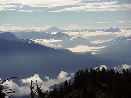
A look across Baker Lake at the North Cascades!
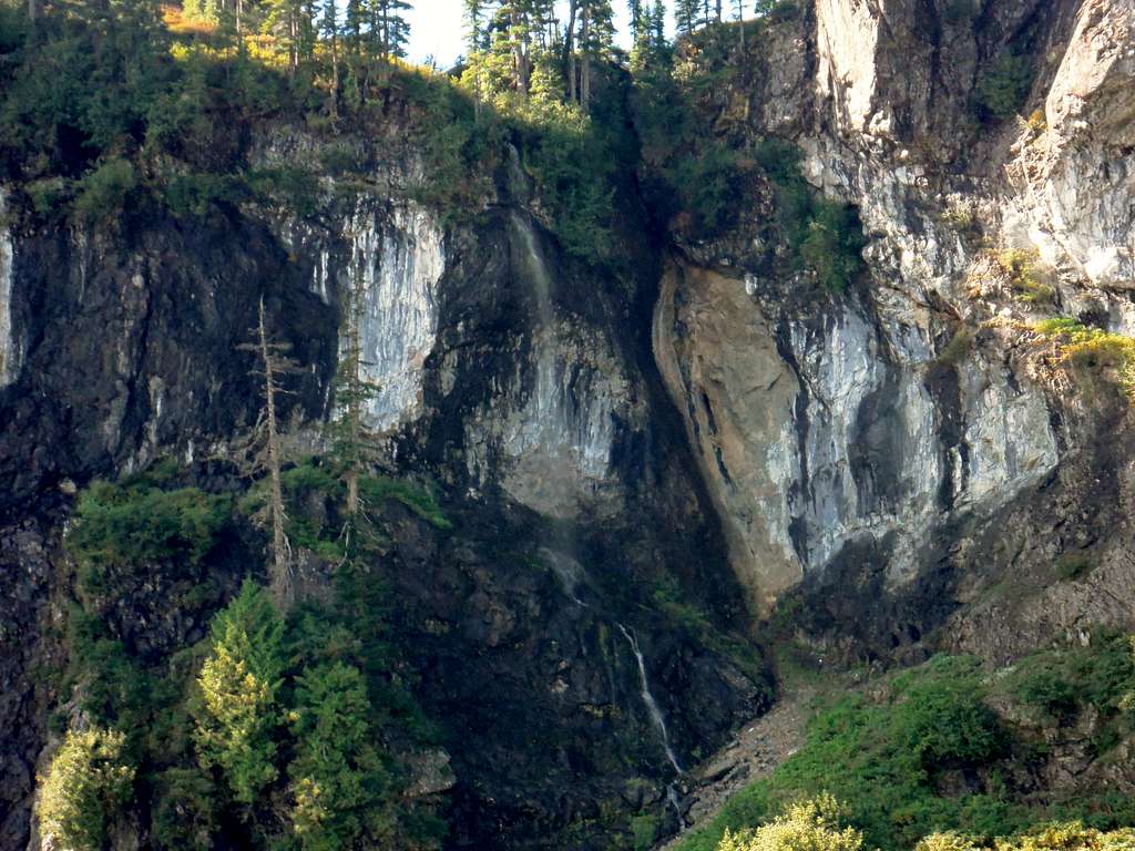
One can cool off before or after this hike at Blue Lake, a small but nice lake in a beautiful cirque, only a 3/4 of a mile from the car. Blue Lake is an excellent glacial lake that is a special sight in itself. The water lies up too its name in being Blue and you can see into the lake a long way. Right across the lake from the the terminal of the trail is a seasonal waterfall that is well worthwhile to see. During the dry summer you not likely to see it but during snow melt or after a rain storm this waterfall will become a special feature. These features make camping at Blue Lake highly desirable.
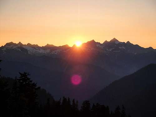
Sunset over the Twin Sisters Range 7,000' seen from the Dock Butte Trail.
Getting To The Blue Lake Trailhead
- Take exit 230 off I-5 head East the you'll have to turn left and then right again (well marked) to stay on Hwy 20
- Follow State Route 20 EAST to milepost 82
- Turn LEFT (north) on Baker Lake Highway (Forest Service Road #11)
- Continue on the Baker Lake Hwy for 12 miles
- Turn LEFT on F.S. Road #12 stay left at forks
- After 7 miles turn LEFT on Road #1230
- After 4 miles the trailhead and parking area are located in at the end of the road
Current Road Conditions
- Once in boots, the hiking trail forks in .25 miles, the left fork leads another .5 miles to Blue lake, take the right fork to Docke Butte.
Road open (if passable) in winter Seasonal Gate closes November 1 to July 1 at MP 8.2. (8.5 miles from the end of the road & 5.4 miles before Pioneer Camp Trailhead) DOES NOT APPLY To Dock Butte
Views from the road are really quite incredible, its probably worth just driving up this road if you're in the area and don't have time to hike.
Map of the Summer Trail up Dock Butte
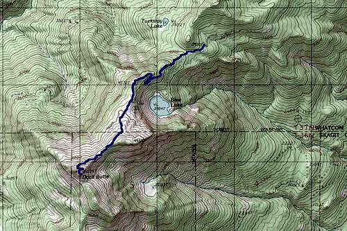
Map of the Summer Route Up Dock Butte.
Red Tape
A Northwest Forest Pass is required to park at the trailhead. Passes cost $5/day or $30/year.Where to get PARKING PASSES:
- Sedro-Woolley Ranger Station
810 State Route 20 Sedro-Woolley, WA 98284
Open Monday-Friday 8 am - 4:30 pm
(360) 856-5700 ext 515 - Baker Lake Resort (on Baker Lake)
Baker Lake, WA
Mon-Thurs 9:00 am - 5:30 pm, Fri-Sun 7:00 am - 7:30 pm
888-711-3033
When To Climb
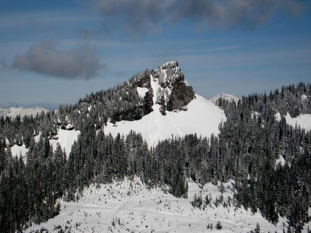
Dock Butte from one mile to the southwest (from Washington Monument) on March 6, 2009.
All year. This is just a basic running shoe compatible day-hike in summer. Winter ascents depend on road & snow conditions. Dock Butte is a much more serious undertaking in winter, prior knowledge of avalanche safety required.
Check Snow Level
Check Avalanche Report Dock Butte can definitely produce slides. You're mostly on East and Northeast aspects, up to 45 degrees
Check Weather Forecast
Remember that these are general warnings and forecast, always use good judgement and retreat if necessary.
Current Road Conditions
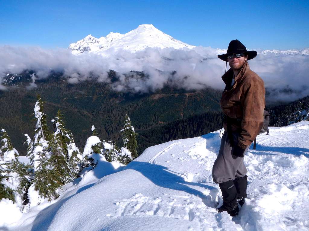
SP member Jimbopo looking like the Marlboro man on the summit of Dock Butte (5239 feet), October 3, 2013. Mount Baker is in the background.
Camping
Listen to the waterfalls as you camp at Blue Lake!!
There are 4-5 campsites available at Blue lake. If you go by trail this is 2.2 miles from the summit. The advantage here though is that you are right by a good source of water and a very scenic area in its own right.
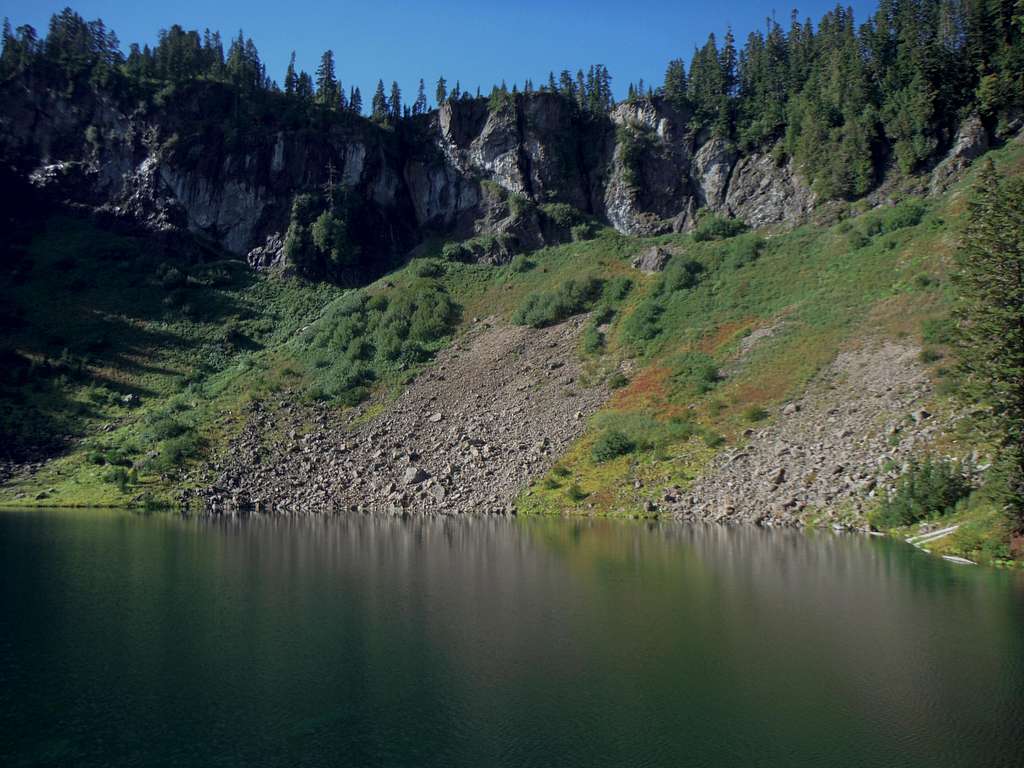
Blue Lake is a great place to camp.
Necessary Equipment
Summer:- trail-runners or boots
- tons of bug spray
- Water
Winter:
- One must be prepared for a long snowshoe depending on conditions
- 10 essentials
- Plastic or Leather Mountaineering Boots
- Snowshoes or Skis
- Shovel, Probe, Beacon
- Possibly an Axe and Crampons late season
kw - Jul 29, 2021 2:31 am - Hasn't voted
Road ClosureA washout on FS 12 on the way to the trailhead will add about 6 miles each way on a forest road to any attempt to hike this peak. The road has remained closed for around a year and it is unclear when or if any repairs are planned.