
-
 8987 Hits
-
 86.85% Score
-
 23 Votes
|
|
Mountain/Rock |
|---|---|
|
|
46.32450°N / 11.91590°E |
|
|
7522 ft / 2293 m |
|
|
Overview
Geographical Classification : Eastern Alps > Dolomites > Pale di San Martino > Monte Caòz
Monte Caòz is located in the remote and solitary Pale di San Lucano Subgroup of Pale di San Martino in the Dolomites. The Subgroup is located to the north-west of the main range and is climbed rarely, probably due to the fact that more interesting mountains surround it. Moreover - though it is counted among the Dolomites - its northern ridge is composed of black volcanic rock, covered by beautiful meadows. Monte Caòz is located on that northern ridge, the first major mountain which leads to the subgroup's highpoint, Cima Pape o Sanson (2503m).
Like all of the summits on that northern ridge Monte Caòz shows an impressive north-west face, which drops 1000m into Valle di Gares below. Being brittle and crumbly no serious climbing is possible on that face. Caòz' south-eastern side however is covered by forests and meadows and offers a moderately difficult ascent route. In fact only the final 350m from Forca di Caòz along the south ridge pose problems due to exposure to the 1000m drop.
Itself not being a perfect beauty Monte Caòz is a good viewpoint to view the surrounding mountains. There is probably no better place to see the north-west pillar of Monte Agner, which is with 1600m (one of) the tallest rock faces of the whole Alps. In fact it dominates Valle di San Lucano in a way that each time the trees open up enough to offer a view to the south your eyes are drawn to that wall in awe. Other nearby mountains include Civetta, Marmolada and naturally the Pale di San Martino. On our own climb, however, clouds rose from the valley to finally cover everything so that many of the photos have been taken on another day, in which we also used part of the ascent route.
Speaking of the route, there are two possible trailheads: Gares at 1381m in Valle di Gares and Col di Pra at 843m in Valle di San Lucano. We used the latter from which you have to climb more than 1200m to reach the summit. Though an easy scramble you have to be in good condition to undertake this climb.
 |
 |
 |
 |
 |
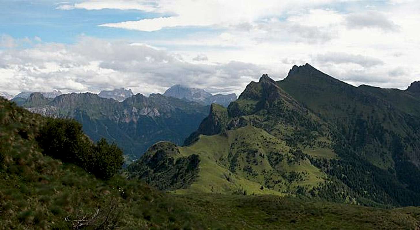
Panoramic View
Monte AltoCrepa RossaLagazuoiP. Zorlet/ S. BiancoLe TofaneValghereM. PalaladaCima di CaòzMonte CaòzC. VanedieiCima PapeM. PrademurCivettaC. BusazzaMoiazzaMonte and Pale di San LucanoTàmer
 |
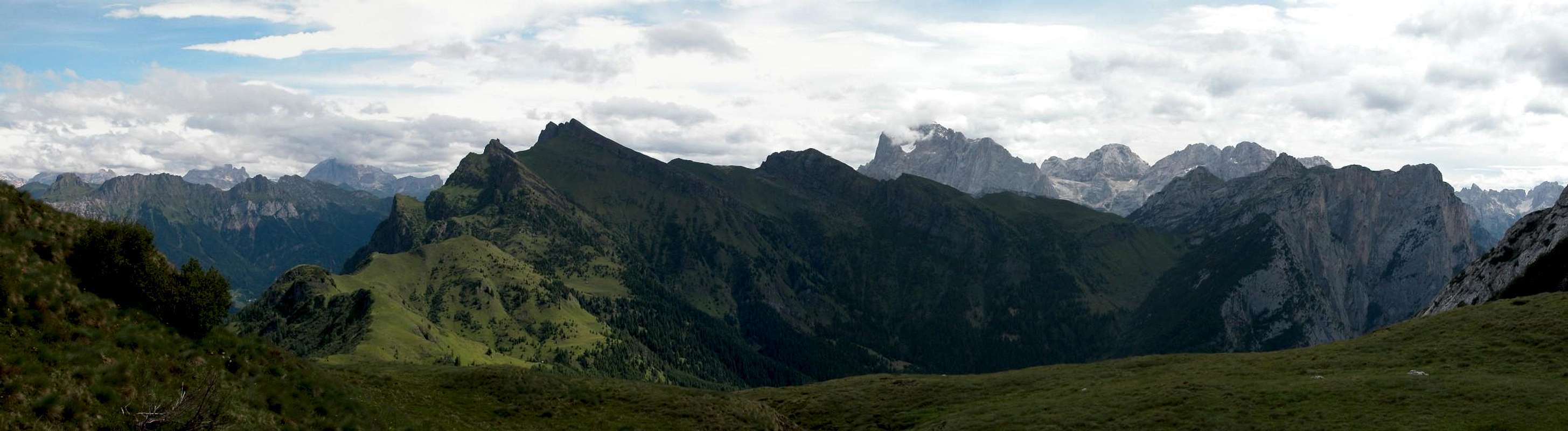 |
Monte Agner
As mentioned in the overview Monte Caòz and in fact all the ascent routes are perfect vantage points for gaping at the Monte Agner North Face (2872m), with 1600m the Alps highest vertical rock face by some accounts. The picture above was probably taken close to the trailhead at Col di Pra and shows Monte Agner with its satellites Spiz d'Agner (2617m) (left), Torre Armena (2652m) and Lastei d'Agner (2844m). To the right is the equally impressive end of Valle d'Angheraz.
 |
 |
 |
 |
 |
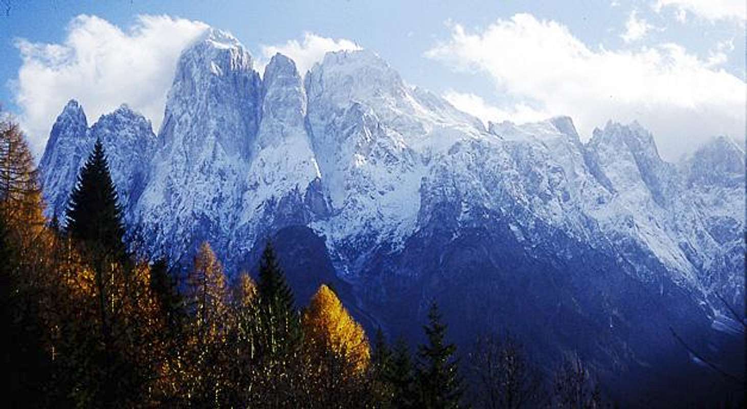
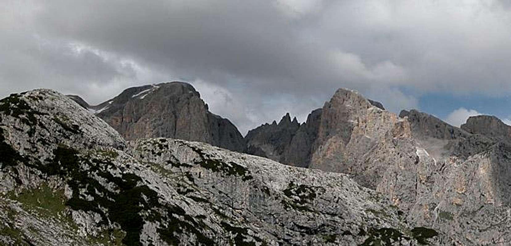
The views
Cima delle ComelleCamp. di Val StrutLe ZircoleCampanile di Val GrandeCampanile del FocobonCima del FocobonCima di CampidoCima ZopelCampanili dei Lastei del Focobon
 |
 |
Here are just some examples of the views you can enjoy while hiking Monte Caòz. The northern ridge of Pale di San Lucano has no vegetaition other than meadows so nothing but mountains obstruct your views. Sometimes - for me twice - clouds do that instead.
 |
 |
 |
 |
 |
Getting There
As said above the Pale di San Lucano Group is rather remote and it is a bit complicated to get there.
- From the North (Brenner / Brennero)
Follow motorway A22 down to Cornedo (north of Bozen / Bolzano). There turn east on SS241 (Dolomite Highway) across Karerpass / Passo Carezza to Vigo di Fassa. Take SS48 south to Moena where you turn east on SS346 to Canale d'Agordo. Here turn south again onto a side road into Valle di Gares or go on to Cencenighe where you turn southward on SS203 to Talbon Agordino. Here the road into Valle di San Lucano turns off west. - From Verona
Take A22 north until the exit Ora / Auer. There turn east on SS48 direction Val die Fiemme which in the end will take you to Moena. Turn east on SS346 to Canale d'Agordo. Here turn south again onto a side road into Valle di Gares or go on to Cencenighe where you turn southward on SS203 to Talbon Agordino. Here the road into Valle di San Lucano turns off west. - From Vicenza / Paodova
Take motorway A31 north to exit Dueville. From there turn to SS47 della Valsugana (in the direction of Bassano/Trento) up to Cismon del Grappa, then SS50bis (in the direction Feltre/Belluno) up to Fonzaso. From here take SS50 to Passo Rolle and SP25 to Falcade. From Falcade take SS346 to Canale d'Agordo or head on to Cencenighe and turn south on SS203 to Talbon Agordino. - From Venezia
Take motorway A27 north to its and near Belluno. Go through Belluno southwest on SS50. In Belluno turn onto SS203d which turns into SS203 and reaches Talbon Agordino where you can turn into Valle di San Lucano. For Gares go on to Cencenighe where you turn west on SS346. At Canale d'Agordo turn south into Valle di Gares.
 |
 |
Red Tape
There is no red tape either in Valle di Gares nor in Valle di San Lucano. Everywhere you are requested to take your garbage back with you but that's a no-brainer. At Gares you need to pay a parking fee of €3 / day.
When To Climb
You can climb Monte Caòz pretty much all year round. In winter reaching the trailheads is probably quite a challenge. For a ski tour you might be in for some longish access through the valleys. The climb is straightforward and definitely possible with tour skis (or snow shoes).
In summer the best time is June through September. July was perfect because of the many colourful meadows you wade through during the ascent.
Accommodation
Camping
I have been able to find campgrounds only in Valle del Biois (north of Gares):
- Camping Eden
Via Pecol 2
32022 Falcade
Tel.:+39 0437 599138
Fax: +39 0437 599138
- Camping Lastei
Pian de Sabion
32022 Canale d’Agordo
Tel.:+39 0437 590700
Fax: +39 0437 590700
Hotels and Appartments
Accommodation links for the Cordevole Valley are also scarce so this is all I could find for the area:
Weather Conditions
Weather conditions in Belluno: www.meteoalpin.com. For the english text you have to scroll down the right frame.
Weather and avalanche conditions in Trentino: www.meteotrentino.it
Weather conditions Dolomites:www.dolomitimeteo.com
Maps 'n' Books
Books
- Dolomiten
P. Fleischmann
Kompass Verlag
ISBN: 3 8705 1409 4 - Pale di San Martino / Pala Gruppe
Luca Visentini (1990),
ed. Athesia, Bolzano
(with a handmade 1:25000 map)
ISBN 88-7014-598-0 (italian version)
ISBN: 8 8701 4612 X (german version)
Maps
- Pale di San Martino
1:25000
Tabacco Map 022
Editione Tabacco