
|
|
Mountain/Rock |
|---|---|
|
|
41.18600°N / 107.031°W |
|
|
Mountaineering |
|
|
Summer |
|
|
11007 ft / 3355 m |
|
|
Overview
Bridger Peak is one of the highest mountains in the Sierra Madre of Wyoming and Colorado, and the highest mountain on the Wyoming side of the range, but it is still little known. Actually just about all of the mountains in the Sierra Madre are little known. The Sierra Madre is far from any major population centers and is not as high or as rugged as some of the other ranges around, such as the Medicine Bow Mountains, Park Range, etc., thus it gets little attention.
Thomas Edison evidently visited the area to fish and local history (perhaps more folklore than history) says that he threw his broken fishing pole into the fire where it burned. The glowing stick supposedly gave him the idea for the filaments in his light bulb.
Bridger Peak itself is a big rounded dome, mostly gentle with only a few steep slopes around well below the summit. Despite being the highest peak in the range, it is also one of the most unassuming. The summit is right at timberline.
The mountain is named after the famous mountain man Jim Bridger, who explored the area in the 1800’s.
Bridger Peak is located in a sparsely populated corner of Wyoming, and is definitely off the beaten path. Even so, a primitive 4wd road leads all the way to the summit of Bridger Peak, where the remains of an old fire lookout are located as well as a ramshackle radio facility.
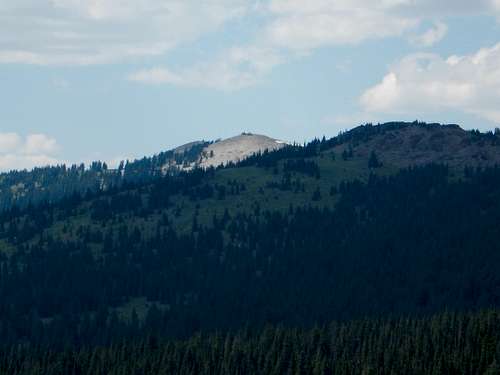 Bridger Peak from the south.
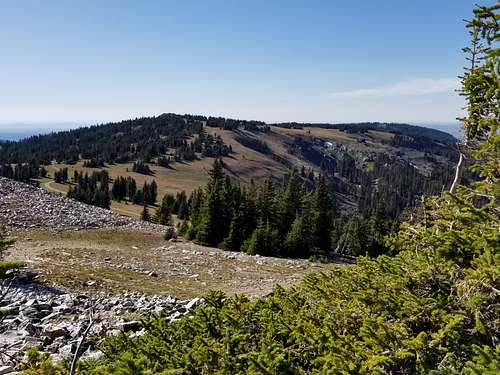
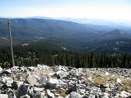 View south from the summit. As you can see, most of the mountains in the area aren't very rugged (though there are a few exceptions).
Getting There
The trailhead is easy to find since it is also a trailhead for the Continental Divide National Scenic Trail.
The trailhead can be reached from the east or west and is right along WY State Highway 70. Most people will be coming from the east, but we came from the west. Battle Mountain Pass and the Continental Divide National Scenic Trail are located on the south side of the highway 12 miles west of Encampment.
The trailhead is one mile west of the pass.
A marker identifying Forest Road 412 is here, as well as a Bridger Peak directional sign. You can park here, or you can continue driving up Forest Road 412. The elevation of the parking area is around 9,840 feet.
 Bridger Peak from Battle Pass.
Routes Overview
As mentioned in the Overview section, there is a 4wd road to the top of the mountain. This is FR 412. It is fairly mild as 4wd trails go and is marked with Continental Divide Signs. Because of this, no detailed route page will be added for the road route. This is three miles from the highway and from the trailhead mentioned above.
Rather than driving the track, most climbers will probably want to walk up the peak. This would be more appealing when the road is closed (before late July). The track would make a fine mountain bike road as well.
Since the mountain isn’t too rugged, other routes are possible. Unfortunately I've only used the road route. Some of the possible routes that look good are from South Spring Creek Lake on the north and Haskins or Smith Creek on the south. No trails exist, but the mountain isn’t overly steep and the forest in these parts is relatively open and easy to walk through.
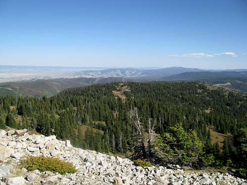 View from the summit.
Red Tape
No permits are required. Tread lightly and use LNT principles.
Camping
Lost Creek Campground is near the Baby Lake Trailhead well to the west of Battle Pass. Haskin Creek Campground is a few miles east of Lost Creek Campground. There are also many informal campsites in the area, including along the access road.
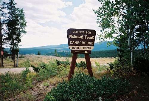 Bottle Creek Campground.
When to Climb
July through early September would usually be considered the normal season to climb the mountain, but if you want to climb it on foot and without having vehicles around, do so before late July. The 4wd road to the summit of Bridger Peak usually isn’t open until mid-July and usually closes sometime in September (into October in dry years, but don’t count on it).
They may not be rugged, but these mountains receive very heavy snowfall. The highway is usually open from May 31 through sometime in October. If you want to climb without 4wds along the summit road, then June to mid-July is best, but be prepared for snow, especially in June. Bring mosquito repellent as well, especially early season.
The Sierra Madre is a very popular hunting destination in September and October so use extreme caution at this time of year.
If you can find a way to the trailhead, this would make a relatively safe and non-technical winter climb, but WY State Highway is closed in the winter, so it would be a very long ski/walk in. Access to a snowmobile will make this an easy climb from the highway, in fact if you wanted to be lazy you could ride all the way to the top.
ountain Conditions
CLICK HERE FOR THE BRIDGER PEAK AREA WEATHER FORECAST
Below is the National Weather Service Climate Summary of Dixon/Baggs, on the Wyoming/Colorado border. The data is from 1922-2012. This is one of the closest long term weather stations, but be aware that higher elevations will be much wetter and colder. Dixon/Baggs is at 6370 feet elevation, so expect the temperatures on Bridger Peak to be 10-20 degrees colder than in Dixon.
| MONTH | AVE HIGH | AVE LOW | REC HIGH | REC LOW | AVE PREC (in) |
| JAN | 32 | 3 | 55 | -55 | 0.89 |
| FEB | 36 | 8 | 61 | -47 | 0.72 |
| MAR | 43 | 16 | 75 | -31 | 0.96 |
| APR | 56 | 27 | 84 | -9 | 1.14 |
| MAY | 67 | 34 | 93 | 9 | 1.18 |
| JUN | 76 | 41 | 96 | 20 | 0.94 |
| JUL | 83 | 47 | 99 | 30 | 1.07 |
| AUG | 81 | 45 | 100 | 26 | 1.12 |
| SEP | 72 | 36 | 92 | 1 | 1.04 |
| OCT | 61 | 27 | 82 | -9 | 1.23 |
| NOV | 44 | 16 | 77 | -26 | 0.80 |
| DEC | 35 | 3 | 62 | -39 | 1.02 |
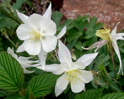 Columbines among raspberry plants near Bridger Peak. The Columbines here are white, rather than the usual blue and purple ones often seen in Colorado, which is farther south.