
|
|
Mountain/Rock |
|---|---|
|
|
44.22900°N / 113.883°W |
|
|
11141 ft / 3396 m |
|
|
Overview
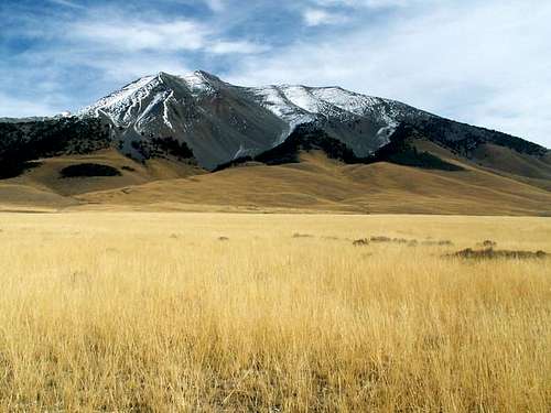
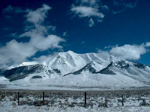
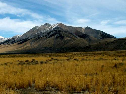
Standing at 11,141', Dickey Peak in the highest and the southernmost summit in the Pahsimeroi Subrange. The Pahsimeroi Mountains are the unnoficial name for the Lost River Range north of Doublespring Pass. These beautiful mountains see very little human traffic and climbing is difficult and not for the novice hiker.
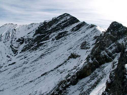
Dickey Peak is a prominent peak, both technically and literally. It has more than 2,800' of clean prominence and dominates the Big Lost Valley north of Mount Borah. Its three summit ridges form a pictueresque pyramid shaped mountain when viewed from Highway 93 but what many don't see when passing by this peak is its complexity. Its summit ridge spans for more than 2 miles, while many subsidary cirques, hidden-broken faces, and even a few unnamed mountain lakes (a rarity in the Pahsimerois), can be found in the depths below Dickey Peak.
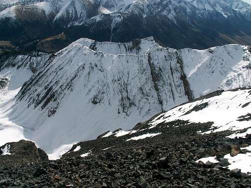
Perhaps the most noticable feature of Dickey Peak is its extensive, massive, and seemingly endless talus slopes. While many mountains in Idaho are at least partially made of decomposing rock, Dickey Peak's summit is a rarity in the fact when approached from any direction, one must encounter the endless talus. Therefore, climbing Dickey Peak is not technical endeavor, but a strenuous one, even with excellent access.
Getting There
To access the southwest slopes of Dickey Peak from anywhere is a challenge unless you live nearby. The closest airport is located in Hailey, Idaho while the closest "town" is Mackay, Idaho. For access considerations, these will be directions from Hailey.
Drive north on Highway 75 for 13 miles until reaching Sun Valley Road in Ketchum, Idaho. Turn right and drive through Sun Valley on said road. Sun Valley Road turns in Trail Creek Road and heads over Trail Creek Summit on a good gravel tread in about 13 miles.
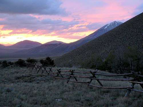
Trail Creek Road then descends into the Big Lost Valley with continually improving road conditions. After 26 miles, Trail Creek Road runs to the base of the Lost River Mountains and meets Highway 93 at an intersection. Turn north, (left) and drive through the unnoticeable hamlet of Dickey, (no services). Shortly after passing through the township, Doublespring Pass Road and an interpretive center on the massive 1983 earthquake that shook the area will be on the righthand side of the road. Set the odometer here and continue precisely 4.7 miles on the highway until reaching an unnamarked dirt road that leads east from the highway. If the road is gated, move it, the people who own the ranch next to Aretson Gulch Road have no right to blocking this access. Drive about .5 miles until reaching a small fork. Go left here. This may require moving another small gate.
Drive north on this faint road for a little less than a mile along the base of Dickey Peak. Keep a watchful eye as another faint road, not shown on the USGS map, leads due east to the base of Dickey Peak and a water tank that is on the USGS map. In the past few years, the road has been extended up to almost the 8,000' mark, however, it is not recommended to drive this far for route considerations.
Red Tape
No red tape or permits required in this area.
Arentson Gulch Road is closed when snowfall is present.
When To Climb
Climbing Dickey Peak is possible year-round but is recommended in spring or fall when avalanche danger has lowered but cornices and snow fields cover the extensive talus slopes.

Camping
Exposure along the ridges and valleys surrounding Dickey Peak is great so camping is not recommended. There is little lodging in Mackay a few miles to the south while Park Creek and Phi Kappa campgrounds are nearly 35 miles away.
Mountain Conditions
Dickey Peak is isolated from any major reporting local weather stations and/or remote reporting sites. The following links will should give a general idea of conditions in the area.
- Salmon Challis National Forest- Reports on local closures and conditions for central Idaho.
- Sawtooth Avalanche Center- Gives daily avalanche reports during winter.
- Idaho Outdoors Forum- Frequent reports of local conditions and climbs in the area.
- NOAA Pinpoint Forecast- Provides a detailed 7-day outlook for te are near Dickey Peak.