
|
|
Mountain/Rock |
|---|---|
|
|
33.90500°N / 111.409°W |
|
|
7128 ft / 2173 m |
|
|
Overview
Mount Ord is one of the most popular and accessible tree-covered summits nearby the Phoenix, AZ metropolitan area. The turn off to Mount Ord Road is less than an hour from the suburbs of Mesa and Scottsdale via the Beeline Highway.
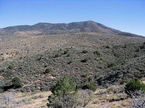
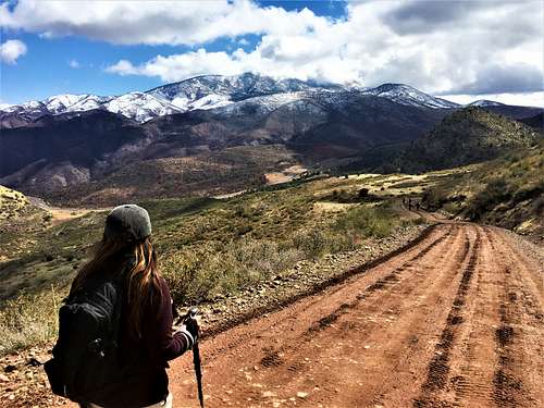
Mount Ord has a prominence of 2,428', ranking 43rd in the state. It is an interesting summit in that hikers can start in an upper Sonoran landscape of creosote, saguaro, and paloverde, ascend through grasslands of manzanita, and end in a deciduous forest of oak trees. If looking for wildlife or vistas, this is the place. The area has one of the densest concentrations of deer, black bear, and mountain lion in all of Arizona, plus a variety of birds. From the top, Roosevelt Lake, the Four Peaks, and the Mogollon Rim can all be clearly seen.
A service road leads from the base of the mountain to the summit. The main road comes in from the west, while there's another road coming in from the north and merging with the main road. The main road coming in from the Beeline Highway leaves the road at 4,530'. From the main road, there are plenty of places to park. From the north, is the longer, steeper route to the summit via Slate Creek.
Due to its proximity to Phoenix, Mount Ord is often used by hikers training for Rim to Rim, or by ultra-marathoners. Mountain bikers also use these routes.
Because there's a road to the summit, and various places to start the hike along the road, reaching the summit of Mount Ord can be an easy walk, or a long, steep training hike.
 |
 |
 |
 |
 |
Getting There
From Phoenix, it is approximately 50 miles (80 km) northeast to Mount Ord. Take 87 North (Beeline) past Fountain Hills into the Tonto National Forest and through Sunflower. Roughly 5 miles after Sunflower, make a right onto Mt. Ord. This is the pull off area.
The steeper route is just about 5 miles further north on 87. More details found at these two links: https://www.alltrails.com/trail/us/arizona/mount-ord-trail and https://hikearizona.com/decoder.php?ZTN=1640.
Red Tape
The lookout tower is not currently open to the public. However, there are still nice views from the summit and the road.
When To Climb
Mount Ord can be hiked any time of the year. It is best in the spring, summer, and fall because of its cool temperatures in relation to Phoenix - usually about 20 degrees cooler with windier conditions and plenty of shade.
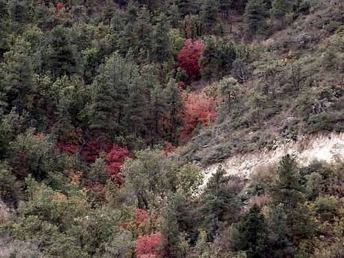
October and November are good times to see the fall foliage change color. In the winter, it gets cold enough to snow. However, even with snow, the service road can still be hiked with appropriate gear.
Camping
There are free camp sites along the jeep road. Additional camp sites can be found if you venture off the service road onto the right branching trail along the west face of Mount Ord. That road junction is about three miles up Mount Ord Road.
External Links
Surgent Trip Report: http://www.surgent.net/highpoints/az/range/ord.html
 |