

|
|
Mountain/Rock |
|---|---|
|
|
49.18306°N / 20.06750°E |
|
|
Hiking, Mountaineering, Trad Climbing, Scrambling |
|
|
7887 ft / 2404 m |
|
|
Overview
|
Mięguszowiecki Szczyt Czarny (Polish) Východný Mengusovský štit (Slovak) 
Keleti-Menguszfalvi-csúcs (Hungarian) Östliche Mengsdorfer Spitze (German) is the most easily accessible summit in the Mięguszowieckie/Mengusovske Peaks group and for this reason it is frequently visited, more often by hikers than rock climbers. According to the most recent measurements the elevation of the summit is 2404m. Older Slovak sources claimed it was 2398m, whereas old Polish sources asserted that it was 2410m. The summit is within reach of the hiker, the normal route requires YDS Class 3 scrambling, but it does not mean an ascent of the peak cannot be dangerous. The southern slopes are unstable, prone to rock avalanches and rockfalls. On 28 August 2016, under perfect weather conditions, a lone hiker was killed by a rock avalanche. Please see this chapter too. Guides from Zakopane first led tourists to the summit of Mięguszowiecki Szczyt Czarny/Východný Mengusovský štít in the 19th century. The first winter ascent was made by Mieczysław Lerski and Jerzy Maślanka in 1910. 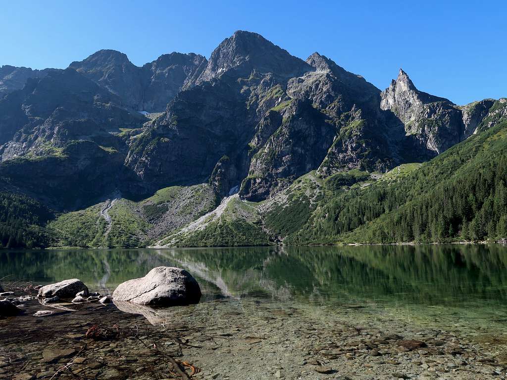
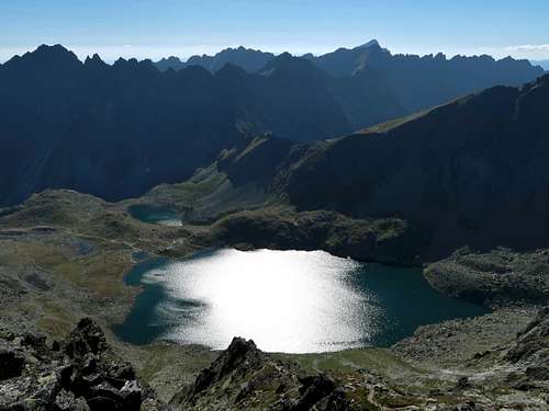
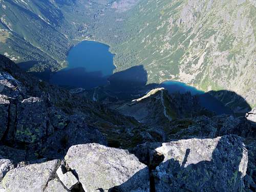
Mięguszowieckie/Mengusovske Peaks were named after the southern valley whose headwall they form, and in turn the name of the valley comes from the Slovak village of Mengusovce, whose inhabitants owned the valley and grazed their livestock in it before the Tatras became a national park. The Polish adjective 'czarny' translates as 'black'. This part of the name of the peak derives from the tarn at its north foot, i.e. Czarny Staw (Black Tarn), whose surface is dark most of the day as it is shadowed by the peaks that surround it. The Slovak adjective 'východný' means 'eastern'.
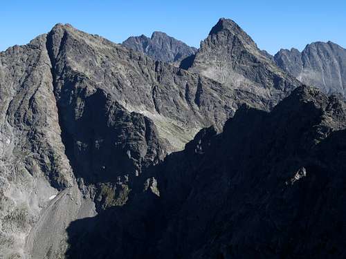
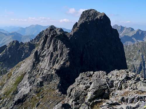
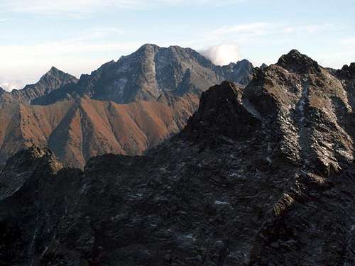
The peak lies on the main ridge of the High Tatras, on the Polish-Slovak border. It is the easternmost peak in the Mięguszowieckie Peaks group. It is separated from Mięguszowiecki Szczyt Pośredni/Prostredný Mengusovský štit by Mięguszowiecka Przełęcz pod Chłopkiem/Mengusovské sedlo, and from Hińczowa Turnia/Hincova veža (the westernmost peak of Wołowy Grzbiet/Volí chrbát) by Czarnostawiańska Przełęcz/Východné Mengusovské sedlo. From a climber's perspective, Mięguszowiecki Szczyt Czarny has a few important walls. The north, the east and the southwest walls reach the crest of the mountain. But the revered one lies a few hundred metres northeast of the summit: To the northeast the mountain puts out a short spur with a buttress called Kazalnica Mięguszowiecka (Mięguszowiecki's Pulpit), whose 500-metre-high wall, which drops into Czarny Staw (Black Tarn), boasts some of the most difficult trad routes in all of the Tatras. 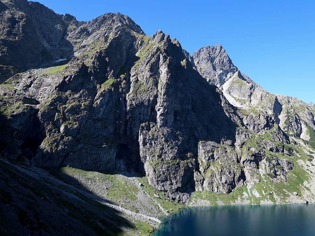
|
Summit Views
|
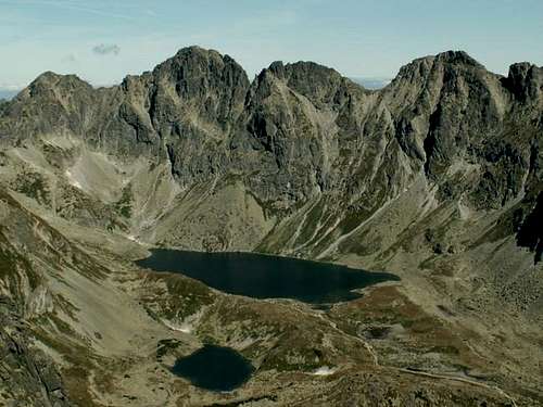
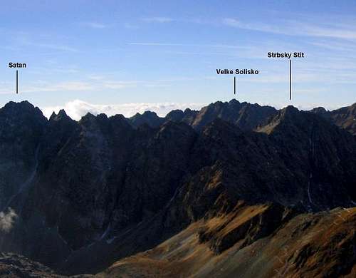
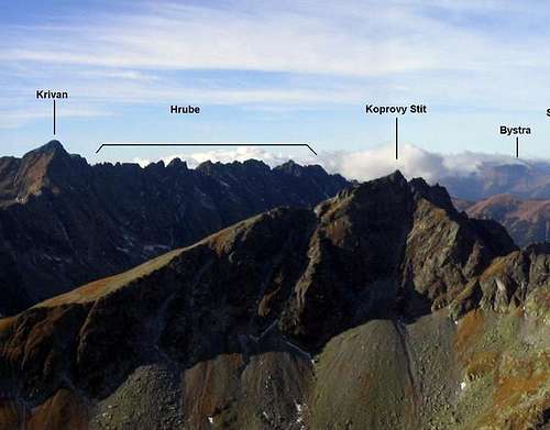
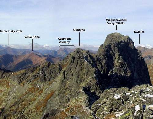
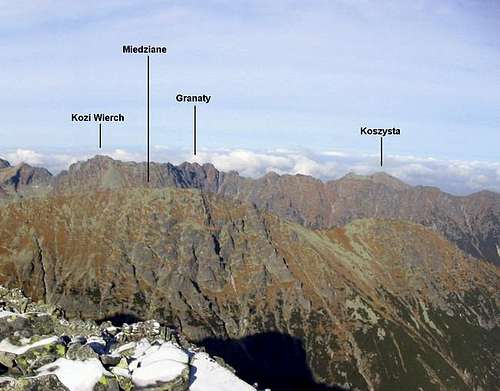
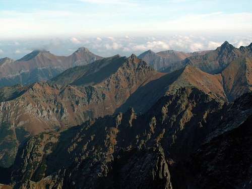
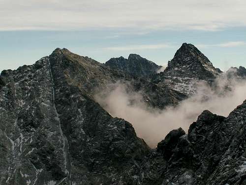
The summit offers spectacular panoramic views, especially of nearby Mięguszowiecki Szczyt Wielki/Veľký Mengusovský štít, Rysy and Wysoka/Vysoká.
|
Normal Routes from Nearest Huts
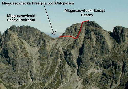
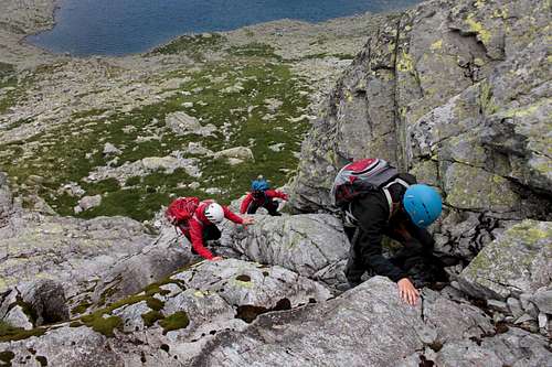
From PolandFrom Morskie Oko take the red stripe trail (the eastern variant is a bit shorter) to Czarny Staw (Black Tarn), from where the green marks will lead you to Mięguszowiecka Przełęcz pod Chłopkiem (literally Pass under the Little Bloke) or Mengusovské sedlo (the Slovak name): Please see this page. From the pass, in theory you can only continue with a licensed Tatra guide (see the Red Tape chapter). At the pass turn east and follow a distinct path traversing the south side of the mountain (photo above) and (year 2023) marked with plenty of cairns, for about ten minutes. This path, generally horizontal, dips slightly at first and after a while more sharply but only for a dozen vertical metres until it gets to a rib beyond which there is a large, outstanding chute. 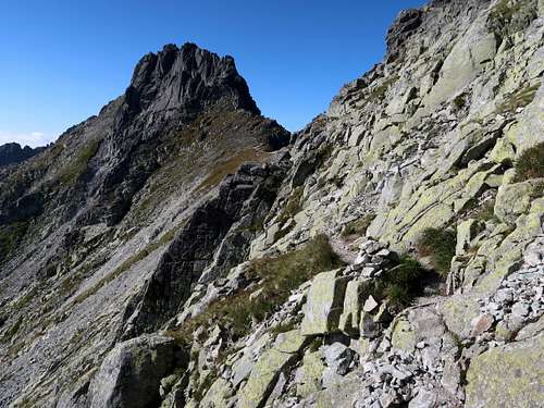
Climb up the rib to the crest. (If you run into a tricky step, there should be a convenient detour nearby - just have a closer look around.) Follow the crest and in a couple of minutes you will stand at the very summit.
Route statistics Time up: Morskie Oko Hut to Przełęcz pod Chłopkiem/Mengusovské sedlo: 3-3.5hrs; Przełęcz pod Chłopkiem to the summit: 30min Back the same way: 2.5-3hrs Net elevation gain: 1,000m Total elevation gain: approx. 1,020m Rock difficulty: Polish grade 0+ / YDS class 3 From SlovakiaThe mountain is less often climbed from the Slovak side. There used to be a waymarked trail (its green marks still show on the rocks there) that led from the southeastern shore of Veľké Hincovo pleso to Mengusovské sedlo, but it was closed years ago due to a serious rockfall hazard. The route is marked with red dots here on www.sprievodca.ta3.szm.com/ Route statistics Time up: Popradské Pleso Hotel to Mengusovské sedlo/Przełęcz pod Chłopkiem: 3.5hrs Mengusovské sedlo to the summit: 20-30min Back the same way: over 3hrs Net elevation gain: 916m Total elevation gain: almost the same Rock difficulty: Polish grade 0+ / YDS class 3-4
Another relatively easy route (YDS class 3 or 4 depending on the variant), also threatened by falling rocks, branches off the once waymarked trail so as to climb the chute descending from Czarnostawiańska Przełęcz/Východné Mengusovské sedlo. From the saddle you can either follow the ridge to the summit or traverse the southern side of the mountain until you get to the normal route from Mięguszowiecka Przełęcz pod Chłopkiem/Mengusovské sedlo. |


Getting There (to Nearest Hut)
|
Poland   Polana Palenica, where you will most likely be entering the national park, lies east of Zakopane, 12km away as the crow flies and nearly 25km away by road. Zakopane sits at the foot of the Tatra Mountains about 100km south of Kraków, where there's an international airport. (BTW The city of Kraków certainly boasts one of the most interesting old towns in East Central Europe.) It should take you less than two hours to drive from Kraków to Zakopane, but at the weekend or in high season, it often takes more than 3.5hrs, which is how long a journey by train lasts. As for the buses, check out this website. (The station adjoins the central railway station 'Kraków Główny'.) In Zakopane, minibuses to Polana Palenica (car park and bus/minibus terminus) leave from in front of the entrance to the railway station. Polana Palenica sits in the valley of River Białka, at about 985m. If you go by car, the only possible way to pay for parking is online. From Polana Palenica you walk up the valley along the same tarmac road (later with several shortcuts marked with red stripes) for about 1hr 45min (nearly 9km), making an ascent of 410m, until you get to the hut that sits by Morskie Oko. (About 25min before Morskie Oko is Polana Włosienica, where you can also get by horse-drawn wagon. A few hundred metres past the place is a restaurant with decent toilets next to it.) Slovakia   From a resort called Štrbské Pleso, built at the namesake lake (1346m), or the train (tram) stop Popradské Pleso (1245m) you will be walking north for about 1hr 15min (5 or 4km) along a waymarked trail until you get to the hut by a tarn called Popradské pleso, which sits at 1494m. The trail from Štrbské Pleso, marked with red stripes, is just a tad longer but it is very scenic.  |
Huts and Campsites
|
Poland
Slovakia
In high season expect all the huts (and the campsite) to be fully booked. You must book a bed online. In the good old days the huts normally offered a place on the floor but this isn't the case any longer. |


Maps
|
As for the analog maps, there are plenty of options. I would recommend the plastic 1:25,000 map of the Polish and Slovak Tatras by WiT. It has a large scale, is waterproof, durable and cheap. |
Red Tape

Mountain Conditions & Rescue

|