
|
|
Mountain/Rock |
|---|---|
|
|
42.94210°N / 122.17106°W |
|
|
Jackson |
|
|
Hiking |
|
|
Spring, Summer, Fall, Winter |
|
|
8013 ft / 2442 m |
|
|
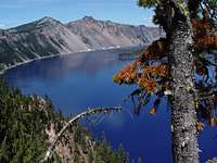
Overview

View North from The Watchman
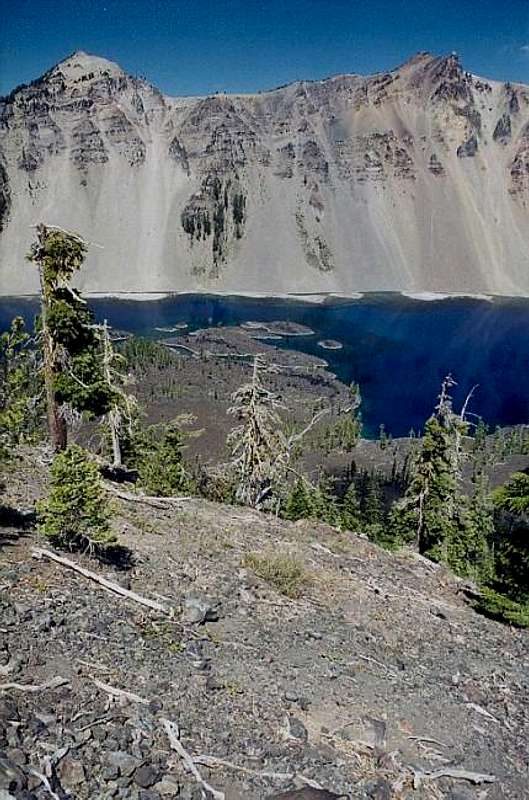
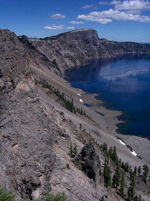
Situated on the western rim of the Crater Lake Caldera, The Watchman is probably the most frequently climbed 8000 foot peak in Oregon. Attaining the summit requires only a short hike and 400 feet of elevation gain from the parking lot. Despite the minimal effort, the views are quite good, with a grand panorama of the southern Oregon Cascades. Nearby crater rim peaks, Hillman Peak, Llao Rock and Applegate Peak are prominently visible. Views of the deepest lake in North America, 2000 feet directly bellow your feet are spectacular as well.
The peak was formed from the remains of a lava flow from ancestral Mount Mazama. Prior to the cataclysmic eruption that created the lake, this lava flow ran from the summit to about 2 miles down-slope of the present day location of The Watchman. Once the volcano collapsed the lava flow was sliced at the crater rim leaving a high point along the rim.
The summit is home to a historic fire lookout which is open to the public mid-July through October.
Getting There
The Watchman and Hillman Peak

The Watchman and Hillman Peak in winter
From Medford: Head north on highway 62 for 73 miles. Turn on Munson Valley road and continue on for 7 miles to the rim village. Drive 4 miles north of Rim Village to a viewpoint between The Watchman and Hillman Peak. Alternatively one can begin a summer hike from the picnic area on the rim one mile before the the overlook mentioned above.

Watchman from the north

Wizard Island Framed by The Watchman and Hillman Peak
From Klamath Falls: Head north on US 97 for 50 miles. Turn on Munson Valley road and continue on for 7 miles to the rim village. Drive 4 miles north of Rim Village to a viewpoint between The Watchman and Hillman Peak. Alternatively one can begin a summer hike from the picnic area on the rim one mile before the the overlook mentioned above.
Route Description

Watchman Map

Summit View
In summer There are 2 options of comparable difficulty. Beginning from the overlook between The Watchman and Hillman Peak, follow the Pacific Crest Trail southwest for just shy of half a mile. You'll come to the junction with the Watchman Trail, from here follow The Watchman trail to the summit.
Alternatively one can begin from the picnic area on the rim just south of The Watchman. To do so simply follow the Pacific Crest trail north for just over a mile to the junction with the watchman trail, then follow The Watchman Trail to the summit.
Both options require only slightly over a mile of hiking and 400 feet of elevation gain one way. See the map on the left for details.
In winter go northwest from the Rim Village, following the Circumnavigation route for about 3 miles. Ascend The Watchman from the south. Descend to the north. Go back to the Rim Village the way you came. Total distance is about 7 miles.
Essential Gear
If attempting in winter, bring Nordic skiis or snowshoes, a map, warm clothing, food, and water. If attempting in summer, no gear is required.  |  |  |  |
Red Tape
Crater Lake National Park requires an entry fee of $10/vehicle (seven-day pass). Those Holding an "America the Beautiful pass" are exempt.Camping

Crater Lake is home to 2 campgrounds
Mazama Campground:198 sites
Located in the Mazama Village
Lost Creek Campground:16 sites for tent camping only
Located near the southeast corner of the park
Contact and Links
View from near the summit
Contact Info
P.O. Box 7
Crater Lake, Oregon 97604
Phone
Visitor Information
(541) 594-3000
Fax
(541) 594-3010
Crater Lake Homepage
Crater Lake Webcams
Current Conditions Page