
|
|
Mountain/Rock |
|---|---|
|
|
41.27910°N / 111.9216°W |
|
|
Weber |
|
|
Hiking |
|
|
Spring |
|
|
8031 ft / 2448 m |
|
|
Overview

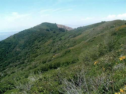
Forgotten most of the time, due to it's more popular neighbors, Lewis Peak is a nice little 10 mile hike, that gives you a variety of trail difficulty, and great scenery. Lewis overlooks North Odgen, between Ogden Peak and Ben Lomond. Vertical cliffs below the summit on the west are very rugged. There are no trails to the summit from the west, but it would make a fun scramble. The trail to the top is part of the Great Western Trail(GWT), and also is known as the Skyline Trail. The trailhead is at the top of the North Ogden divide. This also serves as the trailhead for Ben Lomond.
The Route
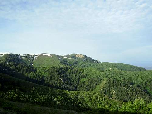
The first 2.5 miles from the trailhead is a steady climb through the pines, switchbacking up the south side of the canyon. Once on top of the ridge though, the view is excellent into the Ogden Valley. The views south of the north face of Mt. Ogden are great as well. Looking north, Ben Lomond looms large over the valley. The trail continues up steadily over a smaller peak. At this point you are east of the summit about 2.5 miles. Once at the top of the smaller peak, it's an easy trail up to the summit. The trail is well maintained and easy to follow. Once on top, you'll be treated to views across the Great Salt Lake, Willard Bay, and the Promontory Range. On clear days, mostly in winter, Pilot Peak on the Nevada/Utah border can be seen. The west face is very rugged and steep with several cliff bands. This area has become popular with the rock climbers.
Getting There
Take I-15 north past Odgen, and take the Pleasant View exit. Turn right onto 2700 north, heading east. You'll come to US-89, continue through the light heading directly east, This turns into 2600 north. Continue until you reach 400 east, and turn left. Now you heading north. Ben Lomond will be right in front of you. This turns into 450 east. Take a right onto 3100 north, heading east again. Continue east through the subdivisions, and you'll start climbing up the North Ogden Divide. This is a paved road, and is well maintained. Follow this to the top, and you'll see the trailhead parking on the right.
Red Tape
Camping
There are no designated camping spots. If you continue east down the road, and turn left at the next intersection, you'll see signs for North Fork Campground.
mountaingazelle - Jun 4, 2006 12:29 am - Voted 10/10
Lewis PeakGood choice for your first mountain page. The elevation of Lewis Peak is 8,031 feet. Here are the coords. LAT 41.2791 LON -111.9216
imontop - Jun 5, 2006 2:02 am - Hasn't voted
Re: Lewis PeakThank you ma'am. I'll update today.
Moogie737 - Jul 24, 2014 3:04 pm - Hasn't voted
Exit from I-15When approaching from Salt Lake City on I-15 take the 2700 North Exit. There is no mention of Pleasant View on the freeway signs. At the bottom of the off ramp one sees at last a reference to Pleasant View. Furthermore, 400 East is called Washington Blvd. I looked in vain for any reference at that intersection to 400 East.