
|
|
Mountain/Rock |
|---|---|
|
|
32.91000°N / 108.162°W |
|
|
Hiking |
|
|
Fall |
|
|
9035 ft / 2754 m |
|
|
Overview
Black Peak is located in the Gila National Forest. It is one of five different Black Peaks in New Mexico, and is the highest point in the Pinos Altos Mountains. Located about ten miles northeast of Silver City, Black Peak is a largely unknown mountain. It just isn't high enough to attract much attention. Although lower in elevation, the nearby Signal Peak, with its fire lookout and summit road, is much more popular. Signal Peak also has a maintained trail to its summit. Black Peak, on the other hand, has no road, lookout, or marked trail to its summit. But with a prominence of 2,349', Black Peak is big enough to make an appearance on the New Mexico Prominence Map.Getting There
From Silver City, drive north on State Highway 15 to Mile Marker 14. The road is paved, but it is also narrow and winding. Just past the marker is the signed trailhead for Forest Trail 742. This trail heads for Signal Peak. Park here if you want to climb to the top. The elevation at the trailhead is about 7,280’. Otherwise, you can drive about a ½-mile past the trailhead to Forest Road 154, turn right, and drive about six miles up the road to Signal Peak.Mountain Conditions
Contact the Gila National Forest, Silver City Ranger District. Their number is 505-388-8201.Topo Map: Twin Sisters.
Forest Map: Gila National Forest.
Camping
There are two Forest Service campgrounds near the trailhead: McMillan and Cherry Creek.External Links
New Mexico Prominence Map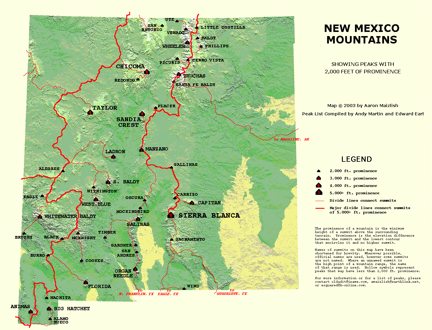
Signal Peak Trail