
|
|
Mountain/Rock |
|---|---|
|
|
40.36603°N / 111.66573°W |
|
|
Utah |
|
|
Hiking |
|
|
Spring, Summer, Fall, Winter |
|
|
8750 ft / 2667 m |
|
|
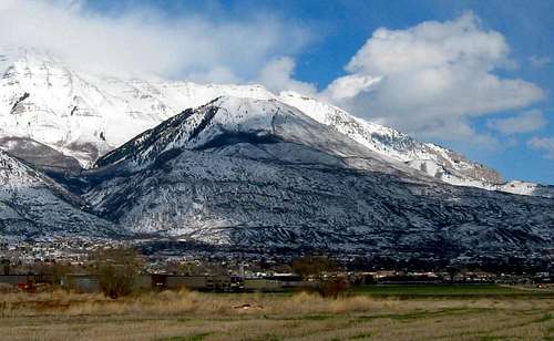
Snow dresses up the mountain in early winter.
![Big Baldy]()
![Big Baldy & his big Buddy]()
Big Baldy and Mt. Timp
You will find that access from the south via the south ridgeline is a great way to get a fairly "steep" workout in. If "steep" means anything that raises your heartbeat to your target exercise rate at a normal-to-brisk pace, then Big Baldy provides a great workout!
If "steep" means anything a big, red rubber ball would bounce all the way down with one kick, then bring extra water and a cell phone to call Search and Rescue when you have a heart attack half way up!
![Big Baldy storm]()
Storm on Big Baldy
The area around Big Baldy is a good place to get some snowshoeing activity in. Skiers also like to "boot" up and ski back down the gully on the southern side. All of this right on surburbia's doorstep, nice.
First, the Dry Canyon TH directions:
![Trailhead Sign]()
Dry Canyon TH sign
Drive to the top of Orem's 2000 North or Lindon's 200 South (those are one and the same) and turn left 50' before the road bends south onto Dry Canyon road. Turn left up through the really posh homes. Er, castles. Stay on that street which is now paved (as of fall 2009) all the way up to the NOW totally paved parking area at the trailhead road. It has a forest service vault toilet and a kiosk explaining a bit about the area. Park and hike up from here. See the route description below.
![Dry Canyon Trailhead]()
Trailhead view
The Battle Creek TH:
From state street, turn north into the center of the old part of town and look for 200 South. Turn right on this street and go on it all the way up the road, passing Pleasant Grove High School as you do so. The road deadends at the Kiwanis Park which is right at the mouth of the canyon. Park there and head up the road past a locked gate. The road ends in a half mile or so (not exact here) and turns into a trail that continues fairly steeply at times up the canyon.See the route description below.
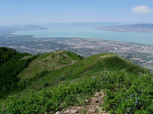
![From the top of Big Baldy]()
Camping? You can camp on the flanks of this mountain but there isn't a need to camp since this is a relatively short dayhike, requiring no more than just a few hours. I have seen people camped up the Dry Canyon trail as there are several spots to put a tent.
There are plenty of motels in the Provo-Orem area if overnight lodging is
desirable and there is a KOA campground in Provo.

Snowshoeing in winter? You bet. From the Dry Canyon TH, some great snowshoeing is possible. Moose? They were sighted up there this spring.
All this and more will be added as time allows so check back once in a while to see the updates as they occur. Recently, in late October, I saw bear scat on the southwest ridge trail so perhaps it might be possible to see a bear
A night climb? SP member Eric Willhite did this on Nov 13th. See pic and link to his trip report with more of his night time pics. Click Here.
![Baldy at Night]()
Eric Willhite pic
Leave the parking area and head up the well marked trail.
Follow the trail between the cliffs to a wide meadow just above. Continue upward till about the end of the meadow where you reach another trail - turn left (north) and stay with it until you reach a fork about the 6300' level. Take the right branch which goes to the east and this will take you to the southwest ridge trail or allow you to continue on towards Big Baldy pass.
The Southwest Ridge begins at 6375' level, marked currently by a cairn and the fork is found just as the trail you have been on starts to drop down a hill. (gps 40.3505 -111.6641 nad 27) It heads directly up the hill and with a few switchbacks, stays pretty much close to the southwest ridge all the way up. It gets very steep in places but the footing is generally decent, follow it to the summit. If you elect to not go up the southwest ridge, you can stay on the regular trail all the way to the shoulder where Big Baldy connects to Timpanogos Everest Ridge at Big Baldy Pass, then follow the ridge to the summit for a milder approach. See the map for the southwest ridge.
![SW ridge]()
SW ridge
The elevation gain is about 3,200' and the round trip distance is about 5 miles if you go direct up the south ridge. It is a mile longer if you go up to the saddle that lies between Big Baldy and Mt. Timpanogos.
BATTLE CREEK (see getting there above)
Park there (near Kiwanis Park) and head up the road past a locked gate. The road ends in a half mile or so (not exact here) and turns into a trail that continues fairly steeply at times up the canyon. A couple simple foot bridges and a waterfall are part of the scenery and in about 2 1/2 miles you will reach a junction with the Great Western trail. Take a right (south) and head for Baldy Saddle, which is at roughly 8300 feet and is about a mile away.
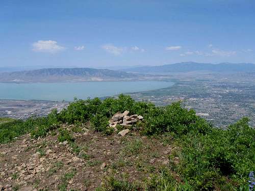
The trail is good all the way to the saddle and switchbacks several times as it heads up the flank of Big Baldy. I found a shortcut at the 7900 foot level that was a bit more direct but either way will get you to where you want to go. At the pass, you will note a fire ring and a trail sign, 020. Head up the path on 020 and in about a mile (slightly less) and several hundred feet higher, you will find yourself at the summit of Big Baldy. You could continue on past the summit with its small cairn and drop down the south ridge but that will be saved for a loop hike description.
My GPS distance from the Kiwanis Park was 4.80 miles. (Dean)
![Battle Creek -Dry Canyon routes]()
![Dry Canyon routes]()
Dry Canyon routes
There are a couple of geocaches hidden on Big Baldy that might be of interest:
Big Baldy Cache
Between-the-saddle-and-the-peak
Not recommended at night, Fox
There are several others on the approach but if you are not into geocaching, please don't bother these. I am one of those who feel they add another incentive to my hike. Its a fun addition to what I do and you can learn more at geocaching.com
Dean
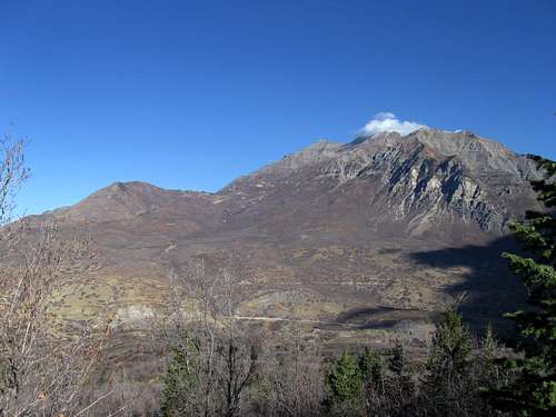
Big Baldy and Mt. Timp
Overview
One of the treasures the lucky folks in the Utah Valley area have at their doorstep is this "little" mountain known as Big Baldy. If you're looking for a medium-size hike in any season, Big Baldy (usually just called "Baldy") is a nice choice. It's the big, obvious lump on the West Face of Timpanogos. It works as a great warm up or work out for more serious ascents, but in Utah terms, it's mild. However, thanks to the rising price of gas, many people are looking for something close to home and can substitute a hike on this mountain to fulfill the need to get a good hike in. Making a loop hike from one trailhead to another trailhead is a good way to get some variety. More on that later on.You will find that access from the south via the south ridgeline is a great way to get a fairly "steep" workout in. If "steep" means anything that raises your heartbeat to your target exercise rate at a normal-to-brisk pace, then Big Baldy provides a great workout!
If "steep" means anything a big, red rubber ball would bounce all the way down with one kick, then bring extra water and a cell phone to call Search and Rescue when you have a heart attack half way up!
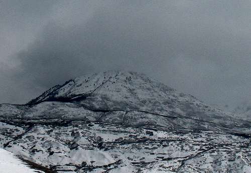
Storm on Big Baldy
The area around Big Baldy is a good place to get some snowshoeing activity in. Skiers also like to "boot" up and ski back down the gully on the southern side. All of this right on surburbia's doorstep, nice.
Getting There
Two ways to access this mountain are within just a few miles of each other. The Dry Canyon TH and the Battle Creek TH.First, the Dry Canyon TH directions:

Dry Canyon TH sign
Drive to the top of Orem's 2000 North or Lindon's 200 South (those are one and the same) and turn left 50' before the road bends south onto Dry Canyon road. Turn left up through the really posh homes. Er, castles. Stay on that street which is now paved (as of fall 2009) all the way up to the NOW totally paved parking area at the trailhead road. It has a forest service vault toilet and a kiosk explaining a bit about the area. Park and hike up from here. See the route description below.
Trailhead view
The Battle Creek TH:
From state street, turn north into the center of the old part of town and look for 200 South. Turn right on this street and go on it all the way up the road, passing Pleasant Grove High School as you do so. The road deadends at the Kiwanis Park which is right at the mouth of the canyon. Park there and head up the road past a locked gate. The road ends in a half mile or so (not exact here) and turns into a trail that continues fairly steeply at times up the canyon.See the route description below.
Camping
Camping? You can camp on the flanks of this mountain but there isn't a need to camp since this is a relatively short dayhike, requiring no more than just a few hours. I have seen people camped up the Dry Canyon trail as there are several spots to put a tent.
There are plenty of motels in the Provo-Orem area if overnight lodging is
desirable and there is a KOA campground in Provo.
Weather
Other tid bits
The Battle Creek trailhead near the Kiwanis camp up 200 south is also a great way to access this peak but it entails a longer hike than going via Dry Canyon. However, it does offer a chance to see a neat waterfall on the way and some of the enticing area that is between where the Battle Creek trail exits onto the Great Western Trail and Big Baldy Saddle.Snowshoeing in winter? You bet. From the Dry Canyon TH, some great snowshoeing is possible. Moose? They were sighted up there this spring.
All this and more will be added as time allows so check back once in a while to see the updates as they occur. Recently, in late October, I saw bear scat on the southwest ridge trail so perhaps it might be possible to see a bear
A night climb? SP member Eric Willhite did this on Nov 13th. See pic and link to his trip report with more of his night time pics. Click Here.

Eric Willhite pic
Routes
DRY CANYON (see getting there above)Leave the parking area and head up the well marked trail.
Follow the trail between the cliffs to a wide meadow just above. Continue upward till about the end of the meadow where you reach another trail - turn left (north) and stay with it until you reach a fork about the 6300' level. Take the right branch which goes to the east and this will take you to the southwest ridge trail or allow you to continue on towards Big Baldy pass.
The Southwest Ridge begins at 6375' level, marked currently by a cairn and the fork is found just as the trail you have been on starts to drop down a hill. (gps 40.3505 -111.6641 nad 27) It heads directly up the hill and with a few switchbacks, stays pretty much close to the southwest ridge all the way up. It gets very steep in places but the footing is generally decent, follow it to the summit. If you elect to not go up the southwest ridge, you can stay on the regular trail all the way to the shoulder where Big Baldy connects to Timpanogos Everest Ridge at Big Baldy Pass, then follow the ridge to the summit for a milder approach. See the map for the southwest ridge.

SW ridge
The elevation gain is about 3,200' and the round trip distance is about 5 miles if you go direct up the south ridge. It is a mile longer if you go up to the saddle that lies between Big Baldy and Mt. Timpanogos.
BATTLE CREEK (see getting there above)
Park there (near Kiwanis Park) and head up the road past a locked gate. The road ends in a half mile or so (not exact here) and turns into a trail that continues fairly steeply at times up the canyon. A couple simple foot bridges and a waterfall are part of the scenery and in about 2 1/2 miles you will reach a junction with the Great Western trail. Take a right (south) and head for Baldy Saddle, which is at roughly 8300 feet and is about a mile away.
The trail is good all the way to the saddle and switchbacks several times as it heads up the flank of Big Baldy. I found a shortcut at the 7900 foot level that was a bit more direct but either way will get you to where you want to go. At the pass, you will note a fire ring and a trail sign, 020. Head up the path on 020 and in about a mile (slightly less) and several hundred feet higher, you will find yourself at the summit of Big Baldy. You could continue on past the summit with its small cairn and drop down the south ridge but that will be saved for a loop hike description.
My GPS distance from the Kiwanis Park was 4.80 miles. (Dean)


Dry Canyon routes
Into geocaching?
One of the more fun things to combine with your hiking is to intentionally hike to places where geo caches have been placed for you to find with a GPS. Geocaching dot com is a treasure trove of information on this hobby and I'll be working on adding more information about the Big Baldy, G Mountain and areas above Lindon and Pleasant Grove. Stay tuned but below are a few appetizers:There are a couple of geocaches hidden on Big Baldy that might be of interest:
There are several others on the approach but if you are not into geocaching, please don't bother these. I am one of those who feel they add another incentive to my hike. Its a fun addition to what I do and you can learn more at geocaching.com
Dean
jtrain - Mar 30, 2014 10:05 am - Hasn't voted
SW RidgeMileage up the SW ridge from my GPS was 2.2 miles. The distance from the trail head to the ridge trail was almost exactly one mile. This makes the SW ridge route almost 2k ft/mile once you break off from the Dry Canyon trail.