
-
 41240 Hits
-
 95.35% Score
-
 52 Votes
|
|
Mountain/Rock |
|---|---|
|
|
48.49600°N / 113.415°W |
|
|
Hiking, Mountaineering, Scrambling |
|
|
Summer, Fall |
|
|
9513 ft / 2900 m |
|
|
Rising Wolf and Two MedicineMahkuyi-opuahsin, the Blackfeet name of this remarkable peak, means "The way the wolf gets up," and on a warm summer day immediately brings to mind wonderful and  The true summit The true summit Not a "rising wolf" I'd care to meet! Not a "rising wolf" I'd care to meet! Both the false and true summits... Both the false and true summits... Lower Two Medicine Lake and Rising Wolf at Twilight Lower Two Medicine Lake and Rising Wolf at Twilight First view of the actual summit First view of the actual summitThe Blackfeet Indians considered the Two Medicine area "The Backbone of the World," and in addition to the normal usage for sustenance, used this portion of what would eventually become Glacier National Park for vision quests. The story of how the area came about its name is taken from the writings of James Willard Schultz,  The mountain in pastel The mountain in pastel The summit The summitNo place in Glacier National Park can be said to be truly unknown, and of course that is not the case here,  Rising Wolf summit, from ridge to Flinsch Peak Rising Wolf summit, from ridge to Flinsch Peak Almost like looking into a cut-away model! Almost like looking into a cut-away model!Ascent Options—and an Important Warning The view south and west from Rising Wolf The view south and west from Rising Wolf Scrambling up the south face Scrambling up the south faceRising Wolf has an elevation of 9513 feet, is the Two Medicine area's highest summit, and climbers should plan on at least a 12-hour day. Two of the three routes up this mountain involve cliffs, where care and patience must be taken in route finding, but with the exception of the East Face route, it is not an unusually difficult Glacier Park mountain to ascend.  Graceful Mount Ellsworth Graceful Mount Ellsworth Canyons and ridges and mountains, and it's all a mishmash! Canyons and ridges and mountains, and it's all a mishmash! Nothing subtle here! Nothing subtle here!The "easiest," and most straightforward route is via the Dawson Pass trail to the ridge between Flinsch Peak and Rising Wolf (between 7 and 8 miles from the Two Medicine Campground, which is the trail head), then a lengthy walk to the summit. From the summit of Rising Wolf follow the ridge further east, toward the false summits seen when viewing the mountain from the east, but rather than continuing to the dangerous cliff descent mentioned above, the south face of the mountain is taken, which eventually has you rejoining the Dawson Pass trail approximately two miles from your starting point.  Lone Walker & the Cloudcroft Peaks Lone Walker & the Cloudcroft Peaks A great trio of peaks! A great trio of peaks! Mount Doody, the Cloudcroft Peaks Mount Doody, the Cloudcroft PeaksThe best thing about any of the options on this mountain is that of the possibility of also summiting Flinsch Peak, which is separated from Rising Wolf by a long ridge with extremely fine views. But be aware that this option will take an already lengthy day and make it more so by at least two or three hours—don't forget your headlamps!—and the additional elevation gain from Dawson Pass to the Flinsch summit is over 1600 feet  Flinsch, Stimson, Morgan Flinsch, Stimson, MorganVolume Two of Climb Glacier National Park has more details on Rising Wolf Mountain and the West Face and Dawson Pass Routes. It can be ordered at Climb Glacier National Park.  A last look at what we accomplished.... A last look at what we accomplished....
 North, from Rising Wolf...(!) North, from Rising Wolf...(!)
Blackfeet Indian ReservationIt is impossible, and not desired, to separate the Native Peoples from either the history or current life of this area. The Blackfeet Indian Reservation is immediately east of Glacier National Park—tribal headquarters are in Browning—and their official website is a great source of information on trip planning, and the cultural history of the region. Do check it out!
Getting ThereFrom the north, take Hwy 89 south from Saint Mary, turning on Hwy 49—a paved road, but very winding and slow going; relax, enjoy the wonderful views!—for approximately eight miles until the Two Medicine turnoff, then it is seven easy miles to the campground, ranger station, store, boat dock, and ample parking. From the south, take Hwy 2 to East Glacier, and in town turn on Hwy 49, head north out of town four miles, to the Two Medicine road. Standard Precautionary Note: All GNP roads are closed in winter, with Going-to-the-Sun Road (the major route through the park; its eastern terminus is at Saint Mary) sometimes not opening until July (average opening is second week in June; earliest opening ever is May 16, 1987, with the second earliest being May 22, 2005). Don't head out early in the year (i.e., June/early July) without checking the status of these roads—it is not unusual to have repeated, sometimes lengthy, road closures due to storms, avalanches, rock slides, or all three! The same holds true for late in the year; weather changes dramatically, beginning usually around the end of August, with road closures normally becoming more and more frequent through the month of September (although don't shy away from going, there can also be very nice—albeit cool or cold—days of Indian Summer throughout this time frame; plus the park is relatively free of people after Labor Day). The following links are pretty much self-explanatory, and provide all sorts of useful and interesting information: Map of Waterton/Glacier International Peace Park
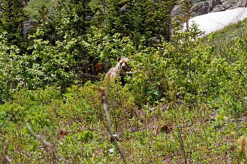
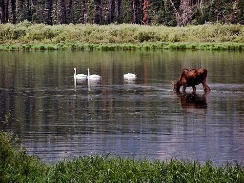
The Red Tape, Wildlife, & Cautions Section
When to Climb, & Climbing ConsiderationsFrom late June/early July (during this time frame expect LOTS of snow in the high elevations) to early fall, depending on snow conditions. Traditional climbing season in the Northern Rockies is July, August, and September—with September weather becoming progressively colder and more unstable (sometimes dramatically so: PAY ATTENTION!) as the month progresses—but does of course vary from year to year. There are occasional winter climbs in the park, but not often, and then only by well-equipped, area-wise, extremely competent individuals. Basically, most of GNP is inaccessable through the winter, and avalanche danger, to put it mildly, is extreme almost everywhere.
Because of the nature of the rock, there are special considerations regarding climbing in Glacier National Park, and grading systems unique to the park have been developed by both J. Gordon Edwards and the Glacier Mountaineering Society. Anyone doing more than just "trail" hiking in this part of the Rockies should read the excellent and important information put together by Fred and Moni Spicker. Much—if not most—of the rock in GNP is sedimentary and rotten, and you need to know about it: Glacier National Park Rock & Grading Systems.
Camping & LodgingThe Two Medicine Campground ($20 per day—no reservations, first come first served basis) is close to the area trailheads, as well as the ferry. There are numerous campgrounds available within Glacier National Park, of which only Fish Creek and Saint Mary take reservations (not required, but probably a good idea during the peak summer tourist period). There are also many campgrounds, as well as motels, just outside the park on both the west and east sides. Click here for General Camping Information, and click here for Current Site Availability in specific campgrounds. In addition, there is a great deal available in the way of accomodations and camping on the Blackfeet Indian Reservation. The community of East Glacier Park is within easy driving of Two Medicine Lake (approximately 20 minutes), and has several restaurants and motels, as well as an RV park which also caters to tenters. And if your credit card is gathering dust, East Glacier Park is also home to the (really nice) Glacier Park Lodge.
Current Park ConditionsWeather page—an overview, plus current conditions and forecast This is the New NPS Web Cam Page.
External Links/Additional Information/Items of Related Interest
In TributeOn March 1, 2011, Vernon Garner, Saintgrizzly, left us after losing a bold, inspiring fight against pancreatic cancer. Or maybe he won, for he is at last free of his pain and has "shuffle[d] off this mortal coil."Vernon was an important contributor on SummitPost, but beyond merely making good, informative pages, he actually inspired many who read his work. No one put more work into his or her pages than Vernon did, and many of those pages, especially those related to Glacier National Park, the place he loved above all others, are works of art in both the writing and layout. More than one person has wanted to visit Glacier or go back to Glacier largely due to what he shared about that magnificent place. Many people on SP counted Vernon among their friends, and many more saw him as one of the best, one of those who exemplified the spirit of this site. He was one of the best of us, he will be missed, and he will not be forgotten. As a tribute to him, Vernon's pages will remain in his name. Any member who sees a need for an addition or correction should please contact site management via the "Send PM to the Elves" feature. Rest well and climb on, Vernon. |