
-
 17557 Hits
-
 86.08% Score
-
 22 Votes
|
|
Mountain/Rock |
|---|---|
|
|
34.27080°N / 118.104°W |
|
|
Los Angeles |
|
|
Hiking |
|
|
Spring, Summer, Fall, Winter |
|
|
5957 ft / 1816 m |
|
|
Overview: Strawberry's "Plain Sister" Has Her Own Charms
Although Mt. Lawlor shares a saddle with its close neighbor, Strawberry Peak, it does not share the latter’s popularity. In his revered hiking guide to the San Gabriel Mountains, Trails of the Angeles, John Robinson notes that Strawberry Peak is referred to by hikers as “the fun peak” of the range. Mt. Lawlor does not make the list of 100 hikes in Robinson’s book. That’s a shame.
The parallels to a Rodney Dangerfield aura don’t stop there. Mt. Lawlor was once also known as “Little Strawberry Peak.” But even when it got its own name, the name was misspelled on both USFS maps and USGS topos. The misspelled name has stuck to this day. The surname of the prominent citizen after whom the peak was named was actually “Lawler.”
Though she may be perceived as Strawberry Peak’s “plain sister,” Mt. Lawlor has her own charms and deserves respect in her own right. For one thing, the two principal routes to the summit of Mt. Lawlor are extremely scenic ridge routes. Particularly adventuresome is the route up Lawlor’s south slope. It is so steep and choked with ferociously sharp yucca plants that someone has found it appropriate to place “aid” on the route in the form of several lengths of thick wire anchored into the ground to be used as hand lines. Second, the summit views are magnificent as one might expect from a peak that is only 43 feet shy of 6,000 feet.
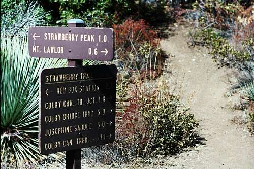
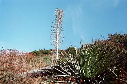
Both main routes to Lawlor begin at the Red Box Ranger Station trailhead. Cross the Angeles Crest Highway and go northeast along the highway for about 100 feet. Then take the fire road that comes up on the left about ¾ of a mile to a trail junction also on the left. Follow the trail left about ¼ mile to the ridge just south of Mt. Lawlor. If you are feeling up for a challenge, at this point go right onto the beginning of Lawlor’s south ridge. As mentioned, this route is extremely steep, with lots of loose dirt, and carpeted with sharp-pointed yucca plants all the way up.
To do the most popular and easier route, continue past the south ridge on the trail as it contours around Lawlor until you reach the signed saddle between Lawlor and Strawberry Peak (elev. 5,200’). Here, you are 2 miles from the start.
 Signed Saddle between Mt. Lawlor and Strawberry Peak
From the saddle, turn right and head up the use trail on Lawlor’s northwest ridge about 0.6 miles to the summit.
 Ascending Mt. Lawlor's main route, the northwest ridge
You get some great views of Mt. Wilson, San Gabriel Peak and Mt. Disappointment as you climb this ridge.
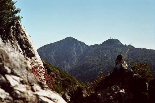 View of San Gabriel Peak (left) and Mt. Disappointment (right) as you ascend the NW ridge of Mt. Lawlor
On the summit, to the northwest you will spy neighbor Strawberry Peak, just 1.3 miles away as the crow flies. Looking northeast, you will see the long summit of Barley Flats (5,600+ ft.). The fenced facility near the summit is currently a religious retreat. On the distant western horizon, Mt. Lukens points its antennas into the sky. Skirt the trees and bushes partially blocking views to the south and you will get excellent views of San Gabriel Peak and Mt. Disappointment.

Looking Northwest (Strawberry Peak in center) from the summit of Mt. Lawlor

Strawberry Peak seen from the summit of Mt. Lawlor
 Looking Northeast to Barley Flats (center) from summit of Mt. Lawlor

Looking west to Mt. Lukens from summit of Mt. Lawlor

Looking south from Mt. Lawlor to San Gabriel Peak
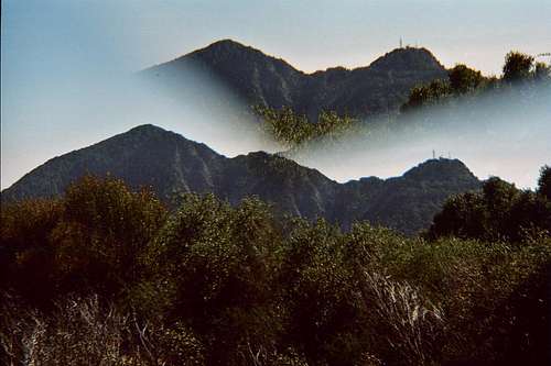 San Gabriel Peak (L) and Mt. Disappointment (R) seen "doubled up" from the summit of Mt. Lawlor
The easier route is 6 miles roundtrip with 1,300 feet of gain, while the steeper route up the south slope is only about 2.75 miles roundtrip with 1,300 feet of gain.
Lawlor could also be approached from Barley Flats by following the firebreak southwest and west on the ridge that connects the two peaks, but this is not a principal route.
Getting There
From the 210 Freeway, exit at Angeles Crest Hwy (SR 2) and go north. At 9.5 miles, you will come to the Clear Creek Information Station and the junction with Angeles Forest Highway. Continue straight on SR 2 about 4.5 miles to the junction with the Mount Wilson Road at the Red Box Ranger Station. This is your trailhead and you will find plenty of parking here.
Red Tape
You will need an Adventure Pass to park your vehicle anywhere within the Angeles National Forest, including this trailhead. These passes are currently sold at the trailhead you will use, the Red Box Ranger Station ($5 per day or $30 for a yearly pass). Otherwise, Adventure Passes are sold at most sporting good stores.
No permits are required for hiking.
Camping
There are no campsites in the immediate vicinity of this peak. The closest camping would be at Valley Forge Campground, 2 miles from the Red Box trailhead.
Mountain Conditions
Check forecast information for nearby Mt. Wilson in local newspapers or on internet weather services. Snow is, of course, common at elevations above 3,000 feet during the winter.
Other Information
USGS Topos: Chilao Flat 7.5