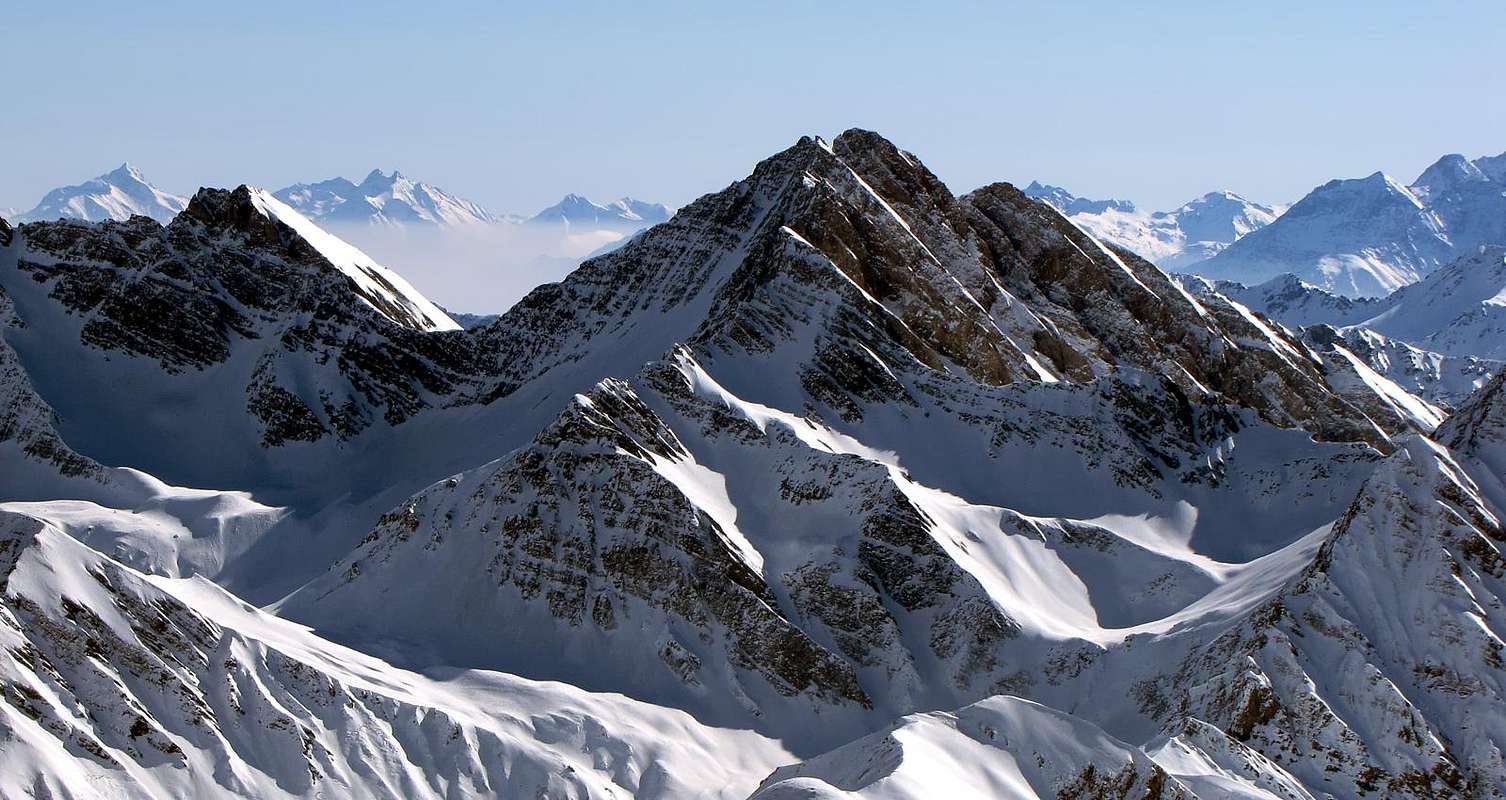
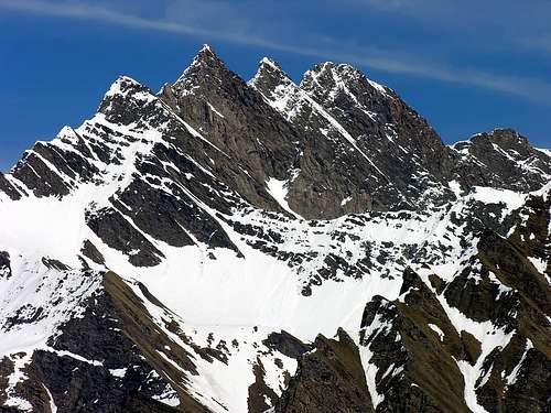
Beautiful and imposing summit located in High Valle d'Aosta, Grande Rochère is the meeting point of three large ridges, which travel in the NE, NO, and S-SE directions. The views from Grande Rochère cover the entire Region of Valle d'Aosta. The vista of Mont Blanc, rising in all its majesty between Aiguille des Glaciers and Mont Dolent, is justly famous. Grande Rochère is not well known because it is difficult to see from the valley floor.
First Ascents
First ascent (southwest aspect): Albert and Casalegno, surveyors of SMS, from Courmayeur via Comba di Chambave, (1832).
S-SE Arête (Varise Arête): abbot Jean Bonin, (Aug 07th, 1891).
N-W Arête: Aldo Bonacossa, Edgardo Rebora, David Quaizier e Julien Rey, (Sep 01th, 1918). First? replay Osvaldo Cardellina, solo (Aug 31th, 2010)
N-E Arête: Marcel Kurz and Eberhard Phildius, (Aug 21th, 1905). First replay R. Craveri and Jean d'Entreves (Aug 06th, 1929) from Col Malatrà; Second? and first? integrally Osvaldo Cardellina, solo (Jun 10th, 2010) from Bonalé Pass.
N Wall: Alessandro Gogna, (previously used as a descent route).
W Wall (Couloir between Grande and Petit Rochère): Osvaldo Cardellina, (Aug 27th, 1988).
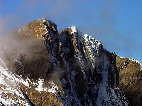
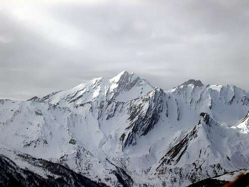
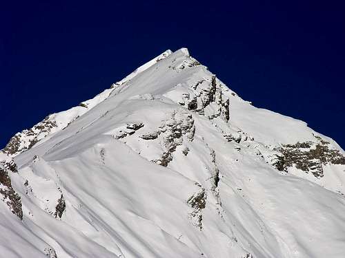
Different Views of Grande Rochère
Getting There
The initial part of your approach depends on where you are coming from:
BY CAR:
From Torino, Milano, etc: Motorway A5. Exit at Morgex.
From Switzerland: through the Grand Saint Bernard Tunnel or the namesake pass.
From France: through the Mont Blanc Tunnel or Petit Saint Bernard Pass: It is not necessary to take motorway A5: you can drive on SS.26, in the direction of Aosta.
From the Morgex exit of Motorway A5, continue east for about 1.5 km along SS.26 in the direction of La Salle (994m). Take the main street of La Salle and continue along the Regional Route leading to the small Village of Morge (1.625m). After a few switchbacks, and past the Villages of Chatelard (1.061m), Remondey (1.349m) and Morge (1.625m), arrive to Planaval (1.750m), where you leave the car.
BY PLANE:
Aeroporto "Corrado Gex" Saint Christophe (Aosta).
Route
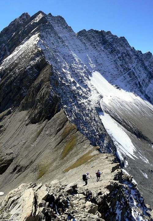
Normal route: From the Village of Planaval hike east taking the pack trail that goes up steeply and diagonally. Go past the Pasture of Montagna Casa Bianca (1.871m), climb the following small hanging valley, surmount a steep slope marked by streams, and reach the Rantin Pasture by a wide diagonal road (2.238m, 1h'00 to 1h'30min). Head west for about 1.5 km, reaching the Pra Barlet Pasture and the Bonalé Hut (2.340m). Cross the floor of the hanging valley on a faint trail, aiming for the grassy slopes to the left of a characteristic beak-shaped promontory above a cliff. Continue in a gully with light-colored rocks aiming for the shoulder that comes down directly from Petite Rochère (not for the scree-filled gully). Past a couple of steep slopes made of calcoschists and grassy turf, reach a faint but very scenic trail that leads, through scree and patches of snow, to the col between Grande Rochère and Petite Rochère. From there, climb scree and broken rocks to reach the summit in about 30 minutes. The route is not difficult, but steep and the trail is discontinuous. The summit trigonometric marker (3.326m) is visible from below. (Three hours from Bonalé Hut; five hours from Planaval.) Lower variation: From Planaval (1.750m) descend briefly to the bridge and walk along the dirt road along the stream. At first the road is almost flat, and then it goes gently uphill till it reaches the Pasture "Les Eculés" (1.880m). From there, a nice view can be had to the east of the waterfalls. Continue on the trail along the stream to elevation 2.083m, and then surmount a steep gully leading to Alpe Bonalè (2.340m). Higher variation: It is currently the most frequently used variation. Climb further left (south) the gully between Petite Rochère (3.267m) and Mont de la Varise (3.006m). The gully leads to a saddle (2.990m) with a safer route. From the saddle, an easy climb takes you to Petite Rochère. Keep east and descend on steep rocks to the notch about 100m below. From the notch, continue along the route that leads to Grande Rochère.
Difficulty
The route is rated EEA/F+.
Equipment
Standard mountaineering equipment.
Campings
Remember that free camping is forbidden (except for emergency reasons, above 2.500m, from darkness until dawn).
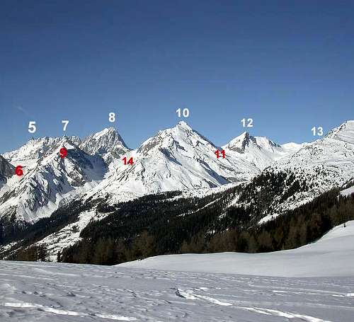
5) Dente del Gigante 4.013m 6) colle di Liconi 2.674m7)Dôme de Rochefort 4.015m8) Les Grandes Jorasses 4.208m9) Aiguille de Chambave 3.067m10) Grande Rochère 3.326m11) colle di Bonalé 2.925m12) Aiguille de Bonalé 3.201m13) Aiguille d'Artanavaz
3.028m14) colle Battaglione Aosta 2.882m.
Mountain Condition
Meteo: you can find all the needed informations at the official site of the Valle d'Aosta Region:
"Guida dei Monti d'Italia-Alpi Pennine" (Vol. I°) di Gino Buscaini-Club Alpino Italiano/Turing Club Italiano, Luglio 1971 (in Italian).
"Diari Alpinistici" di Osvaldo Cardellina e Indice Generale accompagnato da Schedario Relazioni Ascensioni 1964-2019 (inediti).
"80 itinerari di Escursionismo Alpinismo e Sci Alpinismo in Valle d'Aosta", di Osvaldo Cardellina, Ed. Musumeci, Giugno 1977 (in Italian); seconda Ed. Luglio 1981; terza Ed. Luglio 1984; (in French), prima Ed. Febbraio 1978; seconda Ed. Marzo 1980.
MAPS:
Kompass "Massiccio del Monte Bianco Valle d'Aosta Sentieri e Rifugi" Carta turistica 1:50.000.
I.G.C. Istituto Geografico Centrale Torino "Massiccio del Monte Bianco" (carta n° 4), Torino, 1998 1:50.000.
I.G.C. Istituto Geografico Centrale Torino "Monte Bianco-Courmayeur-Chamonix M.B.-La Thuile" (carta n° 107), Torino 1989 1:25.000.
I.G.M. Istituto Geografico Militare "Gr. Rochère" 1:25.000.
Parents refers to a larger category under which an object falls. For example, theAconcagua mountain page has the 'Aconcagua Group' and the 'Seven Summits' asparents and is a parent itself to many routes, photos, and Trip Reports.

 17248 Hits
 95.35% Score
 52 Votes