
|
|
Mountain/Rock |
|---|---|
|
|
39.33389°N / 119.93861°W |
|
|
Washoe |
|
|
10490 ft / 3197 m |
|
|
Overview
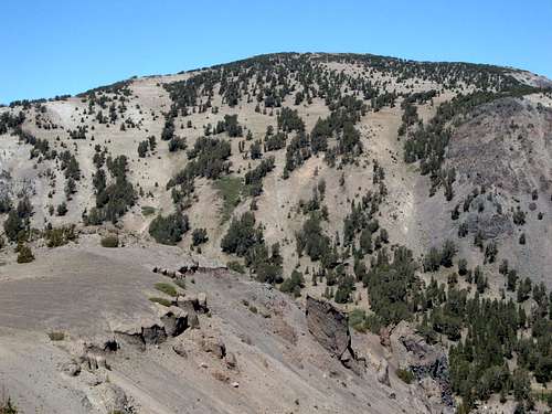 Zoom shot of Mount Houghton
Mount Houghton is the 2nd highest peak in the Mount Rose Wilderness, located near the cities of Reno and Carson City. It is situated on the north edge of the Relay Ridge 1.36 miles west of Mount Rose 10,776'. It rises 750 feet above the saddle it shares with Mount Rose, clearly distinguishing itself as a separate peak.
The trailhead is a 30 minute drive from downtown Reno, making it a very accessible mountain summit. Mount Houghton is overshadowed by Mount Rose, which is why it doesn't see nearly as many hikers on its slopes.
Despite this overshadowing, Mount Houghton is still a worthy destination. It can be hiked in four to five hours round trip. The longer routes are all on trail (ideal for trail runners), the slightly shorter route involves some class 3 climbing. From the summit you will find exquisite views, particularly to the northwest and to the south. Views towards Reno are blocked by Mount Rose.
Getting There
Getting to the trailhead for Mount Houghton is easy. From Reno take 395 to the Mount Rose Highway (431). Take 431 until you reach the Mount Rose Summit Parking Area (8,911'). From here, there are two main routes to the summit, both which will take four to five hours to hike up and down.
There are two main class 1 hiking routes described on this page, and there is a separate route page for class 3 scree slope route, which is 9 miles round trip.
Mount Rose Summit parking area Relay Peak Service Road - Loop Trail
Round Trip Distance: 10.5 miles
Elevation Gain: 1,770 feet
Difficulty: Walk up
This is a loop trail that includes both routes to the summit. For this description, I will start with the primary route, and assume descent via a trail built in late 2010s. The primary trail to Mount Houghton is the same as the trail to Relay Peak. However, the newer trail bypasses this route.
Regardless of what trail you take, you start up the Relay Peak Service Road. From the trailhead, take the trail southwest for about 3/4 mile until it reaches the service road. Take a right and follow the service road for about two miles where there is a sign for the trail to Mount Rose. This is where there is a split, and you can take either route up.
If taking the old primary route, just continue up the Relay Peak Service Road up to the service towers. At this point, there is also a sign saying it is two miles to Relay Peak. It is 1 1/2 miles to reach the top of the Relay Ridge. Once at the top, walk north past the towers. There is an obvious trail up to Mount Houghton.
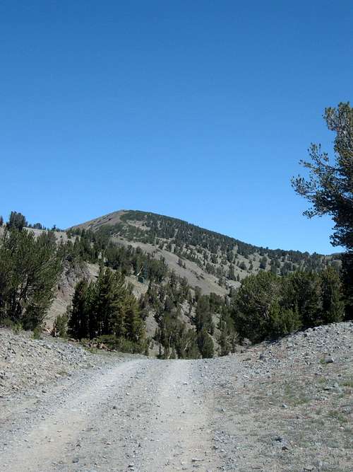 Mount Houghton from the Relay Peak Service Road
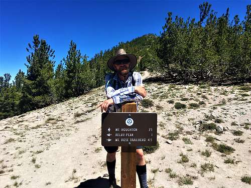
There is a trail sign that states it is 0.75 miles to Mount Houghton, at this point, there is another trail junction. My GPS showed it was less than 2/3rds of a mile to the summit, and if you go back and forth from the summit to this sign, it is 1.25 miles. From here, you can descend the newer trail back to the Relay Peak Service Road in about 1.75 miles.
Red Tape
No red tape, but watch for fire danger signs during high fire season.