
-
 10741 Hits
-
 90.81% Score
-
 33 Votes
|
|
Mountain/Rock |
|---|---|
|
|
34.33900°N / 118.0913°W |
|
|
Los Angeles |
|
|
Hiking |
|
|
Spring, Summer, Fall, Winter |
|
|
5040 ft / 1536 m |
|
|
Overview: The Third Iron in the San Gabriels
This Iron Mountain is the lowest in elevation of the three peaks in the San Gabriel range named after the 26th element. Number one is Iron Mountain #1 aka “Big Iron” at 8,007 feet in the Sheep Wilderness area. Iron Mountain #2 is at 5,635 feet elevation, about 5 miles to the west of Iron #3. Iron #3 has more of a connection with its neighbors, Rabbit Peak (5,307’), Granite Mountain #1 (6,600’), and Round Top Mountain (6,316’), due to the ridge and road configuration that allows the hiking of a loop from Monte Cristo Campground to all four peaks in clockwise or counter-clockwise direction.
Evidence is everywhere why this is one of the “Iron” mountains.

Chunk of iron on the slope
Names of mines abound on the Chilao Flat 7.5 topo in the area, but even remnants of the mines are pretty much just memories. Iron Mountain #3 was on the original 1946 Sierra Club’s Hundred Peaks Section peak list.
The views from the summit are as fine as any in the area. Rabbit Peak is only 1.26 miles to the north and slightly west. From Rabbit Peak, moving clockwise, there is the tree-studded summit of Granite Mountain #1, and then the accurately described Round Top Mountain. If you turn southwest, the unmistakable shape of Strawberry Peak comes into view with Mt. Lawlor directly south.

Rabbit Peak seen from summit of Iron Mtn. #3, 9.15.07
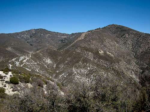
Granite Mtn. #1 (L) and Round Top Mtn. (R) seen from summit of Iron Mtn. #3, 9.15.07
Routes Overview
1. From the campground parking area (3,560’), you can hike up the west ridge of the peak on fire break to its summit. This would be a 2-mile round trip with 1,500 feet of gain, Class 1.

Along fire road 2N23 towards Iron #3
2. From the campground parking area, walk to fire road 2N23 which is at the north end of the campground. This fire road follows Monte Cristo Creek and initially leads away from the peak. It then bends back in the right direction when it acquires the ridge. Follow the ridge south to the summit. This is about a 5-mile round trip with about 1,500 feet of gain, Class 1.
3. Follow the directions in No. 2 above, except continue on the fire road past the point where it makes a sharp left and begins to go southeast under some power lines. When you are at the base of the peak’s southwest slope, start up. You will intermittently find traces of a use trail. This route is extremely steep and loose. About halfway to the top, cairns will start appearing. Make your way to the summit. This route is about 6 miles round trip with 1,500 feet of gain.

The SW slope of Iron #3 is very steep as a route

Animal skeleton marking start of ascent route on Iron #3's SW slope
Getting There
From the 210 Freeway, exit at Angeles Crest Highway (SR 2) and go north for 9.5 miles to Angeles Forest Highway. Turn left onto Angeles Forest Highway and drive 10 miles to the entrance to Monte Cristo Campground on the right. Turn right into the campground and park in the day use area.
Note that it is possible to drive from the campground directly onto County Road 2N23, a dirt road, which road will take you to a point just below the ridge of the summit. This is mentioned in the event that an overwhelming laziness has accompanied you on your outing.
Red Tape
You will need an Adventure Pass or Golden Eagle Pass to park in the Monte Cristo Campground day use lot. These passes can be purchased ($5 per day or $30 for a yearly pass) at the Clear Creek Information Station which station is located where the SR2 and the Angeles Forest Highway intersect. Otherwise, the passes can be purchased at most southern California sporting goods stores.
Camping
The Monte Cristo Campground is a developed campsite. The campsites include picnic tables, fire rings and outhouses. Be forewarned that, on September 15, 2007, the outhouses reeked horribly across most parts of the campground. However, on other occasions this has not been the case. Campsites are $12 per night.
When to Climb/Mountain Conditions
This peak can be climbed year-round. During the winter, with possible snow cover, bring appropriate gear. At the other extreme, it is probably best to avoid hiking this peak during hot summer days because the routes are all exposed.
Check forecast information in local newspapers or internet weather services during the winter months. Check with Cal Trans (see link below) on road conditions and closures during the winter. Always carry chains for your vehicle during the winter.
Other Information
USGS Topos Chilao Flat 7.5
External Links
Angeles National Forest
California Dept. of Transportation
Adventure Pass information