
-
 15068 Hits
-
 91.75% Score
-
 36 Votes
|
|
Mountain/Rock |
|---|---|
|
|
34.26955°N / 118.17729°W |
|
|
Los Angeles |
|
|
Hiking |
|
|
Spring, Summer, Fall, Winter |
|
|
4404 ft / 1342 m |
|
|
Overview: Unknown but Deserving
For the rare hiker who ascends this San Gabriel front range peak, Hoyt Mountain offers invigorating routes to its summit via its east and west ridges and great panoramic views. The peak register on September 29, 2007, contained only two names, including that of this author. Granted, not everyone signs peak registers, but all indications are that this peak receives few human visitors (see image below regarding other types of visitors). Hoyt Mountain is not on the Sierra Club’s Lower Peaks Committee list.
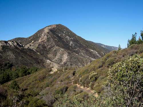 Hoyt Mtn. seen from the north along Angeles Forest Hwy, 9.15.07
 Deer's calling card on Hoyt summit, 9.29.07
Only Harrison’s Angeles Front Country Trail Map identifies the peak by name. On the Condor Peak 7.5’ minute USGS quadrant, you will only see the elevation marking of 4,404’ just west of Georges Gap. Two trailheads, Georges Gap (formerly named Clear Creek) and Grizzly Flat, provide access to this peak. Both routes involve ascending steep ridges.
 Looking west toward Mt. Lukens (L) from Hoyt's summit, 9.29.07
The distance from the Georges Gap Traihead to the summit along its east ridge is only ½ mile, with about 842 feet of gain, but the ridge is steep for most its length. Along Hoyt’s west ridge from the Grizzly Flat Trailhead, the route is about 1 and ½ miles on fire road and then just under ½ mile along the ridge itself with a total elevation gain of 1,400 feet. Both ridges are enjoyable with fabulous views along the way.
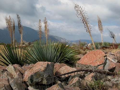
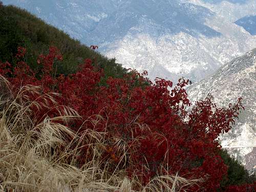 Colorful flora along east ridge of Hoyt Mtn. 9.29.07
 Looking NE across Clear Creek from Hoyt's east ridge 9.29.07
 Looking NW towards Condor Pk and Iron Mtn. #2 from east ridge 9.29.07
Route 1:East Ridge From the east end of the trailhead parking area, proceed north just a few yards to the bottom of the Hoyt’s east ridge. Head west up the ridge on the faint use trail. You will go over a bump at elevation 4,115 feet and at that point you will be able to see Hoyt Mountain ahead of you. After the bump, you will descend into a saddle and then up to the summit.
 Looking down Hoyt Mtn.'s east ridge 9.29.07
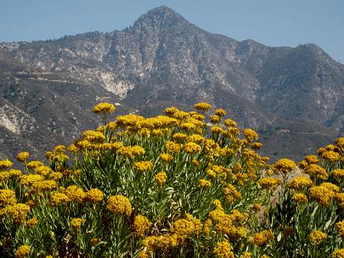 Strawberry Peak (6,164') to the NW from Hoyt's east ridge, 9.29.07
Route 2:West Ridge From the parking area, proceed up County designated fire road 2N79 on your left (west). It climbs a slope overlooking the Arroyo Seco region to the southeast. Within half a mile, you will pass a water tank on your right and immediately encounter a junction. The fire road on your right, part of the Grizzly Flat Fire Road, goes towards Georges Gap and this is the one you want. Continue on the road for approximately one more mile and you will come to a small clearing where the road turns into the Hoyt Trail and where, on your right, is the beginning of Hoyt’s west ridge (elev. 3,853’). There is a metal sign pointing to the Hoyt Trail and just to the right of the sign you will note a faint use trail proceeding up the ridge. Hoyt’s summit is a little less than ½ mile from this point.
 Start of west ridge ascent to Hoyt's summit
 Hoyt's summit seen from west ridge with Josephine Pk. left back, 9.29.07
Getting There
Route 1 Georges Gap Trailhead (3,562’) From the 210 Freeway, exit at Angeles Crest Hwy (SR 2) and drive north for approximately 9 miles. You will pass the Grizzly Flat Trailhead, the start of Route 2, along the way. The trailhead is on the left side of the highway, marked by a large sign. There is an ample paved parking area here.
 Clear Creek Trailhead (Strawberry Pk on right) now known as Georges Gap
Route 2Grizzly Flat Trailhead (3,000’) From the 210 Freeway, exit at Angeles Crest Hwy (SR 2) and drive north for 6.3 miles. There is a large dirt parking area on the left side of SR2. County designated fire road 2N79 begins on your left.
 Grizzly Flat Trailhead
Red Tape
You will need an Adventure Pass or Golden Eagle Pass to park your vehicle at either of the two trailheads. There is no place along SR2 to these trailheads where you can purchase a pass so you will have to get one beforehand. Besides some Forest Service locations, they are sold at most major sporting goods stores in southern California ($5 per day and $30 for an annual pass). No permits are required for hiking the routes described here.
Camping
There is no camping in the immediate vicinity of this peak.
When to Climb/Mountain Conditions
This peak can be climbed year-round. During the winter, with possible snow cover, bring appropriate gear. At the other extreme, avoid hiking this peak during hot summer days because there is absolutely no shade along either ridge route. Check forecast information in local newspapers or internet weather services during the winter months. Check with Cal Trans (see link below) on road conditions and closures during the winter. Always carry chains for your vehicle during the winter.
Other Pertinent Information
USGS ToposCondor Peak 7.5’ Tom Harrison Angeles Front Country Trail Map
External Links
Angeles National Forest Adventure Pass information California Dept. of Transportation
Travis_ - Dec 7, 2007 11:21 am - Voted 10/10
coord slightly offhey Augie, I went to check out the location of this peak via the topozone link but it appears the coords are off, the red cross is not on any summit.
Augie Medina - Dec 8, 2007 12:13 am - Hasn't voted
Re: coord slightly offThanks Travis. I'll check that out.