
|
|
Mountain/Rock |
|---|---|
|
|
47.95850°N / 121.7223°W |
|
|
Snohomish |
|
|
Hiking |
|
|
3080 ft / 939 m |
|
|
Overview
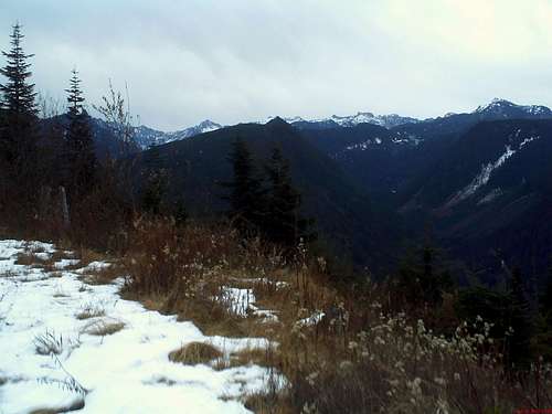
View from on the way up Blue Mountain
Blue Mountain
Elevation 3080 ft.
Elevation Gain: 1030 feet
YDS: Class 1 (walk up)
Distance: 7 miles roundtrip (10 miles if you wish to add another clearcut view of the Olympics)
Are you looking for an obscure mountain with great solitude, good views and which is good for novices. When Blue Mountain (or Old Blue) is the perfect mountain to try. This mountain which is in the heart of the forest industry provided good views of Pilchuck, Vesper and many of the other peaks.
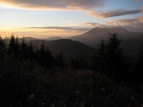
Evening sunset toward Pilchuck
The old logging road that is gated at the bottom. The "trail" heads up a steeper road for the first bit (it is a road: no worries or thrills). Most of the 1050 feet of elevation is done in this section. After this stretch the trail levels out and the first a number of good views open up on the mountain.
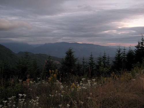
More wildflowers and views
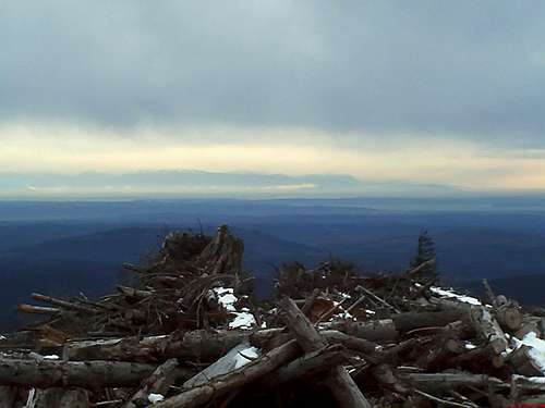
This "trail" then traverse the ridge (with views along the way) at a gradual to level pitch for the next two and half miles. There are some minor ups and down on the way to summit, but these ups and down are gradual at best. A reasonably fit person can do this section in well under an hour. You will have to walk past one more gate and walk a little while longer until you hit the radio tower. This is not exactly the true summit but the views from this vantage point over Spada Lake and North Cascades is amazing. If your goal is to hit the true summit which has no views and is covered in evergreens than bushwhack east into about 100 yards past the radio facility into the evergreen forest and bushwhack along that ridge.
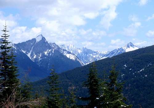
The North Cascades
The only downfall is that there is some active logging in the area and the area is well known for hunting. The ideal time to hit this mountain is in winter. If there is a lot of snow this would be the ideal snowshoe hike. In summer many people hit this old logging as a mountain bike path.
The view west from a recently logged area
If you want a great view and you don't mind getting the view through a clearcut continue 1.75 miles first down a steep road then up and down a dirt road to the clearcut where expansive views of distant downtown Seattle and the Olympics await.
It is also possible to approach from the south. Redwic has found a route on Sultan Basin road roughly 6.3 miles from Highway 2 on the northern (lefthand side of the road). Hike north from the road which curves around the western side of Baby Blue then switchback up the mountain to the summit ridge a short distance west of the summit ridge. (Thanks Redwic)
Maps of the Standard and South Routes
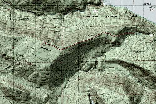
Standard Route from Olney Pass
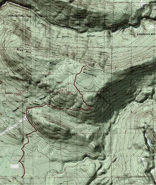
South Route around Blue Blue
Getting There
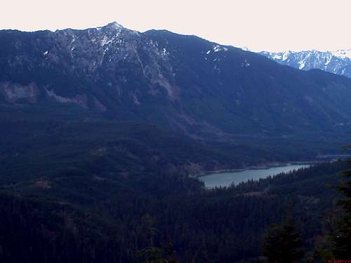
Spada Lake
VIA DIRT ROAD TO SUMMIT: From Route 2 in Sultan head north on Sultan Basin Road. The road will turn into a gravel road (descent condition) roughly 10.2 miles (thanks Redwic for the update) into the drive. It will pass a major clearcut on your right. The road then climbs a number of switchbacks to Olney Pass. Once you make it to the pass look to your left for a steep gated gravel road. The gated road will be 0.4 before the wide gravel pit in the pass. It will be 12.7 miles from Highway 2. That is your trailhead.
VIA FROM THE SOUTH: Route 2 in Sultan head north on Sultan Basin Road. At 6.3 miles on your lefthand side there will be a dirt road on your right. (Thanks Redwic)
Redwic - Jan 2, 2012 5:46 pm - Hasn't voted
Some Updates...-> You should remove the "Disclaimer" section and notes regarding the closure that occurred during 2009. The closure was only temporary, and Snohomish County (usually PUD) sometimes does such temporary road closures, where the road changes from paved to gravel, due to severely icy/snowy road conditions and/or road maintenance. This is not a regular occurrence. -> The turnoff for Blue Mountain Road is 12.7 miles up Sultan Basin Road from Highway 2. ->Sultan Basin Road changes from paved to gravel 10.2 miles from Highway 2. Then it is another 2.5 miles to the road intersection with Blue Mountain Road. Hence, if a temporary road closure happens at the paved-to-gravel location in the future, expect to road-walk/bike/snowshoe an additional five miles roundtrip. -> A current notation on the page says there are views of Wallace Lake from near the summit. That is not true. Wallace Lake is at a totally different area/direction, and blocked by several ridges. I believe you meant to type Spada Lake. -> It is also possible to approach Blue Mountain from the south. At approximately 6.3 miles up Sultan Basin Road from Highway 2, there is a gated road on the leftside (northside) of Sultan Basin Road. Hike northward up the road, temporarily curving around the western side of "Baby Blue", and then follow the switchbacking road up the south slopes of Blue Mountain until reaching the summit ridge a short distance west of the true summit area.
EastKing - Jan 3, 2012 5:31 pm - Hasn't voted
Re: Some Updates...Thanks Redwic. Many of the corrections have been noted. I also planned to add a map of both route in the coming days.
Redwic - Jan 3, 2012 9:00 pm - Hasn't voted
Re: Some Updates...No problem. Nice page, nice peak. Outside of the seeming non-stop road-walking, there are some great views from several spots.