
-
 22878 Hits
-
 81.83% Score
-
 14 Votes
|
|
Mountain/Rock |
|---|---|
|
|
39.70320°N / 105.2938°W |
|
|
Jefferson |
|
|
Hiking |
|
|
Spring, Summer, Fall, Winter |
|
|
8284 ft / 2525 m |
|
|
Overview
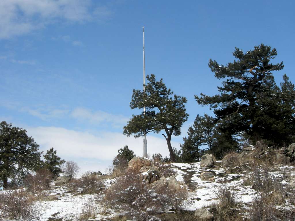
Genesee Mountain is located just west of Denver along Interstate 70. At 8,284 feet, Genesee Mountain is number 3,462 in ranke Colorado peaks. The forest on the peak is comprised of Ponderosa pine, Lodgepole pine and Douglas fir. Access to the historic Beaver Creek Trail offers great backcountry hiking.
Photo below by Belexes
Genesee Mountain Park
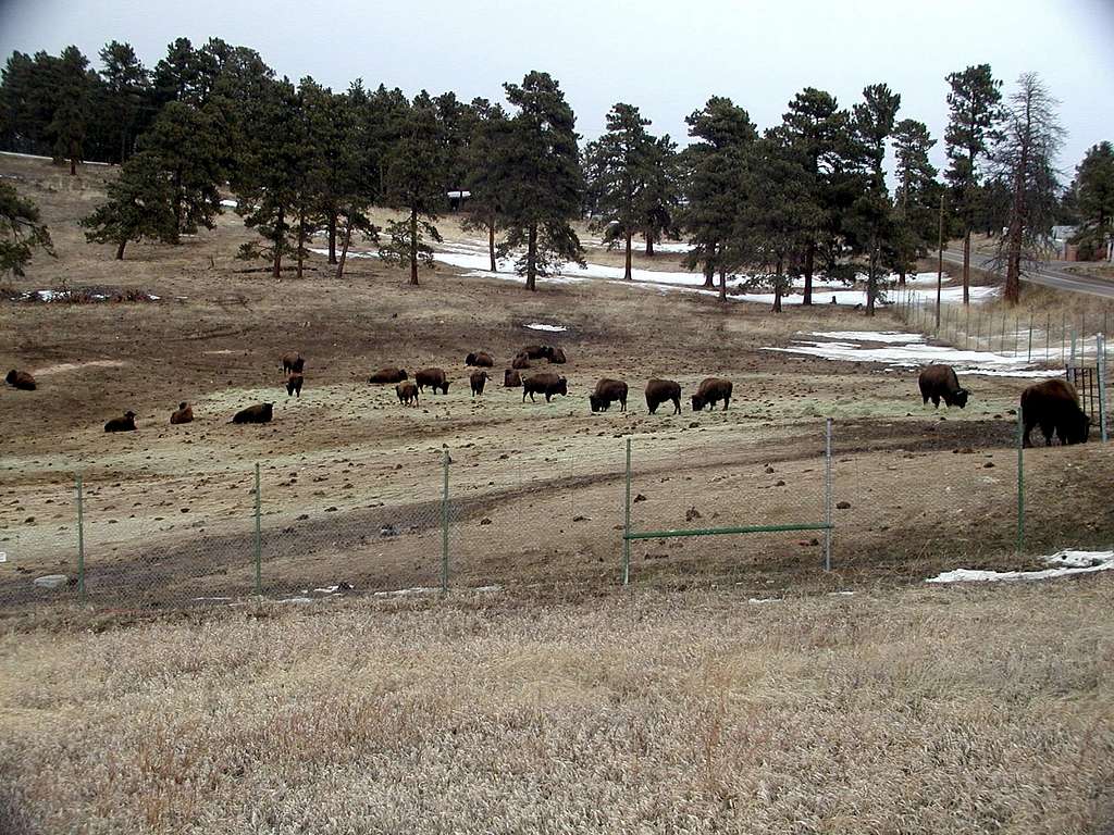
Genesee Mountain is part of Genesee Mountain Park, the oldest and largest unit of the Denver Mountain Park System. Genesee Park is made up of 2413 acres that straddles I-70. The park was established in 1916 and the majority of the land was acquired between 1916 and 1926. The park is immediately west of the small unincorporated community of Genesee, Colorado. In addition to Genesee Mountain, Genesee Park also is the home of a buffalo herd, 7,988 foot Bald Mountain, the 8.75 mile Beaver Brook trail and the Chief Hosa Lodge and campground.
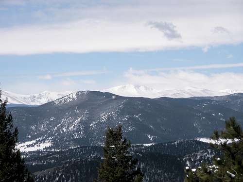
From Genesee's summit there are views of Lookout Mountain, the Eastern Plains, Mount Morrison and the famous Sculptured House, featured in Woody Allen's "Sleeper" to the east; Pikes Peak way off to the south; Bergen Peak and Mt. Evans to the west and innumerable unnamed summits and valleys in the immediate vicinity. The views to the north are somewhat obsured by the pine trees growing on Genesee's northern slope.
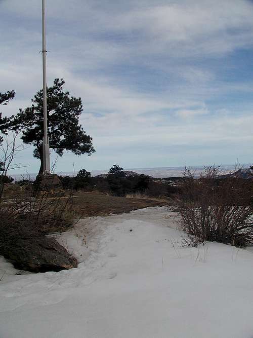
Photo below by Belexes
On the southern slopes of Genesee Mountain there are many picnic sites that include grills, tables and restrooms. There is a large stone shelter house built by the CCC in 1939.
Getting There
To get to Genesee Mountain take I-70 west of Denver to the Genesee Park exit (exit 254) and turn south. Just past the interstate turn right (west) and follow this road as it twists and turns around the northern and eastern slopes of Genesee Mountain. After a few miles one comes to a large parking area which is surrounded by picnic tables and shelter houses. The drive continues on up to the summit where there is another much smaller parking area that is perhaps 175 feet of vertical gain to the actual summit. The road is blocked off past the picnic area during the winter months.
Photo below by Boriss Andean
Genesee Trails & Map
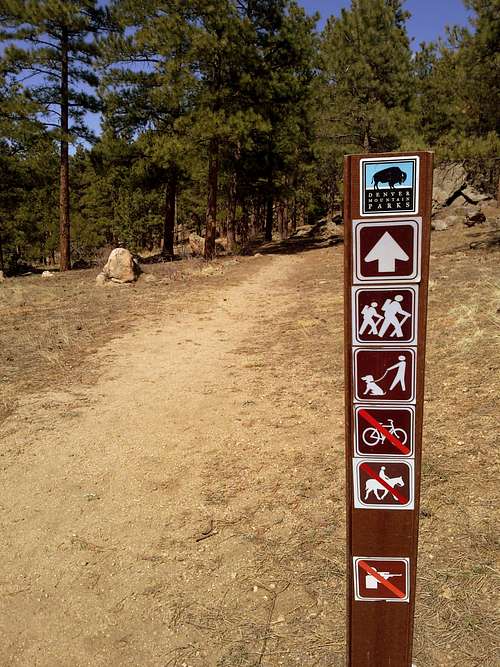
The Genesee Mountain Trail is the main trail in the park. Two branches include the Summit Trail and the American Bison Trail. The trails provide views of both mountains in the park, the bison herd and other mountains in the area. There is a Braille trail area with ropes and signs.
Map below courtesy Denver Mountain Parks System

For a downloadable PDF map, click here:
For other trail information links, click on the links below:
All Trails Listings for Genesee Mountain Park
Genesee Mountain on Hiking Project
Red Tape
There are no fees or permits to use Genesee Park.
When to Hike
The park is open year-around, so you can choose the time best for your plans. To check the latest forecast and conditions, click on the link below:
Genesee Park Weather Forecast & Conditions
Camping
There is camping at the nearby Chief Hosa campground, however there is no camping outside of the campground within Genesee Park. There are a couple other good campgrounds less than an hour away. For more information, you can access their websites at these links: