
-
 38402 Hits
-
 80.4% Score
-
 12 Votes
|
|
Mountain/Rock |
|---|---|
|
|
39.26030°N / 105.1011°W |
|
|
Douglas |
|
|
Hiking |
|
|
Summer |
|
|
9748 ft / 2971 m |
|
|
Overview
Devil's Head is one of the more prominent peaks seen from everywhere in the southern Metro Denver area, all the way down to the north end of Colorado Springs.
With 1,248' of prominence, it is also one of Colorado's most prominent peaks.
Devils Head on ListsofJohn.com.
There is a good history of rock climbing developments along Rampart Range Road and on the Devil's Head massif itself. A good book for climbing in the area is available. Devil's Head Climbing.
See the link below for listed routes in and on Devil's Head.
There is so much camping and hiking available it is almost staggering. Miles and miles and miles of trails exist, although during the summer season you have to share them with motocross bikers and ATV quad riders. This can take some joy from the trails.
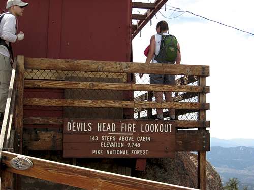
Atop Devil's Head, at the end of 143 stairs, you will find a Fire Tower Lookout, in place since 1912:
(Courtesy of the Forest Service)
History
The original fire lookout structure was built in 1912. It consisted of a table with a fire-finder bolted to a rock. The location was chosen because of the 360 degree panoramic view it offers of the Pike National Forest. A glass-enclosed lookout was built in 1919, the same that Helen Dowe became the first woman fire lookout ranger in the U.S. Forest Service. The tower was reconstructed in 1951 with the help of 100 men and 72 mules of the 973rd Construction Battalion from Fort Carson.
Devil's Head remains as the last of the eleven original Front Range lookout towers. In 1991, the fire lookout was designated on the National Register of Historic Places.
Operation
When you reach the tower you will immediately become aware of the tremendous vantage point it offers. In fact, on clear days, mountain peaks over 100 miles away are visible. The tower's location is even more significant because of the fact that the area south and west of the tower has a very high frequency of lightning strikes. During a typical summer, we experience from 30 to 40 fires caused by lightning. From the vantage point of the tower, the fire lookout ranger is able to spot these fires very soon after they begin. This enables us to quickly dispatch fire crews to contain the fires. The tower is usually staffed mid-May through mid-September.
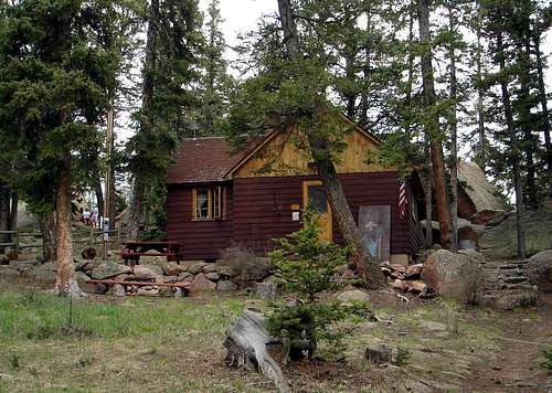
Also, keep in mind that the FS rangers actually live up on the summit area for the season in the Private Residence, and are available in the case of emergency, as well has have phones, etc.
See the link below for more info on the Fire Tower Lookout.
Trail info:
The trail to the tower is 1.4 miles and has an elevation gain of 940 feet. Hiking time up to the tower is from 45-90 minutes, depending on your pace.
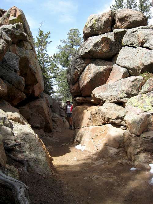
Interesting formations along the way.
There are several rest stops with benches and tables along the trail for your comfort. When you reach the base of the tower you are welcome to climb the steps up to the actual fire lookout tower. Bring along your own drinking water since none is available along the trail or at the tower. A toilet is located near the base of the tower. Trail Interpretative signs have been placed along the trail to explain the role of fire in the forest, among other things. Along the way you will see many types of wildflowers, shrubs, and trees.
Note: parking at the Road Closure near the trailhead right off of Rampart Range Road adds about .5 miles each way, 1 mile RT.
There is also a Zinn Overlook trail, which heads over to the east side of the summit plateau, and provides views of the eastern horizon. They suggest allowing 30 minutes RT for this excursion, with no time for sightseeing.
Getting There
Shortest distance is to drive Santa Fe (Hwy 85) south from Denver or north from Castle Rock to Sedalia and head west on Hwy 67 until you get to the Rampart Range Road. Head south approximately 7 miles and take the east turn to the Devil's Head Trail Head/parking area. Parking can be extremely limited due to large crowds in the summer season.
Red Tape
Rampart Range Road (and most access, except snowmobile) is closed to all motor vehicle traffic from December 1 until the roads are dry (can be as late as Memorial Day Weekend), but as early as April 1.
Dogs must be on leash.
Motorcycles and bicycles are not permitted on this trail.
Camping
Too many spots to list along the Rampart Range Road.
See the camping link below:
Camping
External Links
Rock Climbing Routes
South Platte Ranger District
Peak Info
Devil's Head Fire Lookout
Trail Info & Trail Map