
-
 46326 Hits
-
 87.31% Score
-
 24 Votes
|
|
Mountain/Rock |
|---|---|
|
|
48.14857°N / 113.91927°W |
|
|
Flathead |
|
|
Hiking |
|
|
Spring, Summer, Fall, Winter |
|
|
7528 ft / 2295 m |
|
|
Background
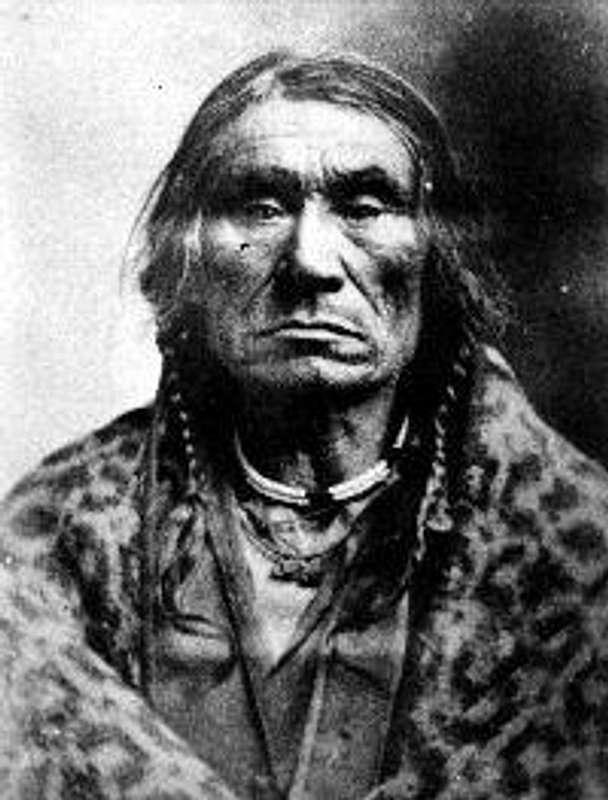
Mount Aeneas is named for Chief Aeneas Paul who was born in 1828 and was also known as Big Knife II and Koostatah I.
As Chief of a band of Kootenai along the western shore of Flathead Lake, Chief Aeneas struggled with the rapid white settlement of the Flathead Valley.
By one account, the half Iroquois Aeneas Paul rose to chief when Chief Baptiste was killed by Blackfeet Indians near the site of present-day Hungry Horse Dam in 1876. He had six children by his wife Woman’s Cry of Triumph. Two of his sons would die at the hands of white men and two would carry on as chief after him.
Chief Aeneas is of the Dayton Creek band of the Kootenai. He is believed to be one of the negotiators of the Hell Gate Treaty of 1855 and an interpreter for missionaries such as Father Pierre Jean DeSmet.
Other names of nearby geographic features — like Broken Leg Mountain, Lamoose Lake, and Baptiste Peak — reflect the names of Kootenai leaders from the mid-to-late 1800s.
Source: Swan Journal article by Keith Hammer
Overview
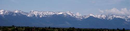
The Jewel Basin from the Flathead Valley
At just over 7,500 feet Mount Aeneas could easily be bypassed for other peaks with higher elevations or in more popular locations such as Glacier National Park.
To do so would be to miss a jewel of a peak. In fact, Mount Aeneas is located in the Jewel Basin. The views into Glacier National Park, The Bob Marshal Complex and The Flathead Valley are worth the easy hike to the summit. The map rates it as strenuous but by Glacier National Park Standards this is an easy class 1/2 hike.
The Jewel Basin is home to 27 lakes and most of them have fish in them. In days gone by it was possible to enter the Jewel Basin and have the area to yourself. Talk about fishing and a great wilderness experience!
Remote campsites are provided at a few selected lakes and most of them are an easy day hike away from the trailhead at Camp Misery (more on the name later). The Jewel Basin is made up of 15,349 acres (62.1 km²) and 50 miles of trails. The Jewel Basin is specially designated for hiking only, with motorized vehicles and horses prohibited.
The locals say that Camp Misery was named for the place that a local tribe spent a terrible winter. It is not impossible to imagine such a winter as the snowfall in this particular area is measured in feet not inches.
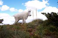
Jewel Basin Mountain Goat
The Flathead Valley from Mount Aeneas Trail
Getting There
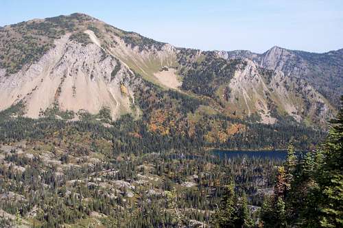
Mount Aeneas and Birch Lake

Views from Mount Aeneas to Glacier National Park's Nyack region.
This hiking only area is designated so because of its close proximity to the Flathead Valley. The popularity of this area is enormous due to its easy access and incredible hiking trails and lakes.
The primary access is from Camp Misery which is reached by following U.S. Highway 83 to the Echo Lake Road, turning North and driving about 5 miles to the Jewel Basin Road (Forest Service Road No. 5392).that can be reached from FS Road 5392 just east of Echo Lake.
The Jewel Basin can also be reached from taking the Westside Hungry Horse Reservoir Road #895 and driving to trailheads in Wounded Buck (Forest Road 895C), Clayton (Forest Road 8933), Graves (Forest Road 897), West Fork Clayton Creek (Forest Road 9833) or Wheeler Creek (Forest Road 895F).
A map is highly recommended and can be purchased at the most local sporting goods stores. A downloadable map is also available at this link, Map of Jewel Basin Lakes and Hiking Area.
The Views Along The Trails
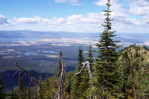
This is a class one/two hike on trail to the summit of Mount Aeneas. The last 1/2 mile travels along the ridge top and offers unique views on both sides of the ridge. On a clear day it is possible to see the jagged peaks of Glacier as well as the numerous peaks of the Swan Range as well as the Mission Range. The views to Flathead Lake and the Flathead Valley are not so bad either with its numerous lakes and braided river system that feeds Flathead Lake, the largest natural body of water West of the Mississippi.
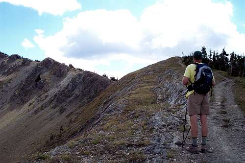
The Ridge to the summit

My great friends at the Microwave Relay Station
Red Tape and Piscatorial Information
There is little red tape with the exception of a 12 person maximum group size on all trips.
There is a strict "Leave No Trace" policy here as should be expected. Stay on designated trails.
Follow all guidelines for camping in bear country if you plan to camp as black bear and grizzly bear call this area their home. There are also mountain lions in this area.
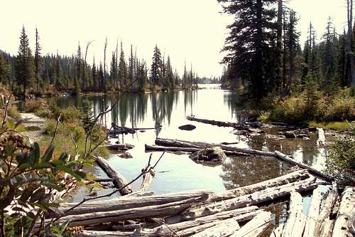
Birch Lake
And Now The Piscatorial Information:
The lakes in the Jewel Basin are stocked with Westslope Cutthroat Trout and there is currently a management plan to clear out the old stock of Yellowstone Cutthroat Trout that threaten the Southfork of the Flathead River. The Southfork is unique due to the Hungry Horse Dam blocking any non-native fish from entering the system. The Southfork empties the Bob Marshal Wilderness System and is teeming with wild catchable cutthroat and Bull Trout.
Send me a PM if you want some recommendations regarding where to fish.
When To Climb

Looking to the North from the summit of Aeneas.
Final Ridge to summit.
This area is usually open by the end of June. On heavy snow years consider a late arrival date.
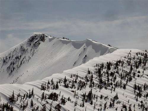
It is possible to do climb Mount Aeneas at any time of the year. However, winter travel restrictions apply to this designated wilderness area.
Camping and Recommended Gear
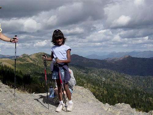
My daughther, Bhavani, completing perhaps the first Indian ascent of Aeneas.
"Leave No Trace" Camping is permitted at designated campsites. Pack it in and Pack It Out when it comes to all other items.
To play it safe bring your camp stove. The areas within 500 feet of Birch, Crater, Twin and Picnic Lakes are closed to open fires.
Human waste must be disposed at least 200 feet from water, campsites and trails.
If you are hiking in the Jewel Basin remember that this area is frequented by bears, both black and grizzly. You are in bear country. Carry your bear deterrent spray, don’t hike alone and make some noise. For more information please go to Glacier National Park's website for Bear Information. The U.S. Forest Service also has helpful information on Grizzly Bear Management.