
|
|
Mountain/Rock |
|---|---|
|
|
47.50648°N / 122.02832°W |
|
|
King |
|
|
Hiking |
|
|
Spring, Summer, Fall, Winter |
|
|
2024 ft / 617 m |
|
|
Overview
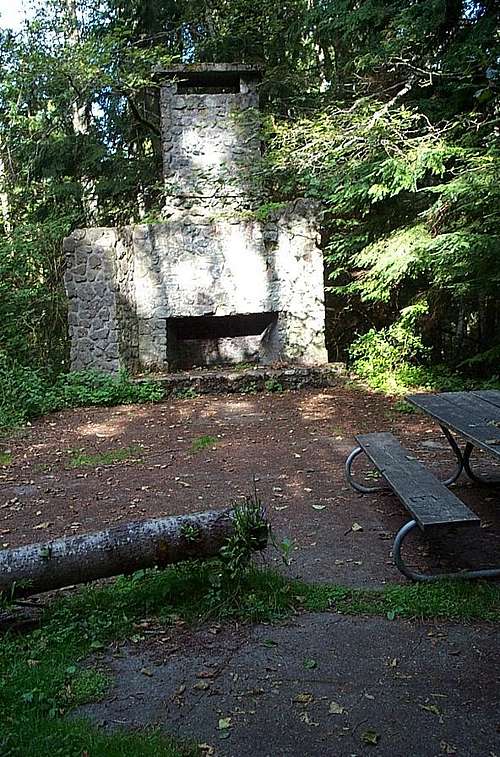
Bullitt Fireplace
Squak Mountain, located in the Issaquah is a very popular hiking and trail running destination close to the Seattle metropolitian area. The true mountain is made up of three summits, the two higher ones reachable by trail. Despite having a summit covered with cell phone tower and very little views on the summit (there is a very faint view from the true summit toward downtown Seattle and some of the Olympics) this mountain has its own state park and a large network of trails. This is due to the very close proximity to downtown Seattle and nearby Interstate 90.
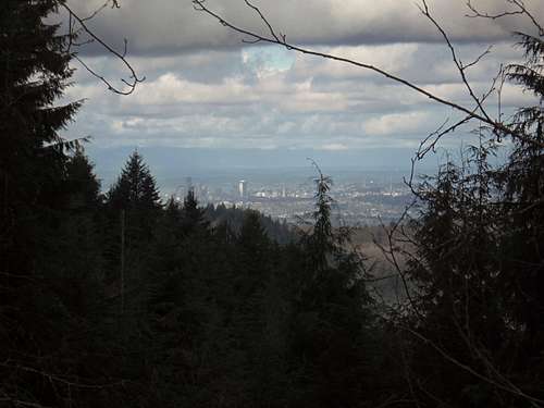
Seattle skyline
One of the major attractions with this mountain is the Bullitt Fireplace, which serves as a great resting spot between the main summit and the West Squak which itself has no views. This mountain is often looked in the climbing community, like all of the other Issaquah Alps as a "Dumpster Dive", or peak in which you bring a heavy backpack and condition on during poor weather when none of the higher peaks are available.
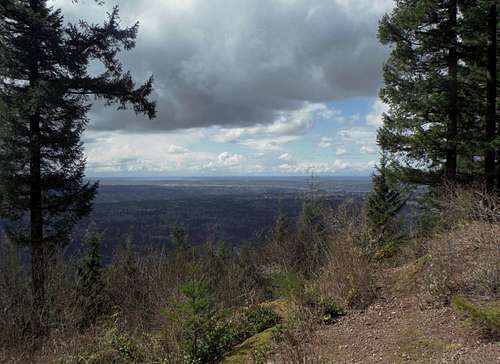
Debbie Viewpoint looking west
The most direct route to the true summit is to walk up the Squak Mountain Road which starts at the Squak Mountain State Park trailhead and rise up 1600 feet in 2.5 miles. It is a well maintained dirt road and is very easy to follow. In order though to truly enjoy the park though it would be key to combine it to one of Squak Mountains many other trails for a nice loop hike. Just don't expect many views because there are few to see.
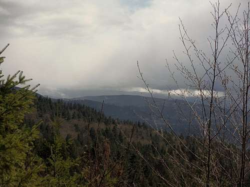
Taylor Mountain from Debbie Viewpoint
Getting There
FROM DOWNTOWN ISSAQUAH: Take Front St. south toward the mountain with the cell tower on it (Squak Mountain). The road will past the Issaquah High School and then turn into the Issoquah Hobart Road. Stay on that road through the gap between Poo Poo Point and Squak Mountain. Once past the gap make a right on SE May Valley Road. The trailhead will be on your right hand side and will be very well marked.Map of the Routes
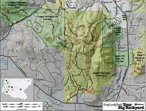
Squak Mountain Map
Red Tape
New for July 2011: Discovery Pass is now required for this and all Washington State Parks. Here is the link to the site Discovery Pass .Camping
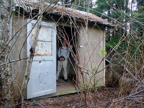
Shelter near the summit. NOT TO BE USED FOR OVERNIGHT CAMPING!!!
External Links
Here is the official Squak Mountain State Park websiteHere is an article about Squak Mountain.
Weather Conditions
This weather is likely what to expect for mountain trailhead conditions. alt="Click for Bellevue, Washington Forecast" height=60 width=468>