
|
|
Mountain/Rock |
|---|---|
|
|
42.47545°N / 13.49994°E |
|
|
Hiking, Mountaineering, Ice Climbing, Scrambling, Skiing |
|
|
Spring, Summer, Fall, Winter |
|
|
8606 ft / 2623 m |
|
|
Overview
 |
|---|
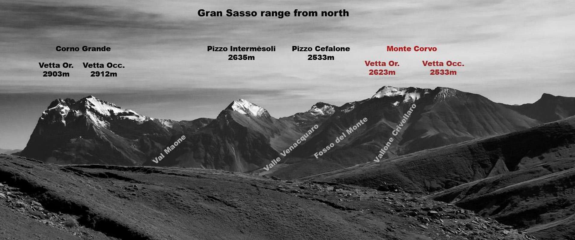
Monte Corvo (meaning Crow mountain, in italian) is a high and mighty mountain, standing alone in the north west part of Gran Sasso range.
 Monte Corvo from east. Click to enlarge
This little massif, belonging to Gran Sasso Western part, is one of the highest mountains of the whole apenninic chain and from its lonely summits the view is unlimited toward the rest of Gran Sasso group and the main ranges of central apennines.
Monte Corvo is sourrounded by two important valleys: Valle Chiarino at south, Valle Venacquaro at east. At north-west, the mount overlooks the Vomano valley.
Its imposing mass is linked to the Southern chain, and the rest of Gran Sasso range, by a ridge; along this ridge, there are three passes permitting the passage between Valle Chiarino and Venacquaro bowl: at north, Monte Corvo saddle (2305m); at south, Forchetta della Falasca (2187m); in the middle, the main pass: Venacquaro saddle (2236m).
Monte Corvo is formed by two main summits, Orientale/Eastern (2623m) and Occidentale/Western (2533m), linked by a long ridge with direction west-east.
From this ridge, three secundary ridges, short and steep, extending toward north, delimit two valleys:
- Vallone Crivellaro on west
- Fosso del Monte on east
The ridge/spur separating this two characteristic valleys is called "Cresta del Mozzone", because of a typical rocky tower placed at its middle.
At the west of the western ridge/spur, lies the Capovelle bowl, merging with Venacquaro valley.
Getting There
 Click to enlarge
The most important cities near Monte Corvo are L'Aquila and Teramo, two easily accessible cities, linked with Rome by the A24 motorway (L'Aquila is 108Km far from Rome, Teramo 166Km).
We can consider two main accesses to Monte Corvo:
- on the west side Diga della Provvidenza, a dam near Passo delle Capannelle (municipality of Pizzoli), at the start of Chiarino valley
- on the north side the small ski resort of Prato Selva (municipality of Fano Adriano)
An access is possible from the east side too, although quite far, starting from Campo Imperatore (municipality of L'Aquila).
The fastest way to reach these access points, in my opinion are:
For the west side:
- Passo delle Capannelle (Diga della Provvidenza): you can reach it by car taking A24 motorway until the station of L'Aquila Ovest. Then exit from motorway and take the route ss80 to Passo delle Capannelle. Go beyond the pass (direction Teramo) for about 9Km, until you reach the dam of Diga della Provvidenza (about 35Km from L’Aquila, 90Km from Teramo)
For the north side:
- Prato Selva: you can reach it by car taking A24 motorway until the station of San Gabriele/Colledara. Then exit from motorway and take the route ss491 to Montorio al Vomano. When you reach Montorio, take the route ss80 until you reach the crossing to Fano Adriano and Prato Selva: follow the indication and you reach it (about 65Km from L’Aquila, 30Km from Teramo)
For the east side:
- Campo Imperatore: you can reach the Campo Imperatore Hotel by car taking A24 motorway until the station of Assergi. Then exit from highway and take the route ss17bis to Campo Imperatore -at the crossing follow the signals to “Albergo Campo Imperatore”- (about 45Km from L’Aquila, 70Km from Teramo). Campo Imperatore is also reachable by cableway from Fonte Cerreto (3Km from highway exit), but keep in mind the timetable (last course at 17.00). In winter, when the route is closed because of snow, the cableway is the only way to reach this starting point.
  |
Routes Overview
 Hiking toward Monte Corvo
Hiking routes
Normal route to Vetta Orientale (2623m):
- From Diga della Provvidenza (1050m) through Chiarino Valley, Sella del Venacquaro and Sella di Monte Corvo saddles: E+, 1560m of elevation gain, 4h 45min
- From Campo Imperatore Hotel (2130m) through Portella Pass, Sella del Cefalone, Sella dei Grilli and Sella di Monte Corvo saddles: E+, 1000m of elevation gain, 4h 30min (but consider that further 700m of uphill and 4h are needed to return at the starting point...)
- From Prato Selva (1360m) through Colle Abetone, Venacquaro Valley and Sella di Monte Corvo saddle: E+, 1250m of elevation gain, 6h
Middle ridge (cresta del Mozzone) route to Vetta Orientale (2623m):
- From Prato Selva (1360m): EE, 1200m of elevation gain, 4h 30min
East ridge (cresta di sinistra) route to Vetta Orientale (2623m):
- From Prato Selva (1360m): PD-, 1200m of elevation gain, 6h
Normal route to Vetta Occidentale (2533m):
- From Diga della Provvidenza (1050m) through the west ridge: E+, 1470m of elevation gain, 5h
North ridge (cresta di destra) route to Vetta Occidentale (2533m):
- From Prato Selva (1360m) through Colle delle Monache saddle: E, 1200m of elevation gain, 4h
 Skitouring on Monte Corvo (by as)
Climbing and mountaineering routes
The rock-climbing routes are few and rarely climbed because of the bad quality of the rock, while there are some interesting couloirs in winter:
- Abracadabra couloir (west side of middle ridge): D, IV UIAA/55°, 350m
- Tridente couloir (north-east side of north ridge): D, 80°, 350m
- Marinozzi dove sei? couloir (north-east side of north ridge): PD, 50°, 800m (to the Vetta Occidentale summit)
- Death to Creepy couloir (north-east side of north ridge): D-, 65°, 700m
- Creepy's channel couloir (north-east side of north ridge): D-, 60°, 700m
- Franchi-Gizzoni route (east face): IV UIAA
- Diretta D'Armi route (east face): IV-UIAA
Ski touring
Many opportunities of wonderful tours, in wild and isolated environment, but, obviously, keep attention to the avalanche risks.
Classic ski-touring routes:
- the traverse from Campo Imperatore to Prato Selva passing by Monte Corvo - Vetta Orientale and vallone Crivellaro: BSA, about 2000m of downhill
- Vetta Orientale by the south side: BSA, about 1500m of downhill
- Vetta Orientale by the north side: BSA, about 1300m of downhill
- Vetta Orientale by the north ridge: BSA, about 1300m of downhill
- Vetta Orientale by the west ridge: BSA, about 1300m of downhill
When to climb
For hikers, the best season is between june and october.Generally from january to may for mountaineers and skitourers, but conditions are very variable by seasons.
Accomodations
Free camping is not allowed in Gran Sasso National Park. To camping you need of a permit granted by the Park Office.The only hut is on the north side: Rif. Del Monte (1614m), 10 beds, not managed, is far 2h of walk, in summer, from Prato Selva. For info, ask to municipality of Fano Adriano (phone 086195124 ) or CAI Teramo (phone 0862938138).
Other kind of accomodations:
For the north side, the small resort of Prato Selva offers few chances of accomodation: the near Prati di Tivo (15 Km) offers many hotels, but quite expensive.
For the west side, you can find hotels in L'Aquila and Fonte Cerreto.
In Campo Imperatore you can find a Hotel (expensive) and a Hostel (cheaper)
Red Tape
Monte Corvo is located within Gran Sasso e Monti della Laga National Park: no fees are dued, no access permits are required, but free camping is not allowed (you need a special permit) and you have to respect the rules for environment protection in force in the Park. 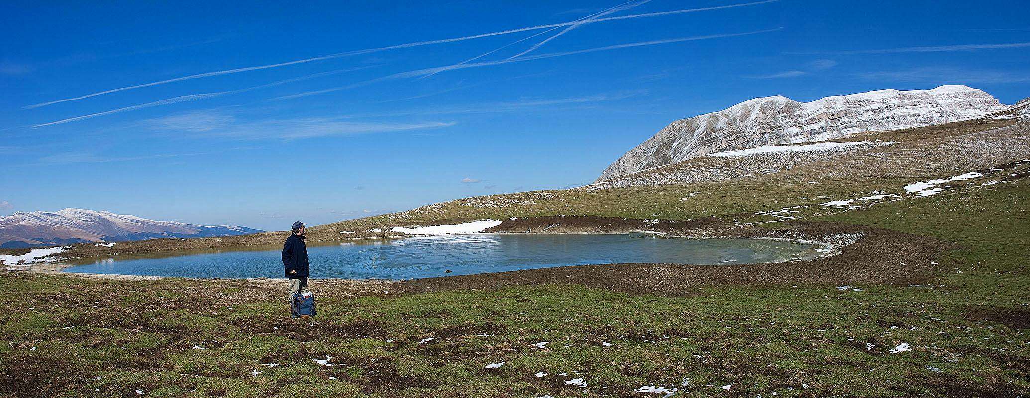 |
|---|
Sceneries
Some views of Monte Corvo  View from Campo Pericoli View from Campo Pericoli |
 Summit enlighten at dawn Summit enlighten at dawn |
 View from Valle del Vomano View from Valle del Vomano |
|---|---|---|
 View from Sella dei Grilli View from Sella dei Grilli |
 View from Piano di Camarda View from Piano di Camarda |
 View from Cefalone summit View from Cefalone summit |
 View from Campo Pericoli View from Campo Pericoli |
 View from Pizzo di Camarda View from Pizzo di Camarda |
 Monte Corvo and Venacquaro bowl Monte Corvo and Venacquaro bowl |
Books, guides, maps, external links
 Descending on south ridge
Guidebooks
L. Grazzini, P. Abbate, “Gran Sasso d’Italia”, Cai-Tci, 1992
S. Ardito, “A piedi sul Gran Sasso”, Iter, 1992
S. Ardito, “A Piedi in Abruzzo” vol. 1, Iter, 1996
A. Alesi, M. Calibani, A. Palermi, “Gran Sasso – Le più belle escursioni”, SER, 1996
ALP monografie “Gran Sasso d’Italia”, n. 167, marzo 1999
Maps
- “Gran Sasso d’Italia. La carta dei sentieri”, 1:25000, edited by Cai-L’Aquila.
- "Gran Sasso: Atlante dei sentieri - hiking atlas", 1:25000, edited by SER (very useful and convenient: advisable!)
- "Gran Sasso d'Italia - Carta escursionistica", 1:25000, edited by Il Lupo
- "Gran Sasso d'Italia L'Aquila", 1:50000, edited by Kompass
- "Gran Sasso d'Italia - Carta dei sentieri", 1:15000, edited by Technopress
Weather conditions
Meteo and webcam live in Prato Selva
Meteo forecast and avalanche bulettin for the central Apennines by Servizio Meteomont