
-
 18560 Hits
-
 89.77% Score
-
 30 Votes
|
|
Mountain/Rock |
|---|---|
|
|
39.86200°N / 105.3799°W |
|
|
Jefferson |
|
|
Hiking |
|
|
Spring, Summer, Fall, Winter |
|
|
9141 ft / 2786 m |
|
|
Overview
Profile image courtesy of Jeremy Hakes.“Windy Peak” calls the lovely Golden Gate Canyon Colorado State Park home. “Windy Peak” is an exceedingly accessible mountain. Just 16 miles northwest of Golden, Golden Gate Canyon State Park is a nearby day adventure for residents of the Denver Metro. Several clear, well-signed trails whisk hikers to the summit of “Windy Peak” requiring only the most basic navigation skills. Drivers can cruise on paved roads all the way to several trailheads servicing the peak.
Colorado Rank: 2,841st highest mountain in Colorado
Prominence: 361
Mountain Range: Front Range
USGS Quad: Black Hawk
Trails Illustrated Map: #100 (Boulder, Golden)
Rank and Prominence Reference: Lists of John

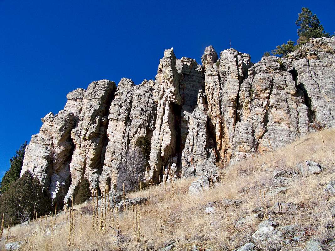
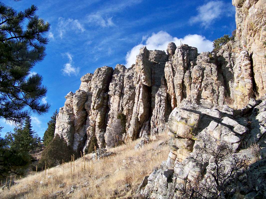
Rock outcrops on the south slopes of "Windy Peak" along the Burro Trail.
Click on images to enlarge.
A hike to the rocky summit outcrop of “Windy Peak” treats the visitor to intimate views of nearby lower peaks along with snow-capped views of the high country giants beyond. A fabulous hike for young and old, flatlanders and high-altitude residents alike, summiting this peak provides a pleasant outing almost any day of the year in the relative civilization of a Colorado state park.
Getting There
 View northwest from the summit outcrop
07 Dec 08
From Golden
Take Highway 93 north from Golden one mile to Golden Gate Canyon Road. Turn left and continue for 13 miles to the park.
From the Denver Area
Follow I-70 west to exit 265 for highway 58. Take highway 58 west to highway 93. Turn right (north) on highway 93 for approximately 1 mile to Golden Gate Canyon road. Turn left and follow Golden Gate Canyon road 13 miles to the Visitor Center. The campground is approximately 5 miles from the Visitor Center. RVs or vehicles towing large trailers may prefer to continue west (highway 58 turns to highway 6 at this stop light). Follow highway 6 west to highway 119. Go north on 119 through Blackhawk to Gap Road (approximately 11 miles). Turn right on Gap Road to access Reverend’s Ridge and Aspen Meadow campgrounds.
From Boulder
Take highway 93 south to Golden Gate Canyon road. Turn right and follow Golden Gate Canyon road 13 miles to the Visitor Center. The campground is approximately 5 miles from the Visitor Center. RVs or vehicles towing large trailers may prefer to continue south on 93 to highway 6. Follow highway 6 west to 119. Go north on 119 through Blackhawk to Gap Road (approximately 11 miles). Turn right on Gap Road to access Reverend’s Ridge and Aspen Meadow campgrounds.
From I-70 East (Dillon/Silverthorne/Idaho Springs)
Take I-70 east to the Hidden Valley/ Central City exit. Follow Central City Parkway through Central City and follow the signs to Blackhawk. Continue through Blackhawk to highway 119. Turn left (north) on 119. To get to the Visitor Center go north on 119 to highway 46 (approximately 8 miles). Turn right on highway 46 to the Visitor Center (approximately 4 miles). To get to Reverend’s Ridge campground continue on 119 past highway 46 to Gap Road (approximately 3 miles). Turn right on Gap Road. RVs and vehicles towing large trailers may prefer to take I-70 east to a LEFT exit for highway 6. Continue on highway 6 and turn left on highway 119. Continue on 119 through Blackhawk to Gap Road (approximately 11 miles). Turn right on Gap Road to access Reverend’s Ridge and Aspen Meadow campground.
From Colorado Springs and Points South
Take I-25 north to the Founders/Meadows exit (highway 85). Take highway 85 north to C-470 west. Continue on C-470 west to the LEFT exit for highway 6. Follow highway 6 west to highway 93. Go north on highway 93 approximately 1 mile to Golden Gate Canyon road. Turn left and follow Golden Gate Canyon road 13 miles to the Visitor Center. The campground is approximately 5 miles from the Visitor Center. RVs or vehicles towing large trailers may prefer to follow highway 6 west to highway 119. Go north on 119 through Blackhawk to Gap Road (approximately 11 miles). Turn right on Gap Road to access Reverend’s Ridge campground.
Route Overview
Thanks to a large quantity of trails in Golden Gate Canyon State Park, there are many ways to get to the summit of “Windy Peak”. Various trails can be combined for a wide variety of routes, both loops and out-and-backs, as indicated by the map and routes table, below.
Click image to enlarge
Below I’ve summarized three primary routes to the summit and included their one-way mileage. Mix and match as you see fit and as meets the needs and abilities of your hiking party.
| Route | Approximate Mileage | Approximate Elevation Gain | Special Note | Driving Directions |
|---|---|---|---|---|
| Burro Trail from Bridge Creek | 3.3 miles one-way | 1,100ft. | Includes initial elevation gain then loss before beginning the real climb | From the visitor's center, travel 2 miles east-northeast. Trailhead on the left. |
| Burro Trail from Nott Creek | 3 miles one-way | 1,200 ft. | Ascends the southeastern slopes of the peak, perhaps avoiding the worst of the summer heat | From the visitor's center, travel 2.75 miles east-northeast. Trailhead on the left. |
| Buffalo Trail from Rifleman-Phillips Trailhead | 3 miles one-way | 150 ft. | Though this route starts high, it begins by losing considerable elevation prior to climbing north then east. | From the visitor's center, follow Mountain Base Road to Gap Road approximately 8 miles (total) to the Rifleman-Phillips Campground. |
Red Tape
This is a Colorado State Park and many rules apply to your use of the property. They may be summarized as follows: Looking west from the summit overlook of "Windy Peak"
07 Dec 2008
- The access fee to this park is $6 daily, or $60 annually with a Colorado State Parks annual pass.
- Do not drive your motorized vehicle off designated roads.
- Park and camp only in designated areas.
- No fires in the backcountry.
- User provided facilities for trash, waste water and RV sewage.
- Pets must be on a leash no longer than six feet at all times.
- Dead and downed trees may be collected as firewood for use in park campgrounds only.
- The maximum camping stay is 14 days within any 45-day period.
- Weapons, including firearms, are not permitted in the park unless you are permitted to hunt during hunting season.
Camping & Lodging
A large selection of camping and lodging options is available right within Golden Gate Canyon State Park.Cabins & Yurts
Within Reverends’ Ridge Campground, the park operates five camper cabins and two yurts. This campground provides flush toilets and running water year round, with showers available in the summer months.
The cabins sleep up to six in bunk beds (bring your own bedding) and are furnished with “propane heater, electric lights, a table and chairs, counter top and closet rack for storage”. Outside you will find a fire ring and a cooking grill.
Like the cabins, the yurts also sleep six people in bunks and are furnished with “a propane heater, a counter top, electric lights and a table and chairs”. They also have a fire ring and cooking grill outside.
Get more information about cabins and yurts in Golden Gate State Park.
 Looking across the valley
07 Dec 2008
Camping
Reverend's Ridge
- 97 sites for tents and RVs
- Flush toilets, showers (summer) and laundry
- Open year-round
Aspen Meadows
- 35 sites, tent only
- Water pump, vault toilets, picnic tables, fire rings, and tent pads
- Typically open mid-May through mid-October
Backcountry Camping
For those wishing for a backcountry camping experience close to the city, Golden Gate State Park provides 20 backcountry tent sites and four three-sided backpacker shelters. There are no fires allowed in the backcountry.
Get more information about camping in Golden Gate State Park.