
-
 27835 Hits
-
 75.81% Score
-
 6 Votes
|
|
Mountain/Rock |
|---|---|
|
|
14.06394°N / 121.42523°E |
|
|
Mountaineering |
|
|
Spring, Summer, Fall, Winter |
|
|
4528 ft / 1380 m |
|
|
Overview
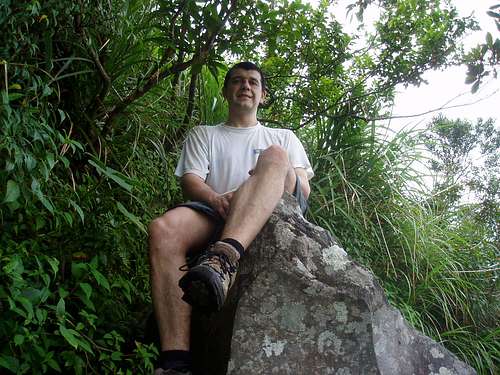
On the False Summit
Mt. San Cristobal – also called Mt. Cristobal – is a nicely shaped conic volcano covered by dense rain forest. The mount is part of the Holocene volcanic complex of Mt. Banahaw but unlike Banahaw de Lucban, which lies on the slope of the huge Banahaw itself, Cristobal seems to be a different mount on it's own. Its youthful morphology suggests that it postdates Mt. Banahaw. The highest peak of Mt. San Cristobal is 1480 m high.
On the flanks of San Cristobal there are andesitic-todacitic lava domes.
Along the slopes of Cristobal, a wide flat area can be seen which was actually a test site of a proposed geothermal plant that didn't push through. Another controversial project that was proposed was the creation of a highway that will link Dolores to Nagcarlan passing between Mts. Cristobal and Banahaw. The project didn't materialized since residents and environmentalist opposed the idea.
For tourists from Europe or from the US the thing that there are monkeys in the mountain gives extra flavour.
The point called False Summit is actually the higest point of the trail leading from the foot of the mountain into the ex-crater of this volcano, where it just crosses the rim of the crater.
Legends
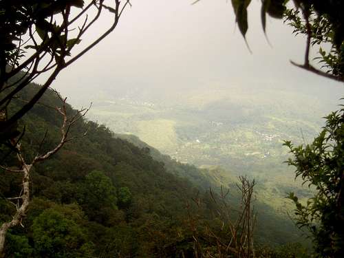
100% humidity - not too much to see
Mt. Cristobal was long known within the mountaineering community as the "spooky mountain." It was always referred to as Banahaw's alter ego meaning that if Banahaw is the power mountain with lots of positive energy, Cristobal is supposed to be the opposite - a mountain with negative energies. Lot's of stories that circulate tend to prove this but we are not just sure if they are fabrics of a mountaineer's adventurous imaginations bolstered by a pre-conditioned mind that this place is supposed to be a "horror mountain." When locals climb the place, one member will claim of hearing strange sounds at night. There is a story when climbers found a dead man on the summit. Local police confirmed that a mysterious murder that happened on the mountain. What a place to do such a thing! It's a bit funny that such a mountain named after a saint would be notorious as a haunting place. Actually once the neighbouring Mt. Banahaw was called Monte Cristobal.
Being a "Spooky Mountain," Mt. Cristobal has a lot of legends, urban legends that is, since most of them are recent stories created by the city hikers which have circulated back within the city limits. One of the popular myths about the mountain is that a creature that the locals call the "Tumao" roams around it's premises. Tumao is actually similar to the Bigfoot of western legends. The best activity to do while you are camping on its peak is to do some night trekking especially when the fog sets in and test the limits of your bravery. Imagine the swamp, mossy crater and dense jungle. The sun sets early in the campsite since you are inside a crater. Try watching "The Blair Witch Project" movie before hiking Cristobal.
When and How to Go
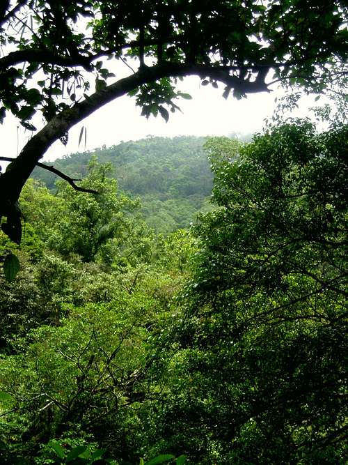
Rain forest
Climbing Mt. Cristobal is safe all year round. Weather is also not a problem except if you don't like being drenched by the rain.
You can do Mt. Cristobal within one day from Manila, or if you prefer spending the night in a tent on the top of the hill, you can do that, too. From Manila you have to take an early bus (around 6 a.m) from the Pasay Bus Terminal to the direction of Lucena City. Get off the bus at San Pablo City after 2 hours of travelling. If you are lucky, you can find a jeepney in San Pablo City that takes you to Dolores. If you are not so lucky, then the jeepney will drop you off at half way to Dolores. In this case you must continue your trip on tricycle. In Dolores you have to change to another tricycle that takes you to Kinabuhayan. The local “bastards” wanted to ask me to pay 400 PHP for this trip. After long negotiation somebody took me for 100 PHP that is an acceptable rate for this.
Before reaching Kinabuhayan, a large intersection with a chapel (that is not very visible – I didn’t notice it from the tricycle) on the corner marks the junction that separates the road ahead to the village Kinabuhayan/Mt. Banahaw and the trail to Mt. Cristobal. If you don’t find this point, it indicates that it’s better to hire a guide. Locals are very helpful in this. Within 1 hour I got a guide. We agreed in a fee of 350 PHP.
Back to the itinerary: at the abovementioned chapel turn left and start your hike. Now you are on 610 m elevation above see level. After a short time you reach the area of the geothermal site. It's a wide field where you can camp if you have started later during the day. The start of the hike passes through plantations. Then you will see a fork before the trail begins to ascend. The left trail is a direct assault to a steep exposed part of the mountain. It offers a superb viewpoint but since exposed, it's hot when the sun is up. The trail is also very steep. The normal trail used is the one turning right. First stop is the psychic's house, Montelibano. The people there are friendly and you can rest inside the house. If nobody is around, you are still welcome to rest at it's balcony. Then, as if entering the Twilight Zone, you will pass through a backyard gate to enter the forest line. From there, the trail is visible up to the campsite. A huge boulder is the midpoint marker of the trail. Before the final ascent, the two trails converge to a single trail going inside the crater to the campsite. You will then reach what they call "False Summit" because you may think it is the highest point in Cristobal. You then descend to the crater. The first campsite is beside a small pond. Following the trail further will take you to the bigger second camp. From this campsite there is a trail going to the view point. The true summit has no trail and if you want to go there, you have to hack your way through tall cogon grass. Cristobal is not yet fully explored so if you are the adventurous type and have lots of time to spend, you can further explore the other craters, peaks and viewpoints. I tried to convince my guide to guide me up to the real summit but he was not opened to the idea, telling that there is no way to get up.
Danger
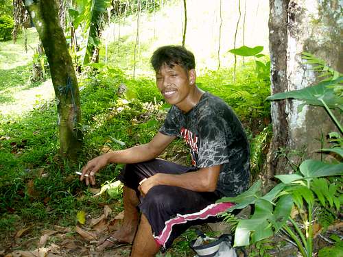
The guide - smoking and in flip-flops
Map
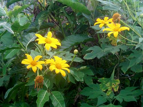
Mountain flowers
Mt. San Cristobal is in the Southwest Luzon area. It's one of the very few areas that is published on a map, and you can buy this map in most bookstores.
SOUTHWEST LUZON Road Map, Scale 1:180000
www.accu-map.com