
|
|
Mountain/Rock |
|---|---|
|
|
41.30340°N / 118.4153°W |
|
|
Humboldt |
|
|
Hiking |
|
|
Spring, Summer, Fall |
|
|
9095 ft / 2772 m |
|
|
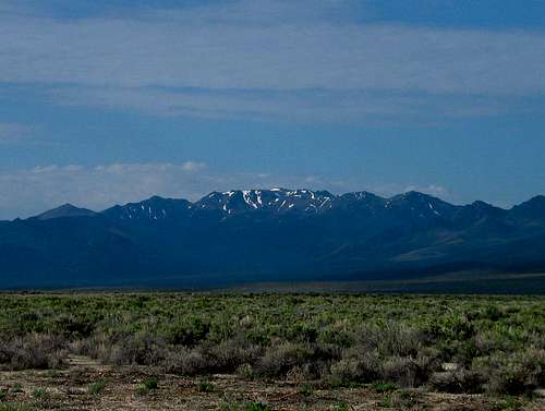
Jackson Creek Canyon & Jackson range
Overview
A lonely mountain range off the beaten track in Nevada, the Jackson Mountains are relatively unknown. The highest point in this range is the 11th most prominent peak in the state of Nevada. The main attraction of this peak is the fact that as just mentioned, it ranks number 11 out of the top 100 most prominent peaks as shown on this list.It was noted in the register that some locals call this highest peak in the Jackson Range, "Dan Dobbins Peak", in honor of a climber who died in a vehicle accident in 1978.I couldn't find any additional references to this individual by googling up the name Dan Dobbins nor any additional mentions of a "Dan Dobbins Peak". See the register page on the upper right corner of this page for this.
Jackson range from highway 140
Getting There
From Winnemucca Nevada, take U.S. 95 north some 30 miles and watch for Nevada highway 140 when it splits off to the left and heads for Denio, some 66 miles away. At MP 33 (53 miles from Winnemucca),watch for the Leonard Creek rest area on the right side of the highway. Across the road from the rest area, look for a road, the Leonard Creek road, and take the Leonard Creek Road on the SW side of the highway. At first this road is paved but where the pavement ends, bear left on Jackson Creek Ranch Road. If you follow the main track (check your Benchmark atlas) it will run along the base of the mountains past Deer Creek Ranch (15 MPH signs) and down to Jackson Creek Ranch, where the most heavily-used track bears left and becomes Trout Creek Road. It was about 31 miles from highway 140 to where we parked on a switchback so it is important to have sufficient gasoline.
Follow Trout Creek Road all the way up to the saddle at 6038T on the map. 4WD is not necessary for this road but high clearance is recommended. Turn left on the less-used track at the saddle and follow it as high as you can. There are really no confusing junctions except at about 7300’ where you have a choice – you want to go back sharply to the right, and follow the road leading up toward Redbird Mine. Most vehicles can get to at least the switchback at around 7700’. (lat/long 41.2985 -118.4267 nad 27) You can most likely go higher but the switchback provides a good spot to stop and be able to park off the road. The road continues further but big rocks make for only a short gain advantage. More info will be provided in the route section below from where you park.

Area map
Note that snow will block the road in late fall through late spring so unless you want to carry snowshoes and walk a lot longer, think about late May as the earliest you will be able to get near the 7700 foot mark.
Red Tape
None that I know of. Nothing was posted as "no trespassing" except inside a mine shaft that it would be smart to stay out anyway. In fact, it would be wise to stay out of any buildings or mines that you might come across. This area was heavily mined and may still be actively mined in some areas.
Camping and being prepared
No official campground but there are several spots along the entry road that would work for car camping. Use the "leave no trace" ethic.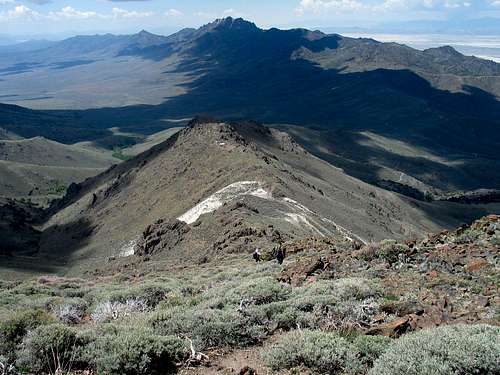
Be sure to gas up in Winnemucca and carry plenty of water in your vehicle. Self sufficiency in this part of Nevada is important in case of a breakdown.
As the Boy Scouts recommend, "Be Prepared".
Weather at Denio Nevada

Route & mini trip report
From the switchback at 7700 feet, walk up the road past an old mine and turn right as the road switchbacks just above the mine. Follow this road up as far as you can before striking up the ridge towards the summit. My group used the summit waypoint as our guide and there was nothing difficult about the route finding as it is pretty obvious. GPS wise, the summit was only one mile away from where we parked and probably close to 2 miles of walking distance. The elevation gain was about 1500 feet so this is an easy hike.Four of our group are all Summitpost members and so you could kind of call this a gathering of sorts. Caleb hails from central Oregon, Dennis from southwestern Oregon, Bob from southwestern Washington and myself from Utah.
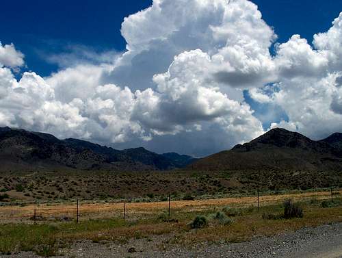
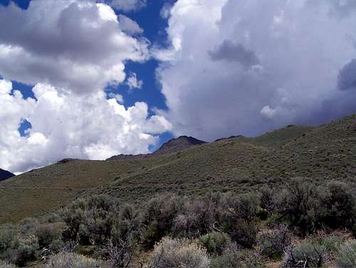
We just barely got back to our vehicles when a thunderstorm let loose over the peak. The clouds formed quickly and built up to electrical status in a pretty short time. It took us about two hours round trip, not including the time we spent on the summit but getting an early start was very key for us. We had driven down from Fields Oregon where we were camping to do this peak, a distance of 90 miles (each way)
Summit register
The summit register contained names mainly of those who are interested in the prominence peaks, with signees coming from California, Arizona, Oregon, Washington, Nevada and Utah. As of July 2015, peakbagger.com shows 29 people have been to the summit of this one. Also on peakbagger are many trip reports from some of the ones who visited this summit including a couple GPS tracks. Kay Komuro's trip report also has a link to her photos from her visit.

Summitpost gathering
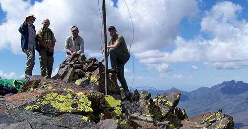
4 on the summit