
|
|
Mountain/Rock |
|---|---|
|
|
41.68253°N / 112.03046°W |
|
|
Cache |
|
|
Hiking |
|
|
Spring, Summer, Fall |
|
|
8766 ft / 2672 m |
|
|
Overview
Far from the hustle of the busy Wasatch trails, the Wellsville Range towers above the peaceful Bear River plains of Northern Utah. Abruptly mounting almost 5,000 feet above the plains on either side, the bold silhouette of this range will capture your marvel while observing from far below in the mountain shadows. Despite the mighty display of these mountains, relatively few explorers challenge their slopes, making them more appealing to the trailblazing adept. The few trails that ascend these rugged mountains deal little mercy. Stamina on their steep inclines is simply a minimum. Extra fortitude is required due to the surprisingly fertile soils, which often make the trails overgrown with tall undergrowth embedded with stinging nettle. Yet, the conspicuous beauty of this range will tempt the investigation of the most vivid wilderness dreamers. Wellsville Mountains, Northern Utah
Way up high on the range, an interconnecting ridge spans the distance between the range’s highest peaks. Acting like a bookend for a colossal wall of earth, Mendon Peak sits at the northernmost limit of the crest. United with its kindred peaks to the south, Mendon Peak summons climbers to a lofty adventure in the Wellsville Mountain Wilderness Area, which shrouds the mountainous empire’s nucleus. Though not as majestic as the kingly Box Elder Peak to the south, Mendon Peak is a prince of the Wellsville monarchy, reigning as third highest crown of the range. With the picturesque Cache Valley to the East paralleled by the endless Salt Lake to the West and linked by the countless waves of Idaho ranges to the North, the view from Mendon Peak is truly stunning. There is only one way to know for yourself. Come and see. Adventure and solemnity await you here on the slopes of this Northern Utah jewel.
 Mendon Peak, Utah
Features
 Wellsville Ridge
Climbing to the top of Mendon Peak will put you on the crest of the Wellsville Mountains, where you can easily access all the high peaks of the range, including the high point, Box Elder Peak.
 Looking Eastward at Logan Peak
Sitting as the last major peak to the north, the views are extensive in three directions from the range.
 Shady Canyon
Lower portions of the Deep Canyon trail will be shaded during morning and afternoon.
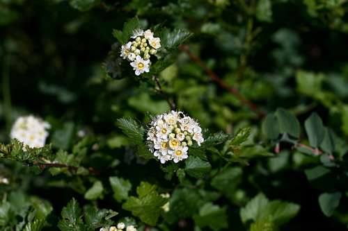
 Colors Abound
Wildflowers of many varieties and colors can be found in abundance.
 Raptor Territory
The Mendon Peak area is known as a corridor for migrating raptors, which are frequently spotted in the vicinity.
History
1) The Wellsville Mountains is a depository of a large number of marine life fossils due to the undersea environment before the mountains began to uplift about 300 – 500 million years ago.2) Up until about 10,000 years ago, the areas surrounding the Wellsville Mountains were buried under the waters of Lake Bonneville. Lake Bonneville was a large inland lake that covered much of modern day Utah.
 Bonneville Remains
3) The range shows evidence of ancient glacial movements on the east face of the range. Three major cirques are visible on the range.
4) Fremont Indians are the first known inhabitants of the region, who mysteriously disappeared and were replace by the Shoshones. The Shoshones used these mountains for annual harvests of bighorn sheep, which are missing in the habitat today.
5) Mountain men and trappers began to permeate the area for harvesting beavers during the early 1800s. Legendary trappers like Jedediah Smith, Jim Bridger, and John Colter used Cache Valley as a rendezvous site and for fur caches.
6) Settlers, including Mormons, began to settle the area in the late 1850s. The new immigrants clashed with the Shoshone people and eventually engaged in what is known as the Bear River Massacre in January 1863.
7) In the early 1900s the Wellsville Mountains had been overgrazed and almost depleted of all vegetation. Bob Stewart and John Hughes worked together to purchase the land from the railroad and then turned over the property to the forest service in the 1930s. A peak in the range bears the name of Bob Stewart.
 Cloudy Times
8) The area surrounding Mendon Peak was recognized for its special qualities as an observatory for migrating raptors, and was one of the first sites in the nation recognized for these attributes.
9) The Utah Wilderness Act of 1984 designated the Wellsville Range as a wilderness area. The efforts to sponsor this legislation were monumental. But, as usual, the mountains were quite capable of speaking for themselves in these matters. The wild virtues of this range were obvious and are now preserved for the enjoyment of generations to come.
10) Today, the Wellsville Mountains have recovered nicely from the scars of the past, except for the absence of the bighorn sheep. Please continue to preserve and promote the wildness of this special place.
When to Go
June through September would be the best times to hike this peak, though June may still have some snow near the saddle. Not sure if the road and the trailhead is plowed of snow in the winter. Deep canyon shows a lot of avalanche debris. Summer brings abundant wildflowers, while fall features the hawk migration and the many fall colors.Getting There
Mendon Peak can be easily accessed from three different trailheads. But one trailhead provides the most direct route to the summit. This trailhead is called Deep Canyon, located near the town of Mendon, Utah. The town of Mendon can be reached from three major logistical centers. Deep Canyon
Primary Access:
Deep Canyon
From Ogden/Salt Lake:
Exit Interstate 15 at Brigham City using exit 364. Follow Highway 91/89 through Box Elder and Wellsville Canyons, passing the Sardine Summit along the way. After about 17 miles along this highway you will reach the town of Wellsville, the first town you will encounter in the Cache Valley. The first major four-way intersection will be with Highway 23, where you will take a left. There will not be a stop sign or a traffic light, but there will be a center lane open for left hand turns. Highway 23 is also Center Street for Wellsville. Once beyond the town, the Highway will travel northward to Mendon, which lies 6 miles beyond Wellsville.
From Logan:
Find Highway 30 that travels westward out of town. Highway 30 is also named 200 North in the city of Logan. Roughly 7.5 miles from Logan, at the only major four-way intersection after leaving town, turn left onto Highway 30. This intersection also has no stop sign or traffic light, but will have a left-hand turn lane in the center of the highway. Follow Highway 30 for short jaunt to the town of Mendon.
From Pocatello, Idaho:
Exit Interstate 15 near the town of Riverside, Utah at exit 387. Follow Highway 30 over the Malad and Bear River bottoms, and up the pass and corridor to the Cache Valley. After descending the pass, you will reach the same intersection along Highway 30 that commuters from Logan will use. Turn right at this intersection and drive the short distance to Mendon.
 False Summit
Once at Mendon, Utah you will be looking for 300 North. Turn onto this road and drive to the west. Mendon Peak will be right in front of you. Continue along 300 North for about two miles to the trailhead of Deep Canyon. The road eventually travels onto private property where it becomes dirt. The road is maintained fairly well, and most cars with good clearance should be adequate for travel. There is a nice parking area where the road ends.
The trailhead has no toilets or running water. The trailhead has a register and some basic information on the wilderness area and the hike. Please respect the property of the property owners who graciously provide us this access.
Alternate Access:
The second trailhead is called Maple Bench on the USGS quad. This location is situated on the maple bench southwest of Mendon, Utah. To skip redundancy, see the directions available to this trailhead on the Box Elder Peak page on SP. This trail is also known as the Bob Stewart Trail or Coldwater Canyon-East (hence the naming of Coldwater Canyon on the Box Elder Peak page.) This trail tops out at the Bob Stewart Pass. From this pass, you can follow the ridgeline northward to Mendon Peak, passing Pleasant Viewpoint, and Scout Peak along the way.
The third trailhead that can be used for this peak is Coldwater Canyon, accessed from the west side of the range near the town of Honeyville, Utah. Although I cannot verify public access at this time, this trail presumably tops out at the Bob Stewart Pass. I have not seen any recommendations or literature for this trail.
General Map:
View Mendon Peak in a larger map
Red Tape
Mendon Peak lies within the boundaries of the Wellsville Mountain Wilderness Area, a part of the Uintah-Wasatch-Cache National Forest.No permits are necessary. Sign in at the trail register.
 Wellsville Peaks
Please follow normal wilderness area guidelines such as these:
Plan ahead and prepare
Travel and camp on durable surfaces
Dispose of waste properly
Leave what you find
Minimize campfire impacts
Respect wildlife
Be considerate of other visitors
Area specific guidelines are mentioned at this NFS website:
One item of interest is that no more than three consecutive nights can be spent at one campsite.
Please contact the Logan District Office for further information:
Logan Ranger District
1500 East Highway 89
Logan, UT 34321
(435) 755-3620
Current Conditions
Visit this NOAA link for a current forecast: Mendon Peak v. Clouds
National Fire Center:
Avalanche Center:
National Forest Road Closures:
Utah CommuterLink:
Maps and Peak Data
 Mendon Peak Summit
USGS Quads:
Honeyville, UT 1:24,000
Logan, UT 1:100,000
Elevation: 8,766 feet
Prominence: 390 feet
Isolation: 2.81 miles
Utah Rank: 933
County Rank: 33
County Prominence Rank: 64
Range Rank: 3
Range Prominence Rank: 3
Camping
Campgrounds:Box Elder Campground is the only campground in the Wellsville Mountains. It is located on US 91/89 near Mantua, Utah. Click here for more information.
 Steep Slopes
Backcountry Camping
Camping in Deep Canyon is not recommended due to the constant steep elevation and the thick foliage. Unless you wanted to sleep on the saddle between Mendon Peak and Peak 8585, find another location for staying overnight. The saddle is large enough for a tent or bivvy, but is extremely exposed. Wind would not be your only problem here.
Accommodations
The city of Logan would make the simplest place to stay overnight. All modern conveniences are available in town, including sporting goods and maps.
Flora and Fauna
 "Hawkwatch Peak"
The most notable fact in this field is the already-mentioned corridor of raptor migration in the Wellsville Mountains. Peak 8585, to the west of Mendon Peak, is locally named “Hawkwatch Peak.” The month of September can yield up to 200 raptors in a single day. Eagles, falcons and almost every hawk species of Western North America can be spotted here. Visit this website of the Bridgerland Audubon Society for more information:
Moose, deer, elk and mountain lions are some of the largest animals in the area.
 Big Tooth Maples
Big Tooth Maple trees dominate the landscape of the lower slopes, eventually graduating to groves of aspen, and then to Douglas-fir and juniper trees. These are supplemented by berries and mountain-ash. This mix presents an array of colors during the fall.
The wildflowers are colorful and varied, providing an aesthetic adventure for the naturalist. These should be in bloom from May to July, depending on the elevation.
The flowers and trees of lower Deep Canyon, create an atmosphere like a combination between an aviary and a greenhouse. Songbirds offer a tremendous symphony of sounds. The bumblings of bees and the fluttering of butterflies add to the musical masterpiece.
It is truly a wild garden!
| The Deep Canyon Gardens | ||
|---|---|---|
 |  |  |
 |  |  |
 |  |  |