
-
 30450 Hits
-
 82.48% Score
-
 15 Votes
|
|
Mountain/Rock |
|---|---|
|
|
38.92990°N / 105.3533°W |
|
|
Park |
|
|
Hiking |
|
|
Spring, Summer, Fall, Winter |
|
|
9230 ft / 2813 m |
|
|
Overview
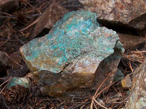
A rock found on the summit of Blue Mountain
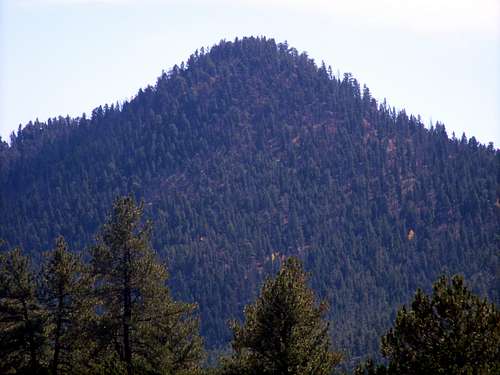
Blue Mountain is a shapely, double-humped 9-er due south of the small community of Lake George, Colorado. The peak is close enough to Colorado Springs to make for a pleasant day outing for residents of that metropolitan area. Those with a 4x4 will find the outing to the summit of Blue Mountain abbreviated enough to attempt en route to other destinations.
The pleasant summit ridge is interrupted intermittently by old mining disturbances. This north-to-south running ridge affords the visitor delightful views to the east of Pikes Peak and to the west offers a surprise view of the trefoil Sawatch Fourteener Mount Princeton.
Colorado Rank: 2784th highest peak in Colorado
Prominence: 570 feet
Mountain Range: Front Range
USGS Quad: Lake George
Trails Illustrated Map: Trails Illustrated #137 (Pikes Peak, Cañon City)
*Rank and Prominence Reference: Lists of John
Getting There

Sawatch Fourteener Mount Princeton

West side of Pikes Peak
Blue Mountain rises just west of the Teller County line in Park County. Due south of Lake George off of Hwy 24, Blue Mountain is circled on three sides by Park County 61, a well-graded gravel road.
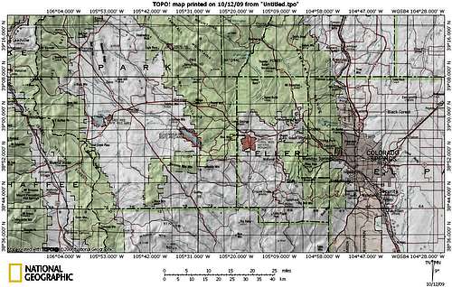 Click on map image to enlarge
Red Tape

Badger Mountain to the northwest

Northeast from the summit ridge
There is little red tape governing recreational use in this part of the National Forest and there is no fee to access this area. Adhere to LNT (Leave No Trace) principals, observe fire ban when in effect and do not harass wildlife or allow your pet to do so.
Camping
FS 244 and Immediate Surroundings
A few rustic campsites can be found along FS 244 and spur roads off of it. These sites are available on a first-come-first-served basis and are dry: No water, from a pump/well or other water body, is available, so pack water sufficient for your group size and the duration of your stay.
Designated National Forest Service Sites
The National Forest Service has a large selection of campgrounds in and around the Lake George area.
| Campground Name | Elevation | Sites | Nightly Rate | Reservations? | Notes |
|---|---|---|---|---|---|
| Blue Mountain | 8,200 ft. | 21 | $12 | Yes | Less than 3 miles as the crow flies from the summit of Blue Mountain. |
| Spruce Grove | 8,600 ft. | 27 | $12 | No | Let the gurgling Tarryall Creek sing you to sleep. |
| Twin Eagles | 8,600 ft. | 9 | $8 | No | Must haul or purify drinking water. |
| Happy Meadows | 7,900 ft. | 8 | $12 | No | Situated along the South Platte River. |
| Round Mountain | 8,500 ft. | 16 | $12 | Yes | Drinking water, vault toilet and trash pickup. |
| Springer Gulch | 8,300 ft. | 15 | $12 | Yes | Situated within the Elevenmile Canyon; water, tables, fire grates. |
| Riverside | 8,000 ft. | 19 | $12 | Yes | Situated within Elevenmile Canyon; large grassy meadow with little shade. |
Cabins, Lodges and Hotels
Numerous cabins can be rented in and around Lake George. There are also a few cabins/lodges/dude-ranches along the Tarryall Creek catering, especially to the fly fishing visitor. For example: Ute River Ranch.
 Approaching Blue Mountain from the North
Weather & Seasons

Looking west from Blue Mountain

Register placed by Bob & Dotty Martin
Summer: The route can be a bit hot and dusty in the summer, but the road should be dry and accessible and the breezes on top pleasant.
Spring: The snowpack is less deep here than in the high country and melts out faster than higher areas to the west. None-the-less, expect post-holing through unconsolidated snowdrifts in the trees.
Fall: The aspen coating the slopes of this peak and surrounding neighbors make this area a golden-hued heaven in the fall.
Winter: Thanks to proximity to US Hwy 24 and “primary dirt roads” 96 & 61, this peak is accessible year-round, though deep snows/drifts and 4x4 road closures would limit the visitor to the eastern slopes access to this peak.