|
|
Mountain/Rock |
|---|---|
|
|
39.88452°N / 105.42875°W |
|
|
Gilpin |
|
|
10540 ft / 3213 m |
|
|
Overview
Located a mere 32 miles WNW of Denver is Golden Gate Canyon State Park. This camping & equestrian friendly tate park contains some ~35 miles of hiking trails in a mostly dry, scrub vegetation foothills terrain. As to be expected, some trails are multi-use (bikes, horses, foot) while others are strictly hiking only. Other activities like: climbing, rappelling, horsebackriding, snowshoeing can also be done here. And like other state-maintained parks, Golden Gate does have operating hours (5:00 am-10:00 pm) seven days a week.
Thorodin Mountain is located inside Golden Gate Canyon SP and within Roosevelt National Forest. This is only a class-2 hike and a short one at that. Expect a 3.0 mile round-trip jaunt with roughly 1,080' of elevation gain from the trailhead.
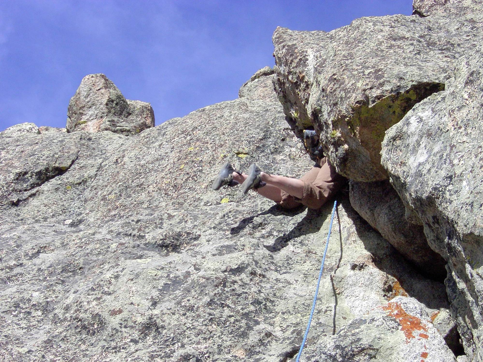
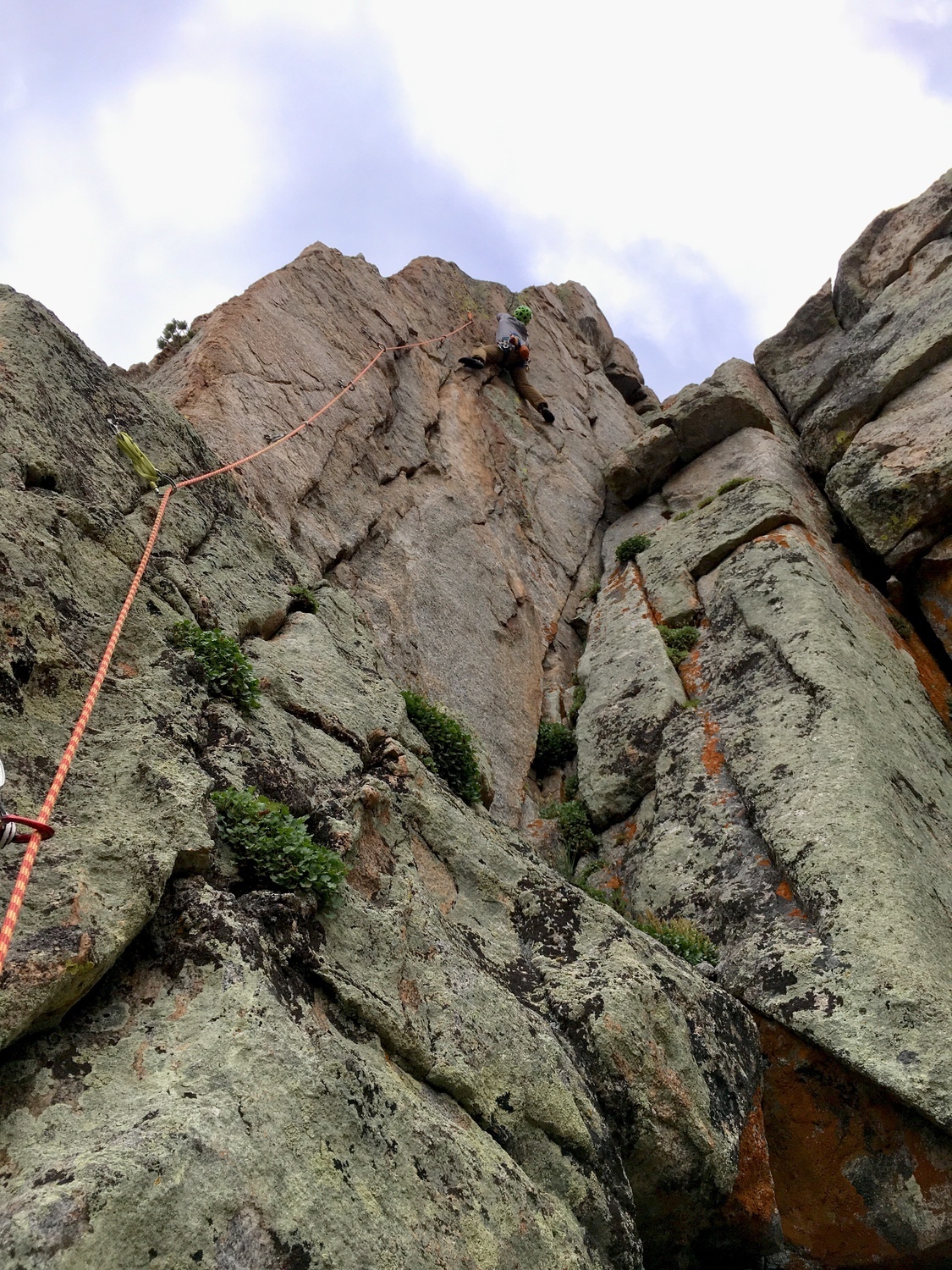
The summit of Thorodin lies below treeline and is actually a gemini summit. Its northern most point is slightly lower but it is officially ranked and named (Starr Peak). There is also a rock formation .2 mile southeast of Starr Peak called, 'Sheepshead' that is popular for climbing. Sheepshead isn't ranked but it is named on local maps. There are also multiple buttresses and rock formations on Thorodin proper that offer scrambling and easy technical climbing (First Buttress, Third Bttress, "Raven Knob").
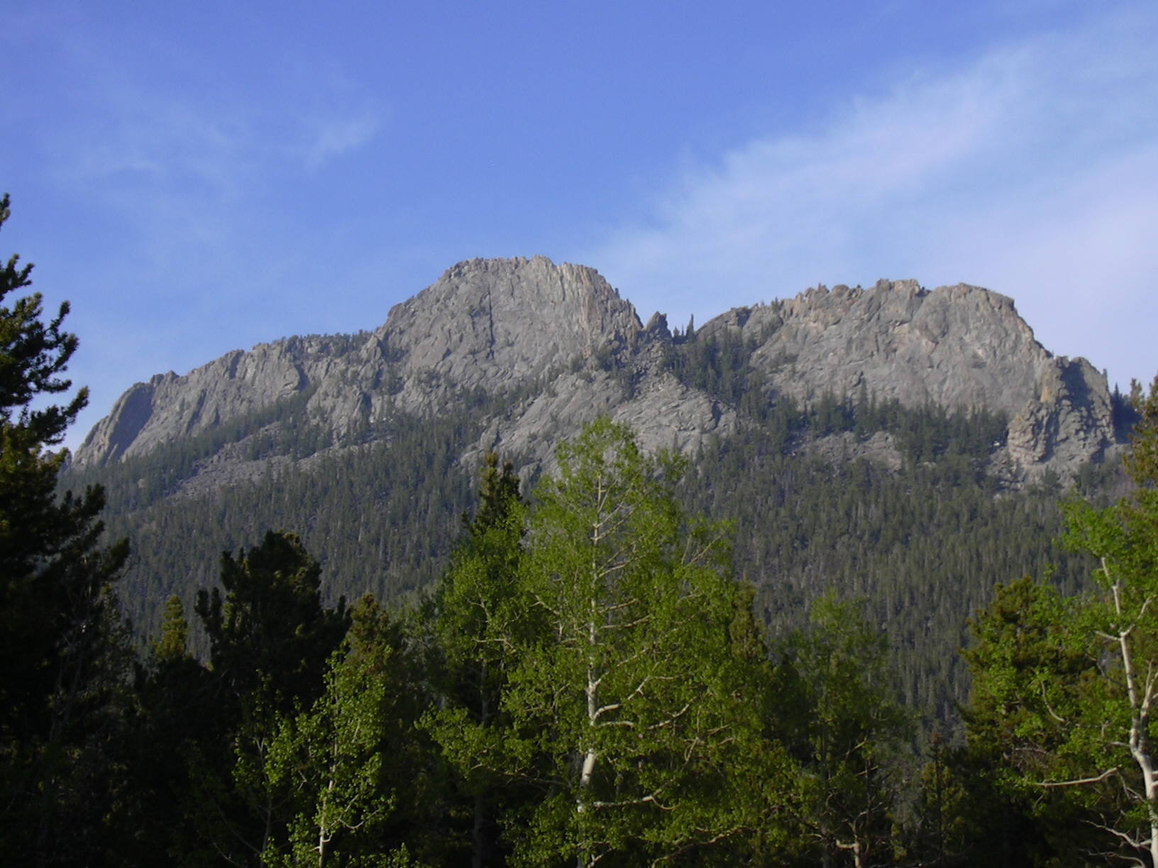
When viewed from the west, Thorodin does indeed look fairly impressive and stands out. The three massive buttresses mentioned above make the summit look far higher than the 1480' of prominance it carries. From the craggy summit, one can see Mt. Meeker & Longs Peak to the north. The Continental Divide and James Peak are to the west and all of Boulders' mountain parks (Bear Peak, South Boulder Peak) lie to the east.
According to local folklore, early settlers to the Gilpin County area were undecided whether to call the mountain 'Thor' or 'Odin.' So Thorodin became the compromised name everyone agreed on.
Not much remains on the mountain from early days, but there is an old shack in a small meadow near the summit. Occasionally, hikers will find traces of old trails or logging roads. There is a Thorodin webcam that works sometimes. Thorodin Mountain is also the site for a 145.310 MHZ repeater station, located near the summit.
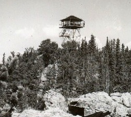
Close nearby, to the north, is Starr Peak (10,511'), where a fire lookout tower was built in 1941. That tower was removed from service in 1976. Tremont Mountain, at 10,388', is just to the south in Golden Gate Canyon State Park. The trail up Tremont to Panorama Point provides some great views of Thorodin to the northeast and is recommended.
| 10,540 feet | 1,480' Prominance | Class-2 Peak/Mountain | Colorado Rank: 2,019 highest |
Getting There & Route Options
Getting to the summit of Thorodin Mountain can be a tricky endvour. It will take some creative route-finding and bushwacking. Even though it lies within the state park, there is a generous amount of private property that borders the mountain. Signs stating as such exist everywhere in the forest. On some of the older maps, there is an actual 'Thorodin Mountain Trail' that's labeled. But again, the private property would negate this legal throughfare...if it exists at all. Possible options to attain the summit are detailed below.
■ From Denver: Head west towards the mountains on Interstate 70. Take the right hand exit and contour onto highway 58 towards Golden (this is marked exit #265). In Golden at the four-way intersection with West 6th Avenue, continue through the intersection into Clear Creek Canyon on hwy. 6. Drive west for 14.2 miles to a T-intersection with hwy. 119. At this intersection, hwy. 6 cuts to the left and rejoins I-70. Continue straight for an additional 8 miles to the gambling town of Blackhawk. From Blackhawk, it's a 12 mile drive north on hwy. 119 to Gap Road (Gilpin County Road 2). Turn right and follow Gap Road to an area known as Reverends Ridge. The shortest distance from Gap Road to the summit would be from somewhere between Mountain Base Road and the Aspen Meadows Campground turn off. Just find a suitable place to park and start!
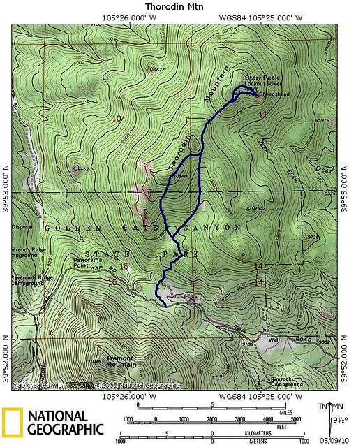
If you want a topo map to bring with you, you'll want the USGS Tungston Quadrangle map. Generally speaking, if you start your ascent from the south (which, you probably will from Gap Road), contour just behind the buttresses. There's a bit of a draw or shallow, open-faced gully in a thinner part of the forest just east of the buttresses. Aim for this and climb up through the broken forest and small crags. Keep ascending the south shoulder keeping to the path of least resistance. The summit is a rocky protusion with good views.
Red Tape
To access Thorodin Mountain, a parks pass is required. A daily pass is $9.00 per vehicle. If entering the park by foot, horse or bicycle, the individual cost is $4.00. For more information about the other types of passes available, go to the Colorado Parks & Wildlife page. All daily passes are good until noon the following day.
Eastern access is tough as there is private homes, cabins and even a few businesses. The Starr Peak Ranch also operates on the eastern side and up into Coal Creek Canyon. Northern access is also prohibited for the same reasons.
When To Climb

Thorodin can be hiked at anytime of the year since the park is open 365. In regards to the weather, obviously the biggest concerns are going to be summer thunderstorms (lightning) and winter blizzards.
Just plan accordingly to the season/weather in mind.
On June 10, 1972, a climber was killed by lightning, while attempting to rappel down the west face of Thorodin. His partner was injured by the lightning strike. While Thorodin is not a major peak in the Rockies, dangers still exist in the form of falls, wildlife, dehydration, freezing temperatures, lightning, and other hazards that are common for hikers and climbers.
Flora and Fauna

For many hikers and climbers, the chance to view plants and wildlife along the way adds great depth to their outdoor experience. Thorodin's forest is part of the Roosevelt National Forest, and consists of ponderosa pine, lodgepole pine, Englemann spruce, Douglas fir, Colorado blue spruce, limber pine, conifer, and aspen.
Other plants commonly found include: antelope bitterbrush, kinnikinnick, Rocky Mountain juniper, Oregon grape, wax currant, big sage, common juniper, blueberry, Woods' rose, snowberry, serviceberry, nodding brome, western wheatgrass, pine dropseed, goldaster, blue grama, lupine, and beardtongue.
Larger wildlife often seen in these forests include: mule deer, elk, black bears, mountain lions, and coyotes. Common smaller animals include bobcats, raccoons, striped skunks, porcupines, snowshoe hare, cottontail rabbits, muskrats, squirrels, and red fox.
Birds commonly seen include: Blue Grouse, Ptarmigan, Golden Eagles, Bald Eagles, Stellar's Jay, Gray Jays, Mountain Chickadees, Rosy Finches, Turkey Vultures, Mountain Bluebirds, Ravens, Common Nighthawks, American Kestrel, and Red Tailed hawks.
Climbing Opportunities
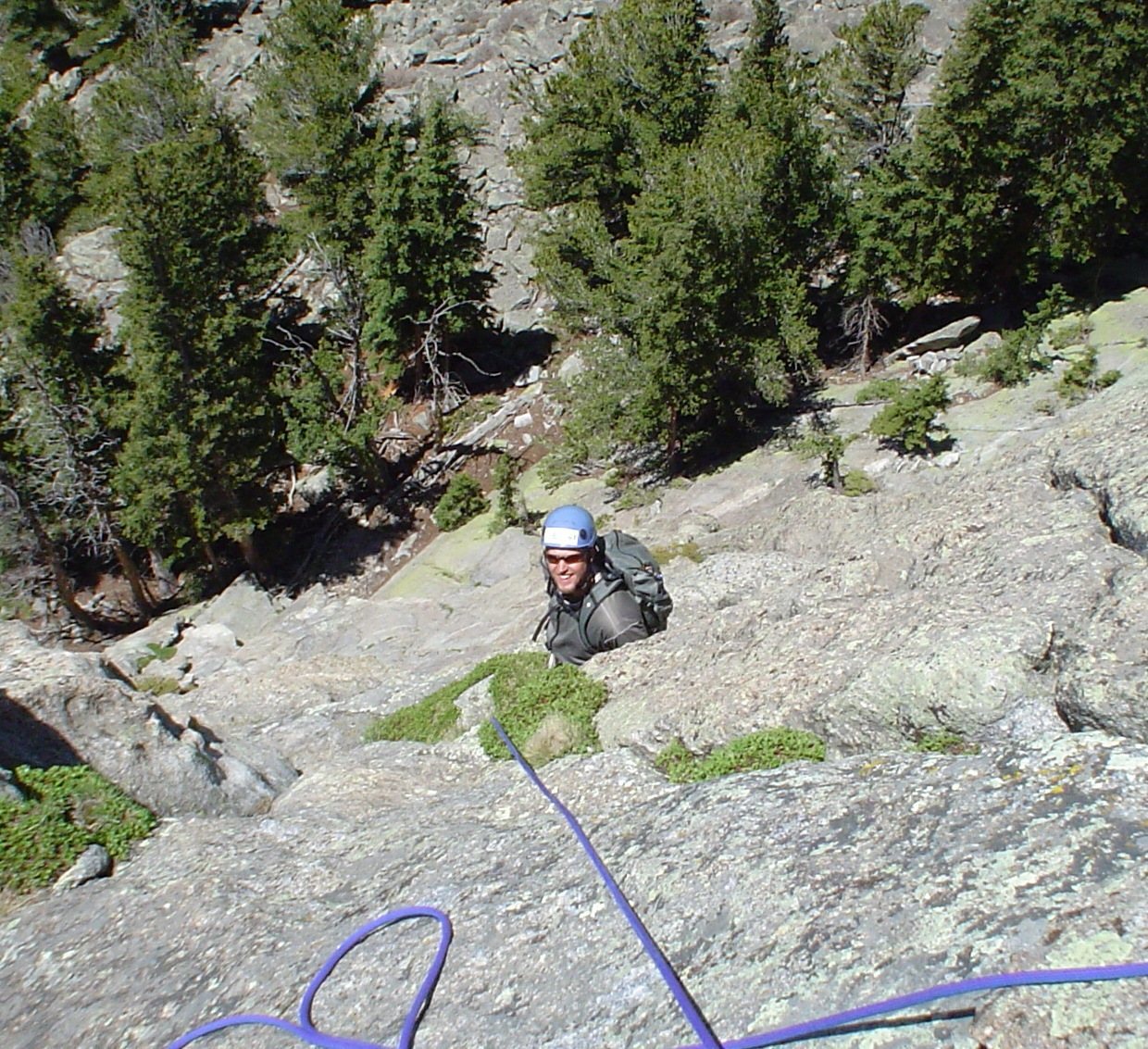
As mentioned in the Overview (ever so briefly), there is climbing in Golden Gate Canyon. With Thorodin specifically, most of the routes are graded in the upper 5th range and typically only a few pitches in length (1-3 pitches). There are trad and sport routes available.
In Golden Gate Canyon proper, there are roughly 10-11 climbing areas with most routes graded in the upper 5th range. Expect routes from 5.6 to 5.11 on fairly trustworthy rock. Mountain Project has some great pages on the local climbs and worth checking out.
|
#720.598.2864 |
#303.884.2755 |
 |
 |
 |
Camping Resources and Options
Golden Gate Canyon State Park offers not only great campsites, but also has cabins and yurts. Roosevelt National Forest has a number of campgrounds. If you prefer lodging, many nearby communities have facilities.
The list below should be of some help:
Roosevelt National Forest Campgrounds, Boulder Ranger District Office (303) 541-2500.
Reverends Ridge & Aspen Meadows (303)642-3856