
|
|
Mountain/Rock |
|---|---|
|
|
41.68455°N / 23.48877°E |
|
|
Hiking, Mountaineering, Trad Climbing, Scrambling, Skiing |
|
|
Spring, Summer, Fall, Winter |
|
|
9265 ft / 2824 m |
|
|
Overview
|
|||
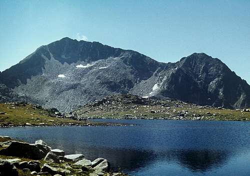
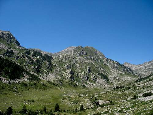
| Kamenitsa rises between the peaks of Malka Kamenitsa (Little Kamenitsa, 2690m – not to be mistaken for Kamenishka Kukla) to the north and Yalovarnika (2774m) to the south, at the north end of a sub-group that takes its name from Kamenitsa itself. The craggy side of Kamenitsa is its northwestern flank, whose highest sections contain walls that are beyond the reach of the hiker. The southwestern slopes show the mountain's gentle face while the eastern slopes - dotted with minor crags – are fairly steep, long and extend hundreds of metres down to the bottom of the deep valley of a creek that has at least three names: Demirkapiyska reka, Zhelezina and Treta reka. This beautiful valley, which has distinct signs of having cradled a big glacier during the Ice Age, is part of the Pirin thru-hike trail. But all the surroundings of Kamenitsa are also fantastic ground for off-trail scrambling. In fact, the same goes for most of the granite chunk of the Northern Pirin, but in its southern part, near Kamenitsa you will see fewer hikers, more cattle (! bulls rather than cows) and shepherd's dogs; and you are more likely to run into a bear. | |||
|
Routes
|
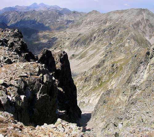
There is no marked route leading to the summit, however, the 2822m peak is easily accessible from Tevno Lake via the pass between Kralev Dvor (2680m) and Malka Kamenitsa. A marked trail leads to the pass, which is called Kralevdvorska Dyasna Porta (the Right-hand Kralev Dvor's Gate), from where you follow the narrow ridge that extends south towards Malka Kamenitsa and then beyond it, forming a long arête which drops abruptly to the west, providing some technical, albeit short (approx. 150m), routes suitable for trad climbing. Near Malka Kamenitsa the path sticks to the east foot of the arête but climbs onto its top as soon as the arête widens. As far as the easiest possible ascent of the 2822m summit is concerned, this can be accomplished from the south-west and will then be just a walk-up across the long, fairly gentle slopes covered with vast fields of granite blocks. Kamenishka Kukla, whose north wall is actually bigger than that of Kamenitsa, offers some interesting, demanding scrambling (and weird climbing) options.
|
||
|
||
| ! Quite a few place names have been changed lately owing to a controversial policy of replacing the Turkish toponyms with Slavic ones - please see History of Bulgaria. For example, on the first map of the Pirin I managed to get (1973 edition) the Demirkapiyska River is labelled Treta reka (literally the Third River), while my 1983 map displays Demirkapiyska r. (Tretata). Now there's the Zheleznishka reka. |
Red Tape, When to Climb & Potential Dangers
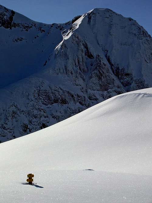
 Kamenitsa and Kamenishka Kukla in winter - photo by Vani.
- In winter there is normally plenty of snow and avalanches are a common occurence.
- The Pirin Mountains are protected as a National Park, even though the way the park is managed seems not to be up to standard yet. No fees to pay or permits to get but camping is only permitted near the huts.
- July and August are pretty hot; possible unpleasant encounters – apart from noise made by "tourists", especially at the hut – can include bulls (the valleys do suffer from overgrazing), shepherd's dogs and bears.
- Rescue Service telephone numbers: Bulgarian Mountain Rescue Service Bansko (Pirin) Branch
Maps
- sketch map of the Kamenitsa Ridge
- Bulgarian online map
- Czech online map
- Slovak online map
- 1:40,000 - paper and online: Select Kamenitsa or Kaмeницa
- 1:25,000 paper
- 1:50,000 paper
Huts & Camping
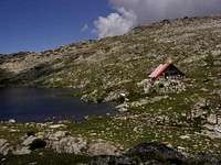
Refuge by Tevno Lake
Demyanitsa Hut
The nearest huts/refuges:
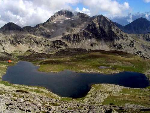
- Tevno Ezero Refuge (manned) at 2515m, 1.5-2 hrs' hike/scramble to the main summit of Kamenitsa. (! The "3 hours" sign at Tevno Lake refers to the easiest route, around Kamenishka Kukla - please see the Routes chapter.) 30 beds, hot meals, privies outside.
- Kamenitsa (former Begovitsa) Hut at 1750m, 2.5 hrs' walk to the west
- Pirin Hut at 1640m, in the Demirkapiyska Valley to the south
- Demyanitsa Hut at 1895m, 4.5 hrs' hike to the north
The huts can get crowded in July and August, but in September, not to mention the other months, you cannot count on much but good luck so it is wise to bring the food with you.
Getting There
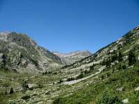
Demirkapiyska Valley
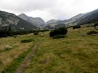
Trail from Demyanitsa Hut,
Tevno Lake beyond the Col
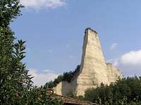
Unclimbable towers near Melnik
BigLee has been there recently and knows best how to get from Sofia to Bansko, by bus or train. The bus option is recommended as the journey by train is terribly long and lasts about 7 hours. However, a reasonable solution can be a train journey - taking 3 to 4 hours - from Sofia to the town of Sandanski (Сандански), which sits on the other, western side of the Pirin Mountains, not far away from the border crossing point between Bulgaria and Greece. (Bulgaria is not a Schengen member yet.) From Sandanski you can take a taxi, or - in the summer season - try and catch a minibus going to Yane Sandanski Hut/Popina Luka (see the Maps chapter above). If you feel like making an arduous ascent and you are not afraid to hike through parched landscapes, it will be a good idea to pick the picturesque little town of Melnik - accessible by bus - for the trailhead. The area between Melnik and Rozhen displays lovely badlands scenery. But it is still 15 km from here to Pirin Hut in the Demirkapiyska Valley.
A few helpful links:
- Sofia Airport
- Bulgarian rail (the red change-language button at the top)
- European rail timetables on Deutsche Bahn site
- Bulgarian Cyrillic by Peterbud
Weather
- Webcams, including one at 2550m, 9km away from Kamenitsa
- Bansko weather forecast
- Bansko on AccuWeather
Select External Links
- Kamenitsa area in winter - photos by Jan Moravec
- Bulgarian-English Dictionary - for the "Prevod sa" boxes, select bugarskog and engleski
- Kamenitsa in Cyrillic
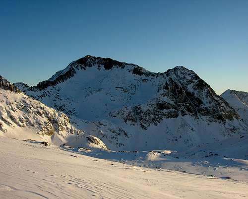
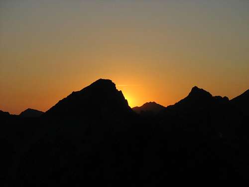 The sun setting behind Kralev Dvor (2680m) - photo by Amorpheus.