
-
 35820 Hits
-
 85.87% Score
-
 21 Votes
|
|
Mountain/Rock |
|---|---|
|
|
37.78299°N / 119.51735°W |
|
|
Mariposa |
|
|
8500 ft / 2591 m |
|
|
Overview
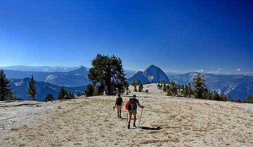
Hikers on Mt. Watkins
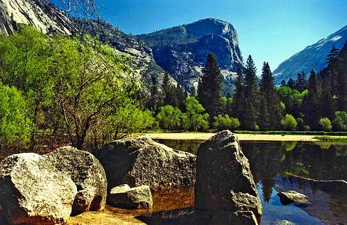
Mt. Watkins from Mirror Lake
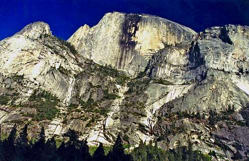
One of the classic views of Yosemite Valley is Mt. Watkins from Mirror Lake. This was first photographed by Carleton E. Watkins one of Yosemite's earliest photographers.
Mt. Watkins sits atop the northwest side of Tenaya Canyon directly across from Clouds Rest and 2.6 miles northeast of Half Dome. This gives you a massive unobstructed up front view of those giant granite monoliths, the 2 largest faces in Yosemite.
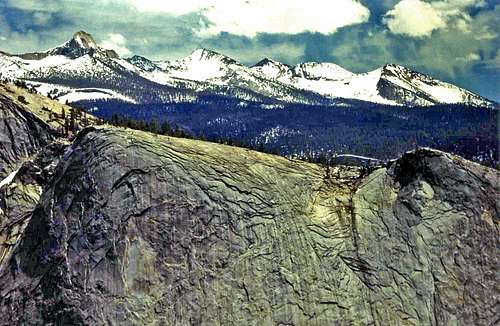
The summit is a huge rolling dome of acreage much larger than Half Dome but with a few pines growing out of the rock here and there. The south and southeast face were heavily carved by the Tenaya Glacier and offer at least one challenging verticle ascent first undertaken by legendary climbers Chuck Pratt, Warren Harding and Yvon Chouinard.
This is an enjoyable but strenuous day hike from the Valley floor or an easier cross country hike from Olmstead Point in the Yosemite high country to the north of the Valley.
The south end of Mt. Watkins offers the best views of Half Dome and the Valley.
Getting There
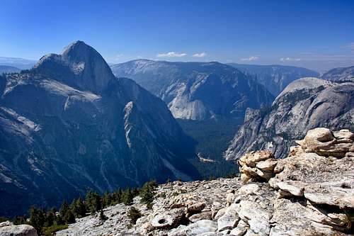
Half Dome, Glacier Pt. (back center) and North Dome from Mt. Watkins
West slope from Yosemite Valley: The hike starts from the Mirror Lake Junction which is stop # 17 on the free shuttle bus that runs in the Valley. Take the paved walkway .07 miles to Mirror Lake. Take the trail on the northwest side of the lake and walk another mile to the junction with the switchback trail that climbs up the northwest side of Tenaya Canyon.
Take note: Bring plenty of water. This steep trail is 2,500' verticle of exposed switchbacks and can get real hot in the summer.
At the top of the switchbacks the trail levels off and goes .3 mile to a junction by a footbridge. Take the trail to the right over the footbridge and go about a half mile as it gradually ascends the west slope of Mt. Watkins. Break trail and hike east over easy forested terrain .9 mile to the summit of Mt. Watkins. This hike is a 4,500' gain.
North slope from Olmstead Point off Hwy. 120: Take the trail below the parking lot that skirts to the right and descends into the forest valley then along a steep slope until it comes to a huge saddle at 2.7 miles. From this forested saddle just head south staying on the big rounded crest .9 miles up the gradual north slope to the top of Mt. Watkins. This hike is about a 1,500' gain round trip.
Climbing route, South Face VI 5.8 C2 First ascent Chuck Pratt, Warren Harding and Yvon Chouinard in summer 1964. They slowly ran out of water and into an epic.
Chuck Pratt wrote: "By the fourth day Yvon had lost so much weight from dehydration that he could lower his climbing knickers without undoing a single button. For the first time in seven years I was able to remove a ring from my finger, and Harding, whose resemblance to the classical conception of Satan is legendary, took on an even more guant and sinister appearance." The 2,000' climb took them 11 days and 36 pitches.
A full history, description of the route, its approach and descent route can be found in Yosemite Big Walls by Chris McNamara and Eric Sloan, SuperTopo
Red Tape
Mt. Watkins left, and HD from Illilouette Ridge
Half Dome from Mirror Lake
There is a 20$ per vehicle entrance fee good for 7 days into Yosemite National Park.
Venturing up deep into Tenaya Canyon between Mt. Watkins and Clouds Rest is dangerous and not recommended due to the steep walls and powerful flow of Tenaya Creek. People have been lost and died there.
Camping
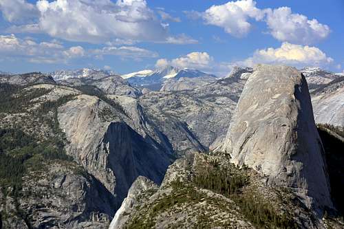
Quarter Domes and Clark Range from Mt. Watkins
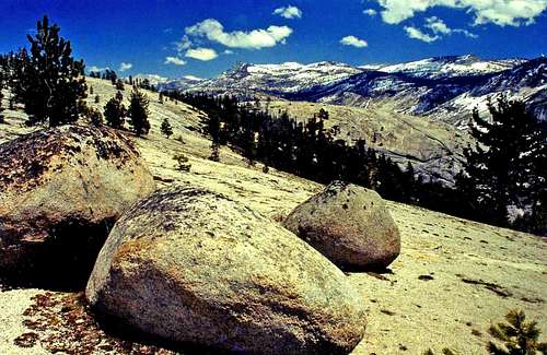
Glacial erratics on Mt. Watkins
There are plenty of places to camp in Yosemite Valley and also along Hwy. 120 on the way to Olmstead Point. For more information on Yosemite camping click here.
Weather forecast for Yosemite

South end towards Glacier Point

Half Dome from the trail up Tenaya Canyon
For the 10 day weather forecast click here.