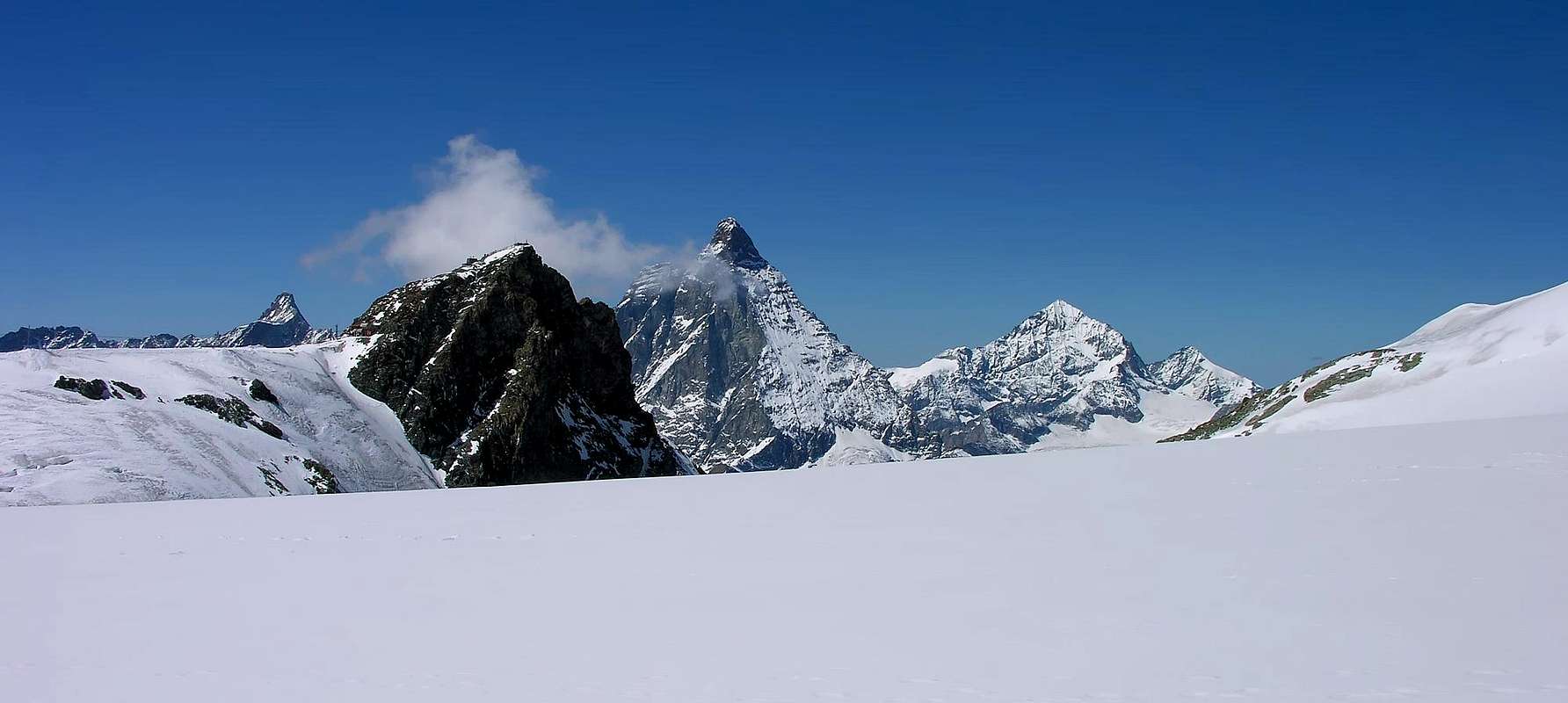
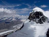
Little Summits, but high mountain, not remarkable from South in slope from Aosta Valley, but in sight from North with North-northwest, Northeast and East-northeast Faces in evidence. Reduced because of greats Glaciers Breithorn in East and rocky pyramid of the Matterhorn in West, appeared secondary summit. Very good lookout with greats Westerner views towards the Dent d'Hérens, Matterhorn, Dent Blanche and to "Giants" of the Vallais.
Piccola sommità, ma alta montagna, poco appariscente da Sud sul versante valdostano, ma ben in vista da Nord con le sue pareti Nord-nordovest, Nordest ed Est-nordest in evidenza. "Schiacciata" dalle masse glaciali dei Breithorn ad Est e dalla piramide rocciosa del Cervino ad Ovest, pare cima secondaria. Ottimo belvedere verso Occidente sulla Dent d'Hérens, sul Cervino, sulla Dent Blanche nonché sui "Colossi" del Vallese.
First Ascents
"in the traces of Bénedict Horace De Saussure"
First in the summit: Bénedict Horace De Saussure and mountain guides J. M. Couttet, J. B. Erin and five mountain guides, (Aug 13th, 1892).
In winter: H. Biehly, R. Helbling and F. Wagner, (Jan 02th, 1889).
W Face (Direct Route): Gilberto Carnevali and Franco Goglio, (Dec 08th, 1953). * First Replay: Section of Aosta of the C.A.I., (Jun 25th, 1967).
W Face: A. Carpignano, N. Cottalorda and R. Montaldo, (Aug 17th, 1971).
W Slope and N-NW Crest: F. T. Wetheredg and mountain guides of Zermatt J. M. Biner and J. J. Truffer, (Jul 29th, 1877).
S-SW Wall of rocky Great Shoulder and N-NW Arête in terminal part: C.A.I. Aosta Section, by Ilario Antonio Garzotto, Fracasso Dino and Genola Piero (Guides), Faggion E (Carrier), Giuseppe Polo, Vittorio Manella, Giovanni De Paoli, Gianni Bortolotti, Vanni Florio, Gianni Junod, Tullio Omezzoli, Renato Faval, (Jun 25th, 1967), with three different routes: on W Slope Carnevali-Goglio Direct Route, Great Shoulder of N-NW Crest and "English Route" on N-NW Arête.
N-NW Arête: Berthie Neuhaus and mountain guides Oskar Supersaxo and Ambros Supersaxo, (Jul 27th, 1904).
N Face: Oskar Eckstein and Wunderlick, (1879).
Little Gully North: Rolando Albertini and Cesare Roberto, (Aug 04th, 1973).
NE Wall: Gino Gandolfo and mountain guide Bruno Bich, (Jul 28th, 1948).
E-NE Face: Vittorio De Tuoni and mountain guide of Valtournenche Mario Barmasse, (Dec 07th, 1986).
Great Tour Gobba di Rollin-Breithorn West-Central-West-Klein Matterhorn-Testa Grigia: Osvaldo Cardellina, Eugenia Comé, Marco Cossard, Camillo Roberto Ferronato, Giuseppe Lamazzi, Sandro Plat and Raffaella Pellizzari, (Aug 10th, 1980. * Replay: Osvaldo Cardellina, Christian Cardellina, Imperial Eusèbe and return with Robert Chester, (Aug 06th, 1986).
Getting There
BY CAR:
From Torino, Milano, etc: Motorway A5. Exit at Chatillon.
From Switzerland: through the Grand Saint Bernard Tunnel or the namesake pass.
From France: through Mont Blanc Tunnel or Petit Saint Bernard Pass. It isn't necessary to take Motorway A5: you can drive on SS.26, in the direction of Aosta.
BY PLANE:
Aeroporto "Corrado Gex" Saint Christophe (Aosta).
Approach
From the exit of the Motorway of Chatillon to continue on the SR.406 along the Valtournenche Valley, after having overcome the Countries of Antey Saint André (1.074m), Valtournanche (1.528m) Breuil Cervinia is reached (2.006m), where almost to center of the country it is situated the "funivia" also cableway (with ample parking lot), that reaches Plan Maison (2.548m) and to the Plateau Rosà up to the Testa Grigia (3.480m), from where the itinerary begins.
Dall'uscita del Casello Autostradale di Chatillon proseguire sulla SR.406 lungo la Valtournenche, dopo aver superato i Paesi di Antey Saint André (1.074 m), Valtournanche (1.528 m) si raggiunge Breuil Cervinia (2.006 m), dove quasi al centro del paese è situata la funivia (con ampio parcheggio), che porta a Plan Maison (2.548 m) e al Plateau Rosà sulla Testa Grigia (3.480 m), donde inizia l'itinerario.
Route
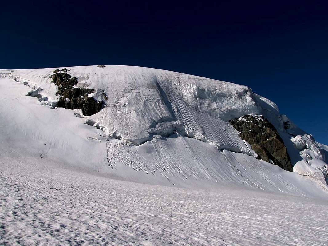
From the "Testa Grigia" (3.480m; Rifugio Guide del Cervino); for the Glacier of the Plateu Rosà to address him to East on numerous traces toward the Breithorpass or Hill of the Breithorn (3.818m), of few to Northern of the Gobba (= Hump) of Rollin (3.899m). To Pass (500 meters~ before) to turn to North and to cover Plateau Rosà Glacier and following Breithornplateau towards the Saddle (3.796m) and trough the easy South-southwest bach to reach the Summit climbing elementary littles rocks (falling rocks for transit numerous mountaineers; 0h'45/1h'20 from Plain Maison Superior Station, on summit of the Testa Grigia (3.480m).
Dalla Testa Grigia (3.480 m; Rifugio Guide del Cervino); per il Ghiacciaio del Plateu Rosà indirizzarsi ad Est su numerose tracce verso il Breithorpass o Colle del Breithorn (3.818 m), di poco a Settentrione della Gobba di Rollin (3.899 m). Dal Colle (un 500 metri~ prima) volgere a Nord e percorrere il Ghiacciaio del Plateau Rosà ed il successivo Breithornplateau verso la Sella (3.796 m) e per la facile "groppa" Sud-sudovest raggiungere la vetta con qualche roccetta elementare (caduta sassi per transito di alpinisti; 0h'45/1h'20 dalla Stazione Superiore di Plain Maison, in cima alla Testa Grigia (3.480 m).
Parents refers to a larger category under which an object falls. For example, theAconcagua mountain page has the 'Aconcagua Group' and the 'Seven Summits' asparents and is a parent itself to many routes, photos, and Trip Reports.

 17127 Hits
 87.76% Score
 25 Votes