
-
 34946 Hits
-
 82.48% Score
-
 15 Votes
|
|
Mountain/Rock |
|---|---|
|
|
35.63131°N / 82.28665°W |
|
|
Buncombe |
|
|
3540 ft / 1079 m |
|
|
Overview
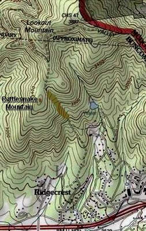
USGS map, modified to locate Rattlesnake Mtn, delete a no-longer existing road, and add a missing contour line at the summit.
Rattlesnake Mountain’s rocky summit is one of the best viewpoints around Black Mountain, Montreat, and Ridgecrest, North Carolina. It has a more dramatic summit, and a completely different view, from its more famous neighbor, Lookout. There is a quick ascent from Ridgecrest Conference Center, but the most rewarding way to reach Rattlesnake is from the Montreat side.
Due to an error that has been perpetuated on most maps (but not the one at right), Rattlesnake Mountain is usually assigned an elevation of 3480 feet. In fact, it has at least 100 feet of prominence above the Rattlesnake-Lookout saddle, instead of the 40 feet shown by USGS, and reaches about the same elevation as the hairpin turn on the Old Mitchell Toll Road due south of Lookout.
Getting There

Bear Creek
Ridgecrest Trailhead: Exit I-40 at Exit 66 (Ridgecrest) and proceed eastward along Old US 70 to Ridgecrest Conference Center. The trailhead is at the conference center’s tennis court, about a quarter-mile directly behind the main assembly buildings. Ask the conference center gate attendant to point you to the tennis courts.
Montreat Trailhead: See Lookout Mountain.
Routes

Rattlesnake Trail
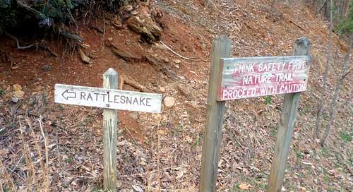
Rattlesnake Mountain Trail: From the Ridgecrest Trailhead (see "Getting There") or from the Ridgecrest Ballfields, follow the well-signposted trail one mile to the saddle between Lookout and Rattlesnake. From this posted junction, turn left and climb 200 yards of steeper trail to the top. There is a little rock scrambling at the end. Total ascent from the trailhead to the summit is 750 feet.


Tranquility Hollow
Much of this trail passes through relatively unattractive scrub, relieved at the halfway point by “Tranquility Hollow,” a beauty spot where the route crosses Bear Creek.
To see a trail map, go here.
Lookout Trail and Old Mitchell Toll Road:
As discussed on the Lookout page, you can approach Rattlesnake by turning off from the “South Side” route to Lookout or by traversing the Lookout summits. From the well-marked turnoff on the Old Mitchell Toll Road, Rattlesnake Mountain is 0.3 miles, during which you descend a little more than 100 feet to a saddle and then re-ascend the same amount to the summit. By approaching the mountain this way, you ensure that your entire hike is in verdant forest.
Dangers
 Whoever laid out the Rattlesnake Mountain trail from Ridgecrest was much impressed by the dangers of the wilderness.
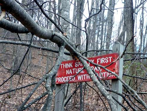 Then again, they may have had a point …
Red Tape
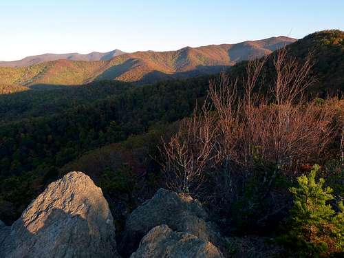
Looking northwest from the summit. In the distance on the left, the Great Craggy Mountains; at upper right, Graybeard. The long sunlit range is the Seven Sisters.
Rattlesnake Mountain is on private land administered by LifeWay, the Baptist-affiliated organization that runs Ridgecrest Conference Center. Hikers are welcome. Don’t camp on Ridgecrest property. Mountain biking is restricted; inquire at 828-669-8022 for details.