
|
|
Mountain/Rock |
|---|---|
|
|
34.69688°N / 119.65399°W |
|
|
Santa Barbara |
|
|
Hiking |
|
|
Spring, Summer, Fall, Winter |
|
|
6820 ft / 2079 m |
|
|
Overview
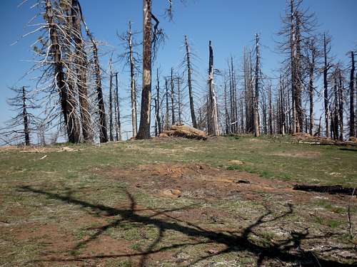
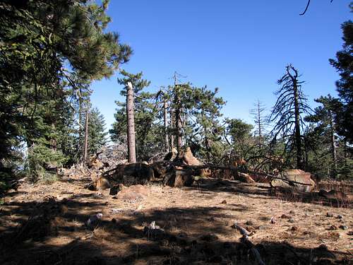
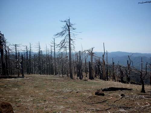
Big Pine Mountain is the high point of the San Rafael Mountains, about 20 miles north of the City of Santa Barbara. Big Pine also has the distinction of being the high point of Santa Barbara County, #132 on California’s 2K prominence list, and on the Sierra Club Angeles Chapter’s Hundred Peaks Section list. Due to its remoteness, Big Pine is typically done as a multi-day backpacking trip or as a mountain bike venture although the 30+ mile day hikes occur on a regular basis. In more recent times, the mountain has become part of a grueling 45 mile day hike with 9500 feet elevation gain known as the Santa Barbara HPS Big 4.The peak and the surrounding area were devastated during the 2007 Zaca fire, often described as the second largest wildfire in the State of California. While much of the area is recovering, burnt remains of trees can be found everywhere and can easily become obstacles on the many roads and trails in the area. Side trails and old forest roads abound in the area so intentionally or not intentionally, there are many areas to explore or campsites to spend the night at. Water is limited but is available from Chokecherry Spring on the way up or from a spring a short ways down the Sisquoc River trail to Upper Bear Camp.
 Big Pine Mtn from Madulce Peak trail during a dayhike of the HPS Big 4 (May 10)
Getting There
As mentioned previously, all routes to Big Pine Mountain are an arduous affair as it is nestled deep in the San Rafael Mountains. The shortest “standard route” is a 30+ mile roundtrip affair either by foot or mountain bike. Even if the OHV road from Oso Campground is open, it would require a punishing drive of somewhere around 30 miles to get to the southwest face of the peak. A few of the possible routes are described here but with the myriad of forest roads and trails abounding in this wilderness, there are countless variations on the exact approach.Santa Barbara Canyon offers the shortest approach and two distinct routes to Big Pine that eventually meet at the saddle with Buckhorn Road (9N11) and Madulce Trail. To get to Santa Barbara Canyon, take CA 33 south 2.7 miles from the junction with CA 166 or north 36 miles from Ojai from the junction with CA 126. Turn right or left (respectively) onto Foothill Road, crossing the river, and then left onto Santa Barbara Canyon after 2.1 miles. Santa Barbara Canyon Road is 12.6 miles of paved, poorly paved, and finally good dirt road to the locked gate on the north terminus of the Big Pine - Buckhorn forest road. A mile before getting to the locked gate is the trailhead for reaching Big Pine via the Santa Barbara Canyon. More specific instructions can be found on the HPS website.
Cachuma Saddle provides access to the backbone of the San Rafael Mountains and eventually gets to Big Pine via the San Rafael Peak trail. The total distance from the trailhead to Big Pine is approximately 25 miles one way. To get to Cachuma Saddle, take US 101 to SR 154 north past Lake Cachuma, turning right onto Armour Ranch Road. After a little over a mile, turn right on Happy Canyon Road and follow it to Cachuma Saddle. More specific directions can be found on the HPS website.
Paradise Road gains access to the Big Pine – Buckhorn OHV Road (27W27) via the Camuesa OHV Road through the Lower and Upper Oso Campgrounds. The approach to Paradise Road is similar to Cachuma Saddle except the turn-off on the right side is about 2.5 miles before you get to Lake Cachuma.
 Big Pine Mountain from West Big Pine (May 10)
Routes
Santa Barbara Canyon trail via Santa Barbara Canyon road winds its way south until reaching Madulce Guard Station (~8 miles) at which point the correct route heads west to join the Madulce Peak trail (10 miles) and finally joins the Big Pine - Buckhorn Road (11 miles). Heading south and then west past the Almar Campground (12.2 miles) leads to the faint spur road (14.2 miles) that climbs Big Pine’s summit (15 miles).Big Pine - Buckhorn Road via Santa Barbara Canyon Road heads west switchbacking up the Sierra Madre sub-range before hitting a junction (4.5 miles) with the Sierra Madre Road which continues west. Continuing south on the main road leads you past Chokecherry Spring (9 miles) to the junction with the Madulce Trail (10.2 miles). The remainder of the route is as described above.
Cachuma Saddle Trail takes the hiker to McKinley Saddle (8 miles) and then branches to San Rafael Peak (10 Miles). At this point, continue along the ridge (~22 miles) to West Big Pine Mountain and finally the junction with the Big Pine – Buckhorn OHV Road (~24 miles) , directly below the west face of Big Pine. A direct but steep ascent goes straight up the west face weaving through trees and brush or hiking a mile northeast to the summit spur road as described in the first route above.
Camuesa OHV Road leaves upper Oso campground and meets a junction (~ 4 miles) with the Big Pine – Buckhorn OHV Road which continues winding its way up the range for about 26 miles until it reaches the junction with the trail from West Big Pine just below the west face of Big Pine. It isn’t clear whether OHVs are permitted past Little Pine Mountain (12 miles from Oso) although I’ve seen 4WD vehicles (forest service volunteers) parked below Big Pine. From there, the same options are available: direct ascent of the west face or a leisurely quick hike to the summit spur road. This road is seasonal for vehicles so check for current conditions with the ranger station.
Red Tape , Camping, and Conditions
You'll need the Adventure Pass, which is $5/day or $30/year (as of 2010). These can be bought at any of the Ranger Stations and most sporting goods outlets in Southern California. Current information on conditions, permits, or closures can be obtained by calling the local ranger station.Campgrounds or campsites abound in this area. The interior ones are primitive with usually just a table. Upper Oso and Cachuma campground provide easy access to two of the trailheads. There is no campsite at the end of Santa Barbara Canyon Road but there are sufficient spots to do primitive tent or car camping near both trailheads.
Hiking can be done in almost any season but April through December (avoiding the hottest months) are the most popular times. In heavy snow years, the north facing roads and trails may hold residual snow into late spring. Check here for current weather
External Links
HPS Page for Big Pine MountainBob Burd’s Trip Report of the HPS Big 4
Rick Kent’s Trip Report of the HPS Big 4
My photos from the HPS Big 4
John Fedak's pre-Zaca Fire Big Pine pictures