
-
 20901 Hits
-
 85.87% Score
-
 21 Votes
|
|
Mountain/Rock |
|---|---|
|
|
38.05910°N / 122.604°W |
|
|
Marin |
|
|
Hiking |
|
|
Spring, Summer, Fall, Winter |
|
|
1887 ft / 575 m |
|
|
Overview
Looking west up Big Rock Ridge from the main ridge top fire road with "The Sixteener" (1,640') upper center and the summit towers, upper back right.
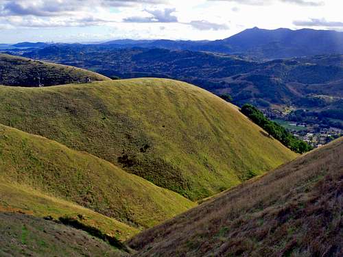
Big Rock Ridge is a massive 5 mile long east-northwest running uplift in the northern part of the county. This is the second highest mountain in Marin. The south face is characterized by large rolling open grassy buttresses that drop steeply into Lucas Valley. The north side is a mixture of forested oak and chaparral covered slopes and subridges. Trails and fire roads coming up from north and south converge into one main fire road that roller coasters along the top to the main summit which supports 2 radio tower facilities. Most of the ridge is accessible as public Open Space land. The relative remoteness and demanding steepness of most of the routes to the top keep this excellent hiking area sparsely populated even when Mt. Tamalpais and the Marin Headlands are at their season peak with tourists, hikers and mountain bikers.
Hiking the whole ridge from the Queenstone trailhead to the main summit towers and back is a very satisfying outing with fine views along the way. Also a one way hike to the summit towers and on down to the Big Rock at the pass can be done as a shuttle back to Queenstone if you have 2 vehicles.
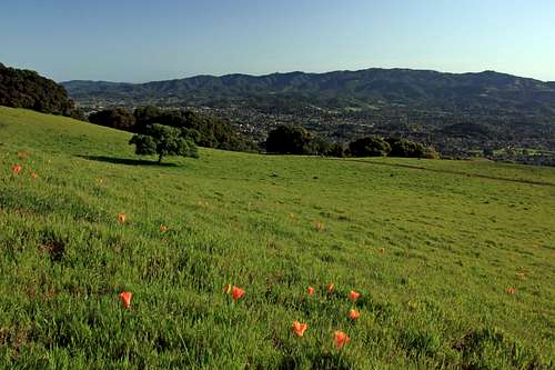
The far reaching Bay Area views from Big Rock Ridge are second only to Mt. Tam.
Getting There
South from Big Rock Ridge to Mt. Tam
From the southeast: From Hwy. 101 in northern San Rafael take Lucas Valley Road west .3 miles. Turn right on Miller Creek Rd. and go .5 miles to Queenstone. Turn left 1 block and park. Take the southeast ridge fire road as it contours around and up to junction with the main ridge at 2.2 miles. Follow the main ridge another 2.2 miles to the summit towers.
From the south, Lucas Valley: From Hwy. 101 take Lucas Valley Road 3 miles west to Bridgegate Drive. turn right. Go 1 block and turn left on Creekside. Go .3 miles and park on the street by the tennis courts. Take the Luiz fireroad switchbacks across the street straight up 1.5 miles to the main fireroad at the top of the ridge. Go left another 1.5 miles to the summit towers.
"The Sixteener"
Note: Although not the high point, the peak just to the west of the junction with the Luiz Fire Road and the main fire road ("The Sixteener", 1,640') has the best views on the ridge and one of the best views in the north bay or the whole Bay Area for that matter.
From the south, Big Rock pass: From Hwy. 101 take the Lucas Valley Road 5 miles west up to the pass with the Big Rock and park on the south side. Take the trail on the north side of the pass next to the Big Rock approximately 3 miles as it contours into the canyon and then gradually switchbacks up to the top of the ridge. Take the ridge road right a little over a mile to to the summit towers.
This is the easiest most popular way to the top. It starts at 650' el. and the well graded trail is no more than 5 percent.
Red Tape
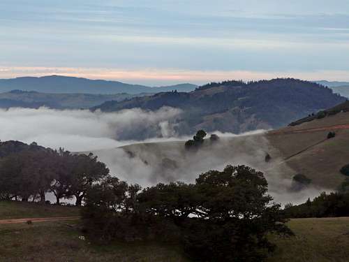
"Dry Ice", West end of Big Rock Ridge in winter

Personally, I have never seen or heard any hunters anywhere on the ridge in 17 years of hiking on it. For more on Marin County Open Space click here.
Camping
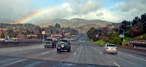
Rainbow over Hwy. 101 with Big Rock Ridge in the distance. The fire road featured in the adjacent photo (1,450') is the top of the rounded peak directly above Hwy. 101
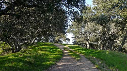
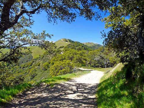
Along the main fire road at about 1,450' el. going west
There is no camping on Open Space lands.
For current weather conditions
Big Rock Ridge from the north. From Burdell Mtn. south slope
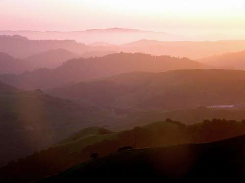
Soft sunset from Big Rock Ridge
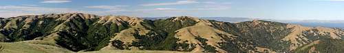
Big Rock Ridge pano from the south. From Loma Alta