
|
|
Mountain/Rock |
|---|---|
|
|
37.55870°N / 118.9414°W |
|
|
Fresno |
|
|
Hiking, Scrambling |
|
|
Spring, Summer, Fall, Winter |
|
|
12077 ft / 3681 m |
|
|
Overview
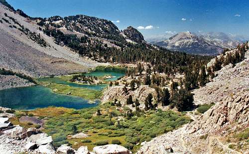
North from Duck Pass Trail
Duck Lake Peak is a stunning mountain summit located northeast of Duck Lake, nestled in the mountains six miles south of Mammoth Lakes, California. The trail to Duck Pass out of Mammoth Lakes is a beautiful route into the Sierra back country. As one crests the pass, pristine Duck Lake lies below and the Silver Divide rises across Cascade Valley to the southwest. Duck Lake Peak (unmarked on most topographic maps, besides an "X") is the highest summit in the immediate vicinity of the lake; and has a prominence of approximately 690'.
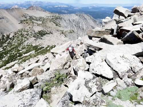
The class 2/easy class 3 west slope is easily accessible from the pass above the lake. The chute at the south end of the east face is class 3 from about a mile south of Valentine Lake on the east side.
The peak is visible from Hwy. 395 going south into Mammoth Lakes.
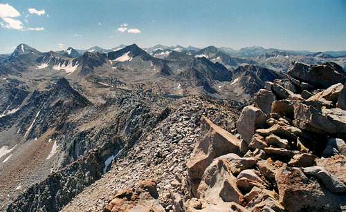
The views from the summit extend as far south as Mt. Hooper above Florence Lake and as far north as Mt. Warren northwest of Mono Lake.
The best time to hike here is late June/early July through October. This area tends to get a lot of snow during the winter.
Appreciation is owed to Windsor Riley (aka Noondueler) who created this page, and who passed away in 2016.
Getting There
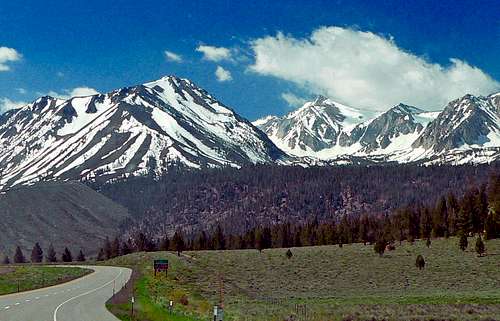
Duck Lake Peak, back right center, from Hwy. 395
From Duck Pass: From the junction of Hwy. 395 at Mammoth Lakes take Hwy. 203 west into Mammoth Lakes staying to the left as the road goes up beyond the town. As the road goes past Twin Lakes take a left at Lake Mary where the road makes a 180 at 7.8 miles from 395. Continue along the northeast shore of Lake Mary to another left at .6 miles. Go .7 miles to roads end at the trailhead parking for Duck Pass.
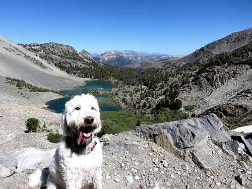
Take the Duck Pass trail 3.5 miles to the pass. Get off the trail and continue along the open terrain towards Duck Lake Peak, which is 1.5 miles away. Do not go down to Duck Lake, because that is an elevation loss. Once you get closer to the peak, the terrain gets pretty rocky. It can be hard to follow at times, but just take the path of least resistance. The terrain becomes Class 2/Class 3. Due to the rocky terrain, dogs are not recommended on this hike, unless you leave them with somebody when you go for the summit.
This is the best way to hike Duck Lake Peak. It is 5 miles and 3,000' of elevation gain. You can add Pt. 11,040 above the pass en route to Duck Lake Peak, which offers a tremendous overlook of the area, while only adding 200' of elevation gain and less a quarter mile of hiking distance.
From Valentine Lake: From the junction of Hwy 203 at Mammoth Lakes go south on Hwy 395 1.4 miles to the Sherwin Creek Road. Go right on Sherwin Creek Road 3.5 miles to the campgrounds. Go left on a dirt road 0.2 miles at the picnic area and take the Sherwin Lakes trail switchbacks approximately 2.5 miles up to Sherwin Lakes. Continue on another 2.4 miles to Valentine Lake. From the south end of Valentine Lake hike off trail approximately 1.2 miles to the chute on the south side of the east face of "Duck Lake Peak". Climb the class 3 chute to the summit ridge and go north to the summit.
From The Pacific Crest Trail: At 2.3 miles north of Purple Lake along the PCT take the trail junction to Duck Lake 0.7 miles up to the lake and take the trail around the north side of the lake to the west slope of the peak. There are no roads near the PCT at Purple Lake, so these directions are relevant to thru-hikers and backpackers.
Red Tape

Duck Lake Peak east face
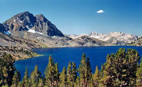
Duck Lake Peak and Duck Lake from Duck Pass
No permits are required for a day hike of this peak.
For overnight camping permits in the
John Muir Wilderness click here.
Camping
South from Duck Lake Peak
The nearest campground is the Cold Water Campground at the south end of Lake Mary at about 9,000'. There are numerous campgrounds around the Mammoth Lakes: There are campgrounds on the east side of Lake George, the east side of Lake Mamie, and the west side of Twin Lakes.
Sherwin Creek Road: From the junction of Hwy. 203 go south 1.4 miles on Hwy. 395 to the Sherwin Creek Road. Go right on the road approximately three miles to several campgrounds on the left and right at approximately 7,600'.
Area weather forecast
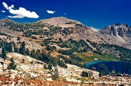
Duck Lake and Peak 3596, Silver Divide in back
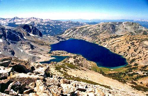
West from Duck Lake Peak
For the current weather and 5 day forecast click here.