
|
|
Mountain/Rock |
|---|---|
|
|
48.50700°N / 120.48813°W |
|
|
Okanogan |
|
|
Hiking, Mountaineering |
|
|
Spring, Summer, Fall |
|
|
8898 ft / 2712 m |
|
|
Overview
Gardner Mountain is high-elevation peak located near the western end of Okanogan County, Washington. The second-highest peak in the county by only 58' elevation, Gardner Mountain is sometimes overlooked by peakbaggers because its taller neighbor, North Gardner Mountain (the Okanogan County Highpoint), is only located ~one mile away to the northwest. Gardner Mountain is no slouch in terms of Washington's mountains, however. With 8898' elevation, Gardner Mountain is the 22nd-highest peak in Washington on the Bulger List, and 25th-highest peak in Washington for all peaks with over 400' of prominence. Gardner Mountain is also the highest point in the Lake Chelan-Sawtooth Wilderness Area.
 Gardner Mountain
Gardner Mountain has been climbed by many mountaineers for many years. A USGS survey group visited the summit sometime between 1898-99. The group built a 7' tall rock cairn on the summit, of which only a minor lower layer still remains. In the later 1900s, a summit register was brought to the summit by a mountaineering party, but that summit register was apparently struck by lightning and destroyed.
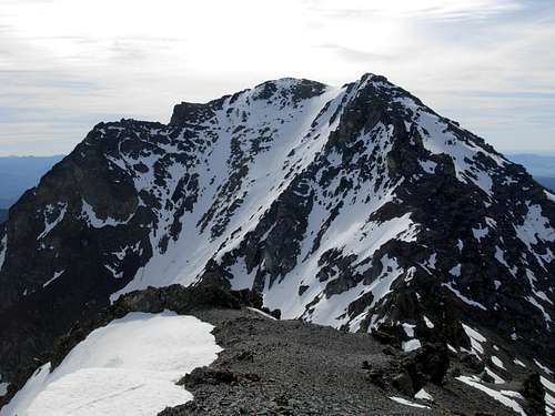
 Summit Of Gardner Mountain
Gardner Mountain has several notable features. The peak has two distinct highpoints, with the northern location being taller. There are also several sub-peaks (false summits) a short distance slightly southeast of the true summit. A small glacier is located in the northeastern gully of the peak. The mountain is largely comprised of volcanic rock and sedimentary rock. As a result, the mountain's slopes, especially the upper slopes, are loose scree and rocks. This particular aspect makes ascents time-consuming, causing some mountaineering parties to instead opt to climb the peak's higher neighbor, North Gardner Mountain, if such extra effort is needed (as North Gardner Mountain is more important on every major peakbagging list).
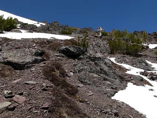
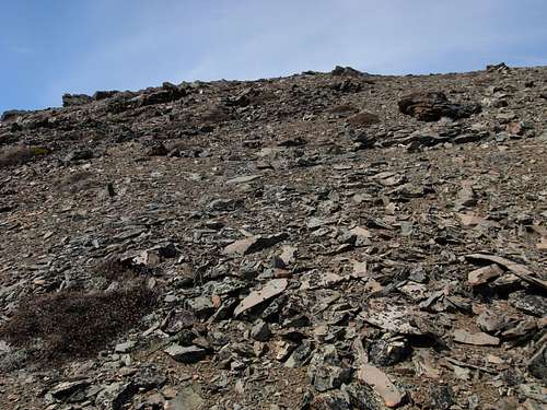 Steep Loose Scree Along South Slopes...
Ascents of Gardner Mountain via the standard southern routes are considered mostly non-technical and YDS Class 2. Some extra precautions should be understood in advance of every summit attempt. In example, an ice axe is recommended during periods of snow-cover, regardless of which route is taken. In addition, western approaches via the "Gardner Traverse" range between YDS Class 3 and YDS Class 4, depending on exact ascent route and conditions.
The optimum timeframe to attempt Gardner Mountain is probably between mid-June and mid-July, while some snow is still on the mountain slopes (helping to ease ascents) but after avalanche danger has basically passed. After snow has disappeared from the standard approaches, expect to ascend steep, loose scree slopes above ~6900' elevation.
Driving Directions
Various printed and online sources have incorrectly described (sometimes significantly) the driving directions, driving distances, and road names required to reach Wolf Creek Trail #527, the trail that leads to the standard approaches for Gardner Mountain. To compound things further, even the USFS website has outdated access information posted on its online Wolf Creek Trail page.
Here are the exact driving directions:
1) Head south through Winthrop along Highway 20.
2) Shortly after crossing a small bridge, turn right onto Twin Lakes Road.
3) After 1.3 miles, turn right onto Wolf Creek Road.
4) After 2.8 miles on Wolf Creek Road, turn left onto Left Fork Wolf Creek Road.
5) After 3.8 miles, the road forks. Veer left at the fork, continuing another 0.6 miles to the Wolf Creek Trailhead and large parking area.
Hiking Directions/ Standard Routes
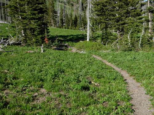
Hike 10.2 miles along Wolf Creek Trail #527 to Gardner Meadows, located south of Gardner Mountain. Wolf Creek Trail is a non-technical, maintained and well-used YDS Class I trail. Several minor creek crossings are required, with the most significant one located 2.3 miles west of the trailhead. Wolf Creek Trail starts at ~3100' elevation and reaches Gardner Meadows at ~5700' elevation.
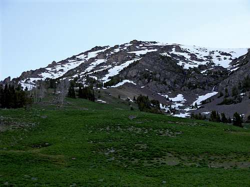
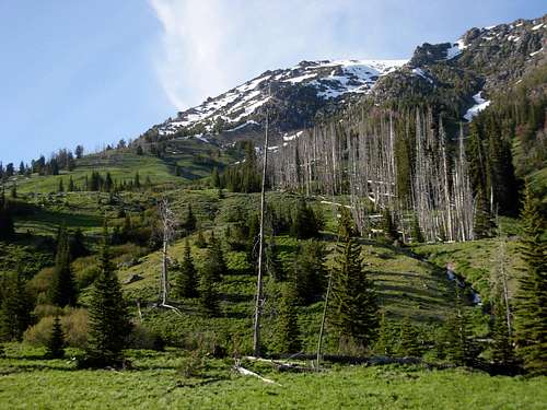 Looking At Gardner Mountain From Gardner Meadows
SOUTH ROUTE (STANDARD/RECOMMENDED):
1) From Gardner Meadows, follow Wolf Creek Trail to the west side of the small stream flowing south from Gardner Mountain towards Wolf Creek. Begin ascending uphill, northbound, staying left (west) of the small stream. It is possible to locate an old northbound boot path veering from Wolf Creek Trail a few hundred feet west of the small stream.
2) A small meadow basin is reached at ~6200' elevation. Continue heading north, or northwest towards a ridgeline leading from Gardner Mountain.
 Meadow Basin At ~6200' Elevation
3) Several small couloirs and gullies lead to the summit ridge of Gardner Mountain. The eastern gully is where the stream originates from, and might have cliff bands to also contend with. The central open gully/slopes west of that area is possibly the most direct approach. Both of those gullies lead to a saddle southeast of the summit. Another large gully west of the central large gully is a possibility, and leads to the saddle southwest of the true summit, between the mountain's two highpoints.
It is recommended to allow 4-5 hours for an ascent of the summit via a southern approach from Gardner Meadows.
 Ascending Steep Scree Gully...
WEST ROUTE (GARDNER TRAVERSE):
This route is commonly used when combining ascents of Gardner Mountain and nearby North Gardner Mountain, via their connecting ridgelines.
1) From the summit of Gardner Mountain, hike southwest along the summit ridge to its false summit.
2) Steeply descend down and scramble through loose scree and snow (if during late Spring/early Summer), reaching a saddle between Gardner Mountain and Point 8487.
NOTE: There are several rocky pinnacles and cliffs to traverse around during this section, eliminating direct ridgetop traverses. Varying elevation loss and gain will be required to reach Point 8487.
3) From Point 8487, head north along the ridgeline to North Gardner Mountain.
If the ridge conditions between Gardner Mountain and Point 8487 are questionable or appear exceptionally dangerous (such as when snow is present), it is highly recommended to descend Gardner Mountain via one of its south couloirs/gullies to at least 7500' elevation, and then side-traverse around the Gardner Traverse cliff bands and pinnacles before ascending to Point 8487.
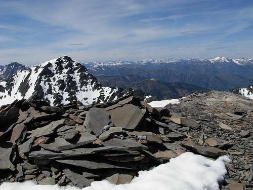
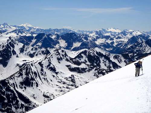
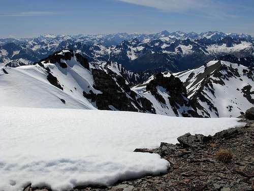 Looking At Gardner Traverse From True Summit
Red Tape
A Northwest Forest Pass (parking permit) is required to park at the Wolf Creek Trailhead.
Wolf Creek Trail #527 is for hiking and equestrian use only.
Wolf Creek Trail, Gardner Meadows, and Gardner Mountain are home to deer, bear, and cougar. The upper slopes of Gardner Mountain and surrounding peaks have also been known habitats for mountain goats and Bighorn Sheep. Make certain to properly hang/store food away from any campsite. Use the "Leave No Trace Behind" policy whenever possible.
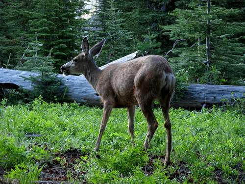 Mule Deer At Gardner Meadows
Camping
Camping is permitted at Gardner Meadows. Multiple possible campsites can be found. The campsite most sheltered from wind and adverse weather is located with a tiny forest grove just beyond the west side of the small stream heading south through the meadow area, on the left (south) side of Wolf Creek Trail. An old-growth tree can be found within the small grove of evergreen trees.
 Gardner Meadows
Camping is also permitted at a few established campsites located along Wolf Creek Trail, as well as a few established campsites along adjoining South Fork Wolf Creek Trail #527A.
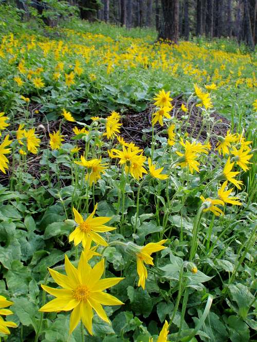 Wildflowers Along Wolf Creek Trail
External Links
For the most current information regarding conditions in the area, contact the Methow Valley Ranger District Visitor Information Center.
ADDRESS: Building 49, Highway 20, 24 West Chewuch Road, Winthrop, WA 98862
TELEPHONE: (509)996-4000.
 Ascending Upper South Slope...