
-
 10491 Hits
-
 78.27% Score
-
 9 Votes
|
|
Mountain/Rock |
|---|---|
|
|
34.89995°N / 33.05861°E |
|
|
Hiking |
|
|
Spring, Summer, Fall, Winter |
|
|
5098 ft / 1554 m |
|
|
Overview
 Papoutsa summit Papoutsa summit |
Papoutsa or Mount Papoutsa (Παπούτσα in Greek) is one of the standalone mountains on the outskirts of the big Troodos Range on the island of Cyprus. ompared to most other mountains on the island, it is a rare thing: a mountain without a construction on top - no radar installation, no fire lookout, not even a radio antenna. The only things you will find is a small sanctuary and a summit cross, both of rather modest proportions. For this alone Papoutsa would deserve to have its page on SP.
 |  |  |
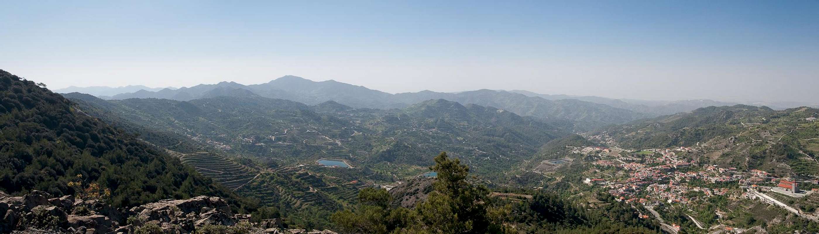
The mountain is dominating the southern skyline of the mountain towns Kyperounta and Agros, both located to the south-east of the Troodos Range. It is part of the mountains surrounding the basin, in which the towns lie, which also include Stavropefkos, Adelfoi and Madari. Thanks to its solitary position as the highest mountain of an east-westerly ridge and thanks to its vaguely pyramid shaped summit, Papoutsa is easily recognizable from almost any direction. The reverse naturally is also true - from Papoutsa you have far reaching views across the Troodos Range and across much of the island's south coast.
 |  |  |
The ascent to Papoutsa's twin summit is a short affair. In only 45 minutes you will stand on its top, if you start from the nearest parking lot at an intersection to the village of Agios Theodosios. However, those 45 minutes can turn into a real torture as you hike through dense golden oak and turpentine bushes. Thousands of spiders have spun their webs there so that you expect to wear a cocoon as you step out onto the main summit of the mountain. The route uses the north ridge of Papoutsa, which joins the west ridge about 200m from the summit. As indicated above, Papoutsa has two summits, both of which reach the same elevation of 1554m. The traverse between the two summits is a rocky affair of UIAA I.
Getting There
  |
You can reach the Greek (southern) part of Cyprus from any major airport in Europe. The island has two international airports at Larnaka in the east and Pafos in the south-west. Both airports are connected by a motorway.
The trailhead for Papoutsa is located on E903, the road between Agros and Palaichori. There a small parking space can be found at the intersection to a side road to Agios Theodosios. While there are several possibilities to reach the spot the shortest and most obvious one is as follows:
- From one of the international airports of Southern Cyprus, at Larnaka or Pafos take the motorway (A1 / A6) to Lemesos
- At the exit 27 take E110 to Agros
- At Agros turn onto E903, direction Palaichori.
- After 5km a side road will turn off to the right to Agios Theodosios. There is a small parking space directly at the intersection.
Red Tape
 Zystus salvifolius with crab spider
 There is no real red tape here. On the summit there is a small sanctuary. You are requested to respect it (signs).
Accommodation
 Agros (below) and Kyperounta (above) as seen from Papoutsa
Accommodation of all kinds is easy to find along the coasts of the island. You can book hotels and apartments from any travel office. Moreover, a lot of British expatriates are living on the island part time. You can get lucky to book one of their winter homes in summer.
Near Papoutsa little accommodation can be found. The closest town is Agros, where you'll surely be able to find inns and hotels. However, more likely you will stay at the south coast on the strip between the cities of Lemesos and Larnaka.
Weather Conditions
Maps & Books
Maps
I must admit that I didn't find any decent maps of the island, maybe caused by the military nervousness mentioned above. I have used the following street map:
- Cyprus / Chipre / Zypern
1:200 000
Freytag & Berndt
ISBN: 978-3-7079-0478-9
Books
Here the situation is different. An excellent guidebook is available from Rother Verlag, both in German and English. It covers the whole island in 50 daytours.
- Zypern (Süd & Nord) / Cyprus (South & North)
Rolf Goetz
Rother Wanderführer / Rother Walking Guide
Rother Verlag
ISBN (German): 978-3-7633-4271-6
ISBN (English): 978-3-7633-4814-5