
|
|
Mountain/Rock |
|---|---|
|
|
22.39972°S / 44.66207°W |
|
|
Itamonte |
|
|
Hiking, Mountaineering, Toprope, Mixed |
|
|
Fall, Winter |
|
|
8048 ft / 2453 m |
|
|
Second time at the summit.
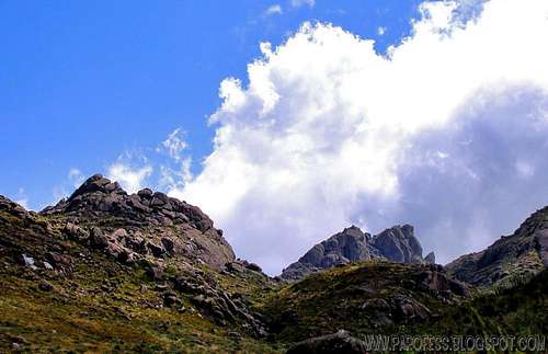
Pedra Assentada and Prateleiras Peak.
Pedra Assentada, or Pedra Sentada ("sitting rock"), is a "almost never" visited mountain of Itatiaia National Park, MG, Brazil. It lies after Prateleiras Peak so the impressive landscape of that mountain makes it almost impossible for people to care about anything else there. At the base of Prateleiras Peak are Pedra da tartaruga (or turtle rock click to see it) and Pedra da Maça (or apple rock click to see it) rocks, so it only gets worse since these are outstanding nature shaped rocks. That's the reason almost no one knows that summit in Brazil.
It is not far from Prateleiras base, around 30 minutes light trekking descending a little bit before starts the scrambling way up thru a rocks labyrinth. The last 15 meters are rock climbing. At the beginning a light 5.6 way up. But for the summit, a final push of 5.10a has to be done, the crux.
Getting There
By busFrom Minais Gerais/ São Paulo/ Rio de Janeiro, you have to take a bus to a little city called Itanhandú. Several bus companies can take you there. Once you get to Itanhandú, take a nother bus from the same bus station to Itamonte, a smaller town.
There is the point: Once you get to Itamonte, it is hard to find transport to the park entrance. But there's some taxi drivers that know the park and can take you up to the park, and that's gonna cost you around R$ 100,00 (about US$ 45.00).
From the main entrance, you have to register at the military office, than you're free to get into the park from 8am to 5pm. It is important to get out at the right time to avoid problems.
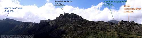
Take the same way to Agulhas Negras but, when you get to Abrigo Rebouças ( the highest brazilian mountain hut - 2.393 m), continue on the main way to Prateleiras massif. Once at its base, you'll be able to see the mountain easy to find (look at the page photo). Go on a straight line.
From the entrance of the park to the summit and come back, it can take up to 8 hours, it's up your shape.

To the summit block.

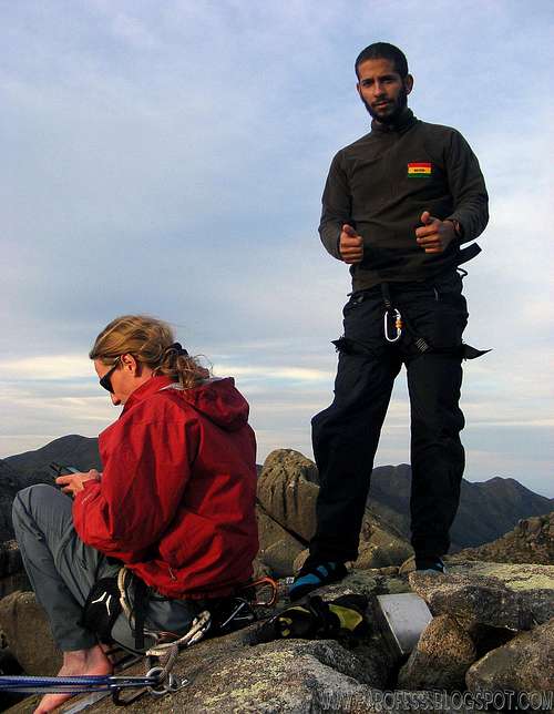
Fun route!


Stop looking at my ass! :P
Camping
Camping inside and outside the park is strictly forbidden and strongly fiscalized, don't even try that. There's is a camping site called alsene 2km outside the park down the road, but it is closed now for crimes against the flora, bastards!I recomend to stay at some cheap hotel at Itamonte (R$ 50,00 - around uS$ 26.00).
Weather Forecast
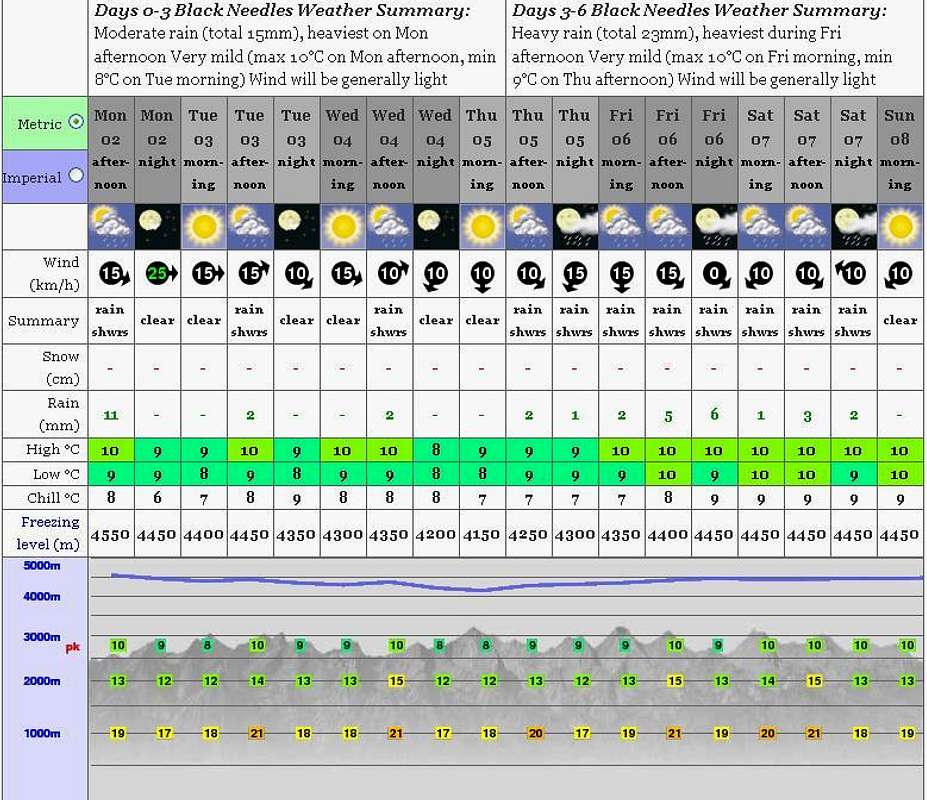
PS: The weather forecast on this link is not for this mountain but it will do just fine since the mountain from the forcast (Black Needles) is just a few kms away from it.
Red Tape
If you go by the high entrance of the park, as soon as you get there register yourself and pay a fee of R$ 25,00 (about USD 11.00) for the entrance.Parking lot at the entrance;
Well marked trails (just to camp by Marombinha Peak and Maromba summit);
What’s forbidden:
At all costs, don't make fire or Deforest any places. Respect the nature and wildlife please!
BE CAREFUL ABOUT SNAKES AND POISONOUS SPIDERS (BROWN SPIDER)
A GPS is highly recommended for that part of the park, on a foggy day you will be lost in no time.
The Park
The area of the Itatiaia National Park is divided into two different environments. One is the Atlantic forest with numerous centenarian trees that keep hold of the lower part, and the other which characterizes for its mountainous topography with crags and peaks on its highest part.
The mountainous place is ideal for long and amusing hikes in the midst of landscapes of singular beauty. Altitudes vary between 700 and 2792 metres.
It is considered the first national park in Brazil for the preliminary data concerning its creation goes back to the beginnings of the XX century. The Pico das Aguilhas Mountain, the fifth tallest of the country, is located in this natural reserve between the limits of Minas Gerais and Sao Paulo.
After a failed project the then Biological Station of Rio de Janeiro's Botanic Garden became a National Park in July of 1937, during the mandate of president Getulio Vargas, with an area of 12 thousand hectares. Its extension was enlarged to cover 30 thousand hectares in 1982.
Soon i'll do a page for this area.
Legal Issues
To hike/ climb is a dangerous activity and requires proper equipment and clothing, the owner of this page cannot be blamed by injuries caused to anyone who read this page for its info about the mountain, and eventually got hurt by doing so with reckless behaviour or bad weather conditions.
Paulo Roberto Felipe Schmidt – AKA: PAROFES
External Links
My youtube channel: www.youtube.com/parofes - Now with 270+ videos online!
The biggest brazilian website about climbing and mountaineering, for which I'm a columnist: