
-
 18692 Hits
-
 86.67% Score
-
 24 Votes
|
|
Mountain/Rock |
|---|---|
|
|
39.64026°N / 105.59887°W |
|
|
Clear Creek |
|
|
Hiking |
|
|
Spring, Summer, Fall |
|
|
12216 ft / 3723 m |
|
|
Overview
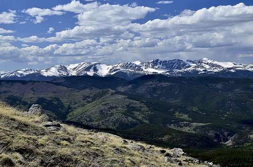
Goliath Peak is the prominent above-treeline summit as you approach and pass Echo Lake. As you climb Mount Evans Road toward loftier ground Goliath must be traversed from its eastern side around its northern and western slopes and across the saddle to the south of the peak along the main ridge.
Its easy to overlook Goliath as a hiking destination, but its impossible to ignore as you head for Evans and other high points in the area.
There are two obvious approaches and both are fairly easy. Goliath Peak (or Mount Goliath on some maps) is a nice, easy 12er which makes for a good family hike above treeline.
 Ridge Ridge |
 Summit Summit |
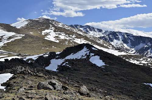 Mt. Evans from Goliath Peak. Mt. Evans from Goliath Peak. |
Getting There
From I-70, exit Evergreen Parkway.Drive 2.4 miles south to Squaw Pass Road and turn right. It's about 18 miles onthis curvy, mountain road to the entrance station to Mount Evans. There is a fee here, typically $10, unless you have a National Park pass. From the entrance station, it's about 2.8 miles to the Mount Goliath Research Natural Area parking lot.
Hike
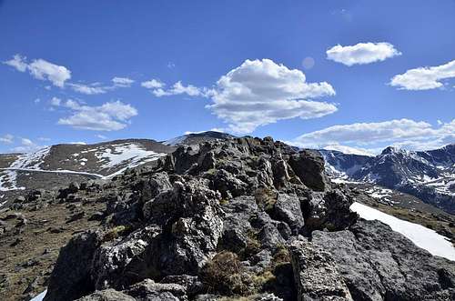
Views from Goliath Peak.
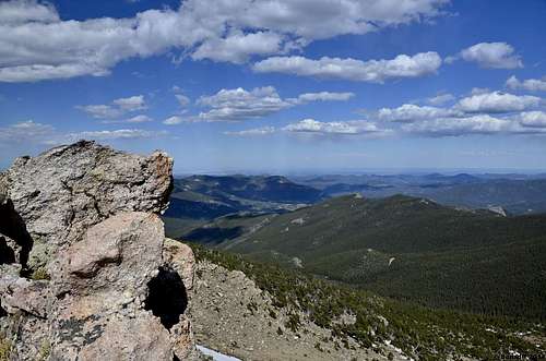
Summit
 Looking back at Botanical Garden Center
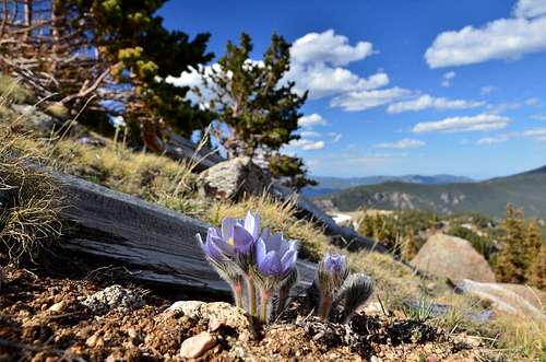
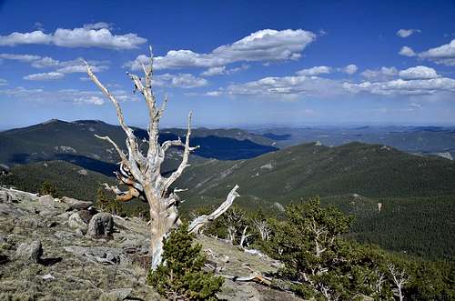
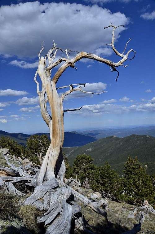
Want to get away from the heat in the city? Then it's time for a drive up Mount Evans between Evergreen and Idaho Springs. Mount Evans is one of only two 14ers (peaks over 14,000-feet high) in Colorado that you can drive to the top of. (Directions below)When it's 90 degrees in the city, it's 70 degrees or cooler on the road to Mount Evans. Why? Because the temperature drops 3 to 5 degrees for every 1,000 feet in elevation gain. So if it's 90 degrees in Denver at 5,280 feet, it's likely 18 to 30 degrees cooler at the Mount Goliath Research Natural Area at 11,540 feet.This nature trail is the perfect walk for families and visitors. While it may only be a quarter mile in length, walking at this elevation can be difficult. The air is thinner, so it can be hard to catch your breath if you're visiting from sea level.In the parking lot, start at the Dos Chappell Nature Center.Signs here explain how plants and trees survive at this high elevation. There are also signs that name the colorful wildflowers that dot the landscape. Evenat 11,540 feet, small wildflowers put on a show in the middle of the summer.Now walk outside and enjoy the amazing, expansive views.Then it's time to take a few steps to the trail. A sign gives hikers options.You can go either direction for the 1/4-mile Bristlecone Loop Nature Trail or turn right for the Pesman Trail which winds up the mountain for 1.5 miles to the Upper Mount Goliath pull-out/parking area.For this walk, let's go left. Quickly you'll find yourself in the middle of a forest with colorful, twisted trees. These are Bristlecone Pine trees. Some of the trees are 1,500 years old. They're short because the growing season up here is short. The road to Mount Evans is only open from Memorial Day to Labor Day each year and sometimes it'sclosed, even in the middle of summer, because of snow storms.As you walk here, you'll find two benches. This is a nice spot to sit and really look at these special trees. Notice that one side of the trees has very few branches? That's because of the strong winds that blow here.Two interesting facts about the Bristlecone Pine: 1. Their branches bend in the wind, they don't break. 2. Bristlecone Pine trees drop their needles every 10 to 15 years instead of every year to save energy.Walk a few more steps and the trail begins to loop back. Here you'll find yourself climbing a few steps. If your guests appear winded, then stop and point out the views. Look up and you notice "treeline." That's the spot where trees stop growing because of harsh conditions.As you finish the loop, ask the kids if they know why the trees are leaning here? That's because much like people lean into strong winds,so do the trees.If the kids have more questions, let them ask the rangers who work here. Better yet, come for one of the programs here that are run by the Denver Botanic Gardens.
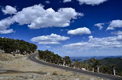
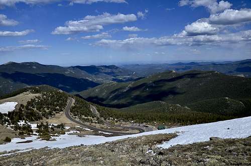
Mt. Evans road.
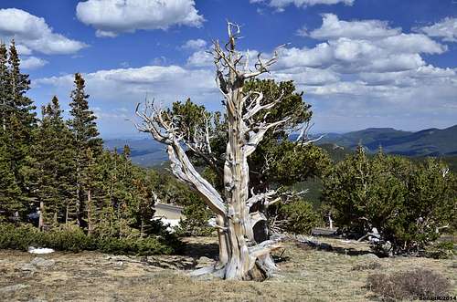
Bristlecone pine
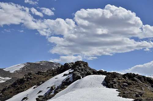
 Goliath Peak
Red Tape
Road Opening:
(See the HomePage of this site for road status.)
The road to the top of Mount Evans is typically opened in May (Memorial Day) when CDOT (Colorado Department of Transportation)has completely plowed the road. Usually, the road to Summit Lake is opened before the last 5 miles to the summit is opened.
Once opened, the road is open 24 hours a day, 7 days a week. Unlike Pikes Peak that is only open from 7:00 am to 7:00 pm.
Road Closing:
(See the Home Page of this site for road status.)
CDOT has returned to closing the top five miles the day after Labor Day. CDOT says that the first 10 miles (of 15 to the summit) will be open until the"first significant snowfall" or the first weekend in October, whichever is first. Exactly, what is a "significant snowfall" is not defined.
For Up To Date Road Information:
The Colorado Department of Transportation has opened the Mount Evans Road for the 2011 season. For the latest information visit: http://www.coloradodot.info
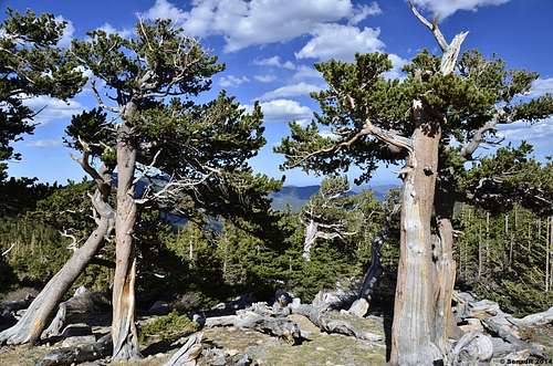
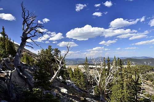
Rocky Mountain Bristlecone Pine
Bristlecone Pine
Bristlecone Pine
 Bristlecone Pine
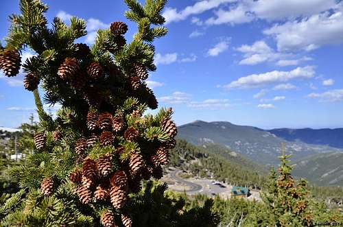
The Bristlecone pine is famous as a long lived tree, growing in exposed and harsh conditions on high mountains. Two varieties of bristleconecone live in the lower 48 states,the Great Basin Bristlecone pine of California,Nevada and Utah,and the Rocky Mountain Bristlecone pine of Colorado,New Mexico, and Arizona. The Rocky Mountain Bristlecone pine is found from around 7000 feet above sea level to treeline, near 11900 feet (3640 m) in central Colorado. It can survive on rocky and windy ridge tops.The Bristlecone pine grows to large size in forest settings, and even grows in meadows on occasion. Bristlecones may be prostrate near treeline, or reach 40 feet high in a protected forest. Bristlecone pine may be mixed with Limber pine in woods up to several hundred acres, or with other trees typical of its elevation. Bristlecone and Limber pine can survive where winter winds sweep the high country free of snow,while the neighboring spruce and fir are buried several feet deep. Ancient trees have often have extensive die back, with wind sculpted dead limbs, and a few stripsof living bark and associated branches with green foliage. Bristlecone pine can be very long lived. A Bristlecone five feet high may be over 500 years old. Bristlecone pines near South Park are the oldest trees in Colorado. The oldest known tree in Colorado is 2453 years old(in 2011), dating from 442 BC. It grows on a mountain along the south edge of South Park.The oldest trees are found in arid locations with reduced precipitation, on well drained,rocky, south facing slopes. It can grow in cool places with very little water, where it grows so slowly that the growth rings are very narrow. One of the oldest trees near South Park, over 2202 years old, has 90 annual rings per inch (35 rings per cm). The oldest trees are 2.5 feet (80 cm) across near the base, or more. The trees in this area are the oldest living Rocky Mountains Bristlecone pines, and the oldest trees in Colorado. A similar Bristlecone pine in California is about 4600 years old, possibly the oldest individual tree on Earth.
Bristlecone Pine
Botanical Garden
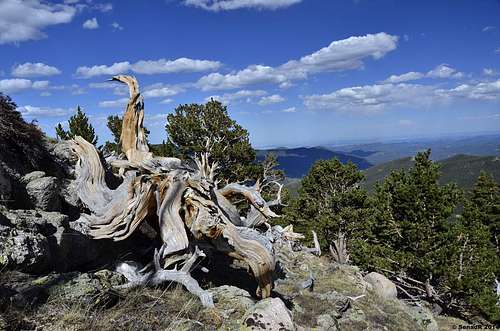 Oldest trees in Colorado
Map
<ahref="https: maps.google.com="" maps?q="goliath+peak+colorado&ie=UTF8&hq=&hnear=Goliath+Peak&t=p&z=14&ll=39.640821,-105.59889&source=embed" style="color:#0000FF;text-align:left" "="">View LargerMap</ahref="https:>
Camping
There are campgrounds at Echo Lake and West Chicago Creek.-
Camping in the Clear Creek Ranger District offers you agreat chance to get away and see some of the best that Colorado has to offer. The elevation of thecampgrounds ranges from 9,200 to almost 11,000 feet providing you with coolmountain days and nights. There is also great fishing, hiking, mountain biking,and many other activities that you can do while you are relaxing in and nearthe campgrounds on the Clear Creek Ranger District. Come on up and relax inyour National Forest.
Camping is prohibited within one-half-mile of the Mount Evans Roadand building, maintaining, attending, or using a fire, campfire, or stove fireis prohibited within one-half-mile of the Mount Evans Road.
(*) Denotes that a campground is available for reservations by calling theNational Forest Reservation System at 1-877-444-6777. For more informationon the campgrounds, please contact the Clear Creek Ranger District at (303)567-3000 or see below.Echo Lake Campground:
(This campground is located near the entrance to Mount Evans. There is no camping along the road to thetop of the mountain.)
Sites: 17
Elevation: 10,600 feet
Max Vehicle Length 20 feet
Daily Fee: $15.00
Location: 14 miles south of Idaho Springs at theintersection of Hwy 103 and Hwy 5.
More info: visit ForestCamping.Com
West Chicago Creek Campground:
Sites: 15
Elevation: 9,600 feet
Max Vehicle Length 30 feet
Daily Fee: $14.00
Location: 7 miles south of Idaho Springs on Hwy 103 then 3miles off of Hwy 103 on Forest Road 188.
More info: visit ForestCamping.Com
Bob Sihler - Jun 14, 2014 9:38 pm - Voted 10/10
6000Unless the tree has recently died, the oldest-known bristlecone is close to 6000 years old and is located in the Schulman Grove of the White Mountains in California. Rangers do not disclose the exact location in order to protect the tree. What a tree!
Senad Rizvanovic - Jun 15, 2014 10:45 pm - Hasn't voted
Re: 6000Bob, there is another area in Colorado well known for these trees ;) http://www.summitpost.org/windy-ridge/585070