
|
|
Mountain/Rock |
|---|---|
|
|
Scrambling |
|
|
Overview
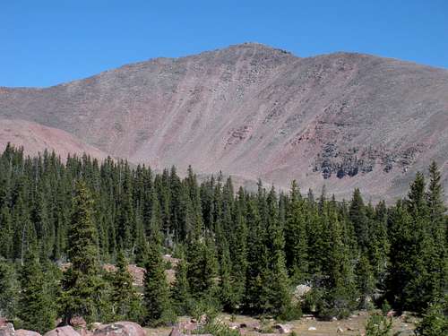
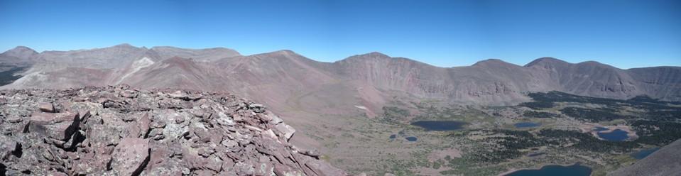
North and South Timothy Peaks are named after the Timothy Lakes nestled high in the Uinta Mountains below the highest peaks in the range. These two peaks are west of Mount Emmons and on a sub ridge south of Kings Peak. Both make for a fairly easy climb if camping at the lake basin or could be done as a loop trip utilizing the Bluebell Pass trail. Unfortunately, they are like most of the mountains in the area, a giant mess of rocks that isn't too fun after a few hours.
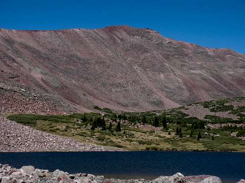
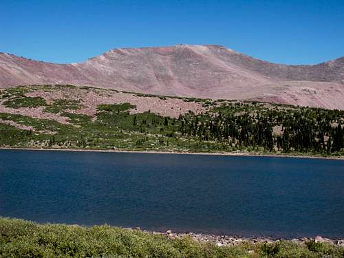
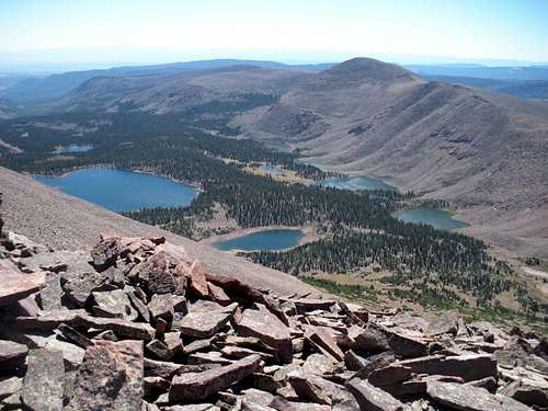
North Timothy Peak & Center Timothy Lake
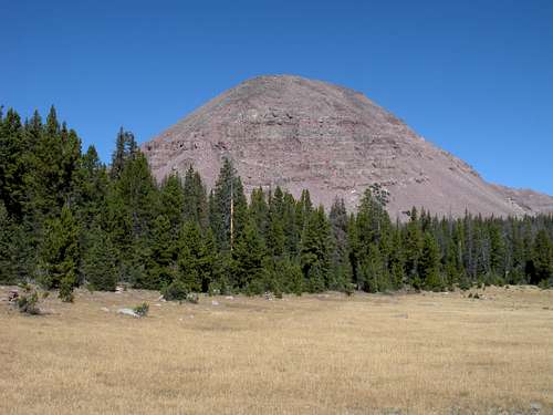
South Timothy Peak
Getting There
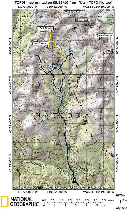
From Duchene on US Highway 40 or the intersection with Highway 35 from Francis/Kamas, go north on State Highway 87. Follow State Highway 87 to the turnoff for State Highway 134 and Mountain Home (between milepost 15 and 16). Follow State Highway 134 north through Mountain Home. From Mountain Home, continue north on the Moon Lake Road. After five miles, turn east on the Yellowstone River Road. Follow the Yellowstone River road to the trailhead at the end of the road.
 Swift Creek Route to Timothy Lakes Basin & Peaks
Red Tape
None. Be sure to park in the hiker parking not the horse parking or the Forest Service will put a note on your car. They said there was a sign but I didn't see it when I arrived at 3 A.M. This trail had been closed in 2010 until September so check with the Forest Service just in case. They are removing a earth dam on one of the lakes.
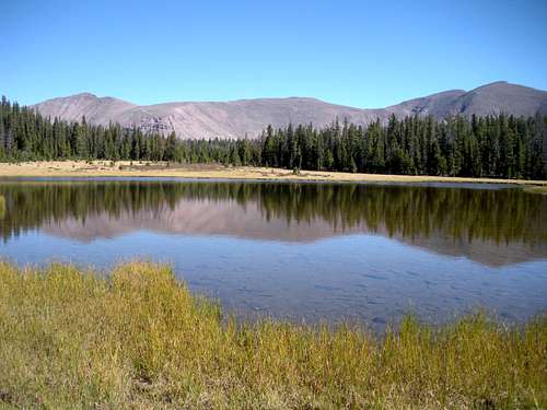
Camping
There is a Forest Service campground at the trailhead. There are also two more campgrounds within a few miles of reaching the trailhead. Ultimately, this is a backpacking trip. Camping at Timothy Lakes or Farmers Lake would make the most sense. The two peaks can be done as a day trip but it is a long day. I did it in a day including doing Trail Rider Peak and Painters Peak but it was 15 hours with few breaks.
Route
From the Swift Creek Trailhead hike up the trail 1/4 mile to a Y (a bit after a big bridge over Swift Creek). Left is the Yellowstone Creek trail, right is the Swift Creek trail. Go right. The "creek trail" starts out climbing switchbacks well above the creek. After a few miles, the trail drops a bit and merges back along Swift Creek. There are two crossings with no bridges (in 2010). These may require a ford. At 6 miles, Deer Lake is encountered. About a mile past the lake is another Y. Go right again toward Timothy Lakes. Now the meadows start and glimpses of South Timothy will come into view. The trail will hit another split where left is Farmers Lake and right is Timothy Lakes. Go right again and follow the trail to East Timothy Lake or just before the lake. Go cross country to West Timothy Lake. At the north end of the lake, ascend the mountain to the saddle between the 2 Timothy Peaks. From the saddle both are easy rock hopping to the tops. To make a loop, descend the south summit to Bluebell Pass. You can also ridge traverse north from the north summit to Trail Rider Peak. From there, peaks go in both directions on the highest ridge in Utah. You'll be between Kings Peak and Mount Emmons. These peaks are congregated onto one summitpost page Kings-Emmons Ridge
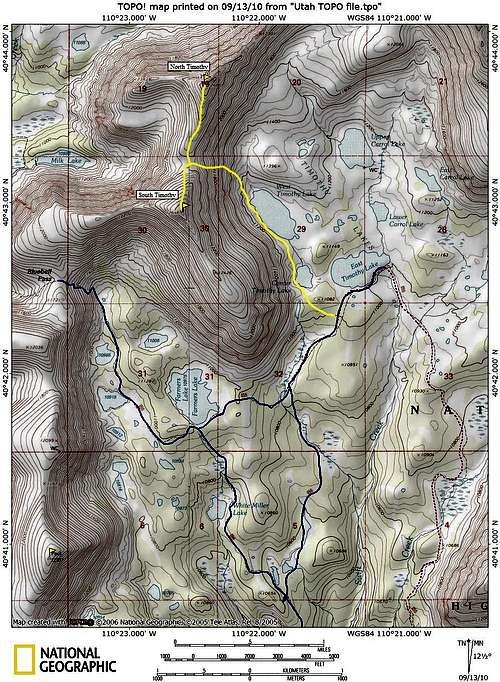 Timothy Lakes Map
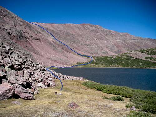
Showing route from West Timothy Lake
Roberts Peak, North Emmons, Emmons
Roberts Peak
Trail Rider Peak
  |
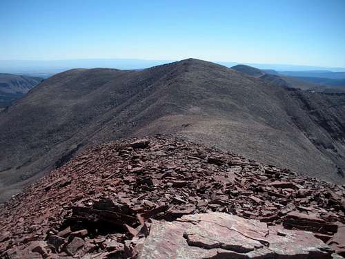
South Timothy from North Timothy
Farmers Lake Basin
External Links