Overview
![Cantata from the Northwest]() Cantata Peak is the dark pyramid in this view from Rendezvous Ridge. The route goes up the big grassy ramp at center, then onto the right skyline.
Cantata Peak is the dark pyramid in this view from Rendezvous Ridge. The route goes up the big grassy ramp at center, then onto the right skyline.
A dozen miles northeast of Anchorage is the magnificent South Fork Valley, with a fine trail up its floor into the heart of the Western Chugach. Cantata Peak dominates this valley with a rock pyramid that looks technical from every side--a discouraging prospect in this area of friable rock. In fact, Cantata is an easily attainable summit that offers a wonderful grandstand into the wild hinterlands of the park. It makes a viable 18-mile daytrip or a great weekend camping destination through country that would improve many a national park.
Cantata probably sees a dozen or two ascents a year. Beyond Eagle and Symphony Lakes, you’ll likely have the mountain to yourself.
![West Ridge]() West Ridge
West RidgeGetting There
Cantata Peak is approached from the South Fork Valley trailhead in Chugach State Park. To reach the trailhead, take the Eagle River Loop Road exit from the Glenn Highway and then turn right at the traffic light onto Hiland Road. Follow this several miles into the South Fork Valley. After crossing a bridge over the South Fork, look for South Creek Road on your right. This is the turnoff for the trailhead, marked with a small brown sign.
From the trailhead at 2000 feet elevation, follow the
South Fork Valley Trail up the main valley. Already a well constructed trail, the initial section of this trail was bulldozed in the fall of 2011 into a veritable boulevard, which some consider the most massively over-engineered trail in the state. At any rate, it makes fast walking. You’ll cross the South Fork on a bridge after 2.2 miles. After 5 miles you’ll reach a large moraine, where a second bridge built by British volunteers takes you back across the South Fork. Beyond the bridge, make your way through a boulder field to gain the crest of the broad moraine between Eagle and Symphony Lakes, and walk the trail on the crest until it butts into the lower slopes of Cantata Peak. It is six miles from the trailhead to this point and, counting the ups and downs on the trail route, you’ve climbed about 1000 feet.
![South Fork Approach]() Along the South Fork approach (the peak in the picture is Harp Mountain)
Along the South Fork approach (the peak in the picture is Harp Mountain)![Eagle Lake and Entrance to Flute Glacier]() Eagle Lake (photo by Natestation)
Eagle Lake (photo by Natestation)![Eagle Lake]() Eagle Lake from the moraine
Eagle Lake from the moraine![South Fork Valley Trail]() South Fork of the Eagle River
South Fork of the Eagle RiverRoutes
![West Ridge Route]() West ridge route marked in red. Click to enlarge
West ridge route marked in red. Click to enlarge![Start of the West Ridge]() The final col before the main mass of the peak. The west ridge route veers off the crest onto the south face to make this step.
The final col before the main mass of the peak. The west ridge route veers off the crest onto the south face to make this step.Regular Route: West Ridge (Class 3+)
There aren’t many ridges that look as fearsome as the West Ridge of Cantata Peak, but turn out to be so mellow. This is probably why the first ascenders of Cantata spent days reconnoitering the mountain and eventually used a 5th class line from the southeast. Indeed, when I first explored the mountain in the 1980s I dismissed the West Ridge as much too outrageous for a solo. I should have persevered.
From the end of the moraine between Eagle and Symphony Lakes, a path leads you onto the SW flank of Point 3600 before petering out. Continue to the col just south of Point 3600. On the far side of this col is a broad ramp-like valley. There is good all-season water along the northern margins of this ramp. Walk up the grassy ramp to the vicinity of Point 4755. Continue eastward along the ridge crest to the final col between Point 4755 and the main body of the peak (this col can also apparently be reached on scree slopes from Mirror Lake).
At the col, you’ll be faced immediately with a steep 4th class step on the ridge. The climbing can be kept in the class 3 range by following a sheep/climbers path onto the south side of the ridge, and then angling back to the crest at the first opportunity, using
this gully followed by a slightly improbable, overhung ledge that ascends from left to right. This chossy area is intricate enough that many first-timers will find themselves on a harder line.
After regaining the crest, about 500 feet of pleasant class 2-3 scrambling leads to a small col with dark, friable rock, followed by another steep step. This can be tackled directly (cl. 4), or bypassed by a downward traverse to the right on the south face. Regain the ridge crest and follow it over and around various pinnacles to the summit. Although none of the scrambling is especially hard, there is 1800 feet of terrain that keeps your attention, and this ridge can take a while on both ascent and descent. Trailhead to summit takes 6-10 hours.
South Face (Class 4)
The south face can offer a viable route from the Mirror Lake area, using a steep snow gulley (ice axe needed) to help get through the cliff bands along the bottom of the face. The route might be pretty difficult if the snow has melted out. The upper 1500 feet of the face is low angle but loose. This face needs to be scouted from below; don’t try to descend the south face if you’re not familiar with the line, since it’s easy to get cliffed out in very unpleasant terrain.
Camping
There is good camping on the moraine between Eagle and Symphony Lakes. You’ll see a few tents here on a summer weekend.
There are truly spectacular campsites with perennial water in the “ramp-like valley” referred to in the route description. The best ones are at about 4100 feet on the north margin of the valley, below the Point 4755-Point 4710 col [Point 4710 is shown as 4727 on some maps].
Red Tape and Cautions
Chugach State Park has few restrictions on hiking, camping, and climbing. Campfires are not permitted and very large groups will need a permit.
As of 2018 there is no parking fee for the South Fork trailhead.
In the summer of 2018, a hiker was killed by a grizzly bear while walking on an informal trail near the houses the South Fork valley. Carry bear spray and make noise, even when in sight of the houses by the trailhead.
Summit Views
![Southwest View]() Past Calliope Mountain toward Turnagain Arm and upper Ship Creek
Past Calliope Mountain toward Turnagain Arm and upper Ship Creek![Summit View]() View to the southeast across Flute Glacier to Organ Mountain
View to the southeast across Flute Glacier to Organ Mountain

 19936 Hits
 90.48% Score
 32 Votes
 Cantata Peak is the dark pyramid in this view from Rendezvous Ridge. The route goes up the big grassy ramp at center, then onto the right skyline.
 West Ridge
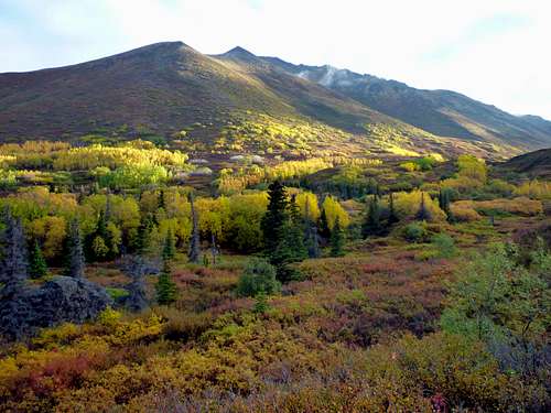 Along the South Fork approach (the peak in the picture is Harp Mountain)
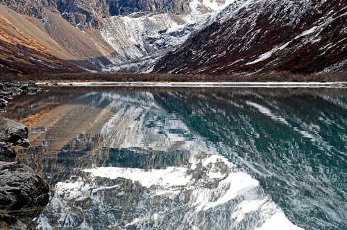 Eagle Lake (photo by Natestation)
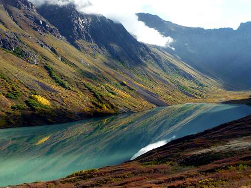 Eagle Lake from the moraine
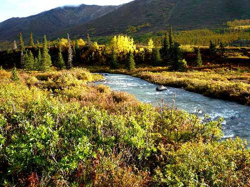 South Fork of the Eagle River
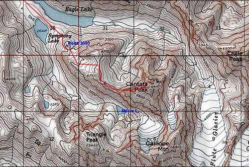 West ridge route marked in red. Click to enlarge
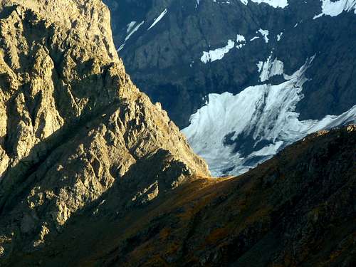 The final col before the main mass of the peak. The west ridge route veers off the crest onto the south face to make this step.
 Past Calliope Mountain toward Turnagain Arm and upper Ship Creek
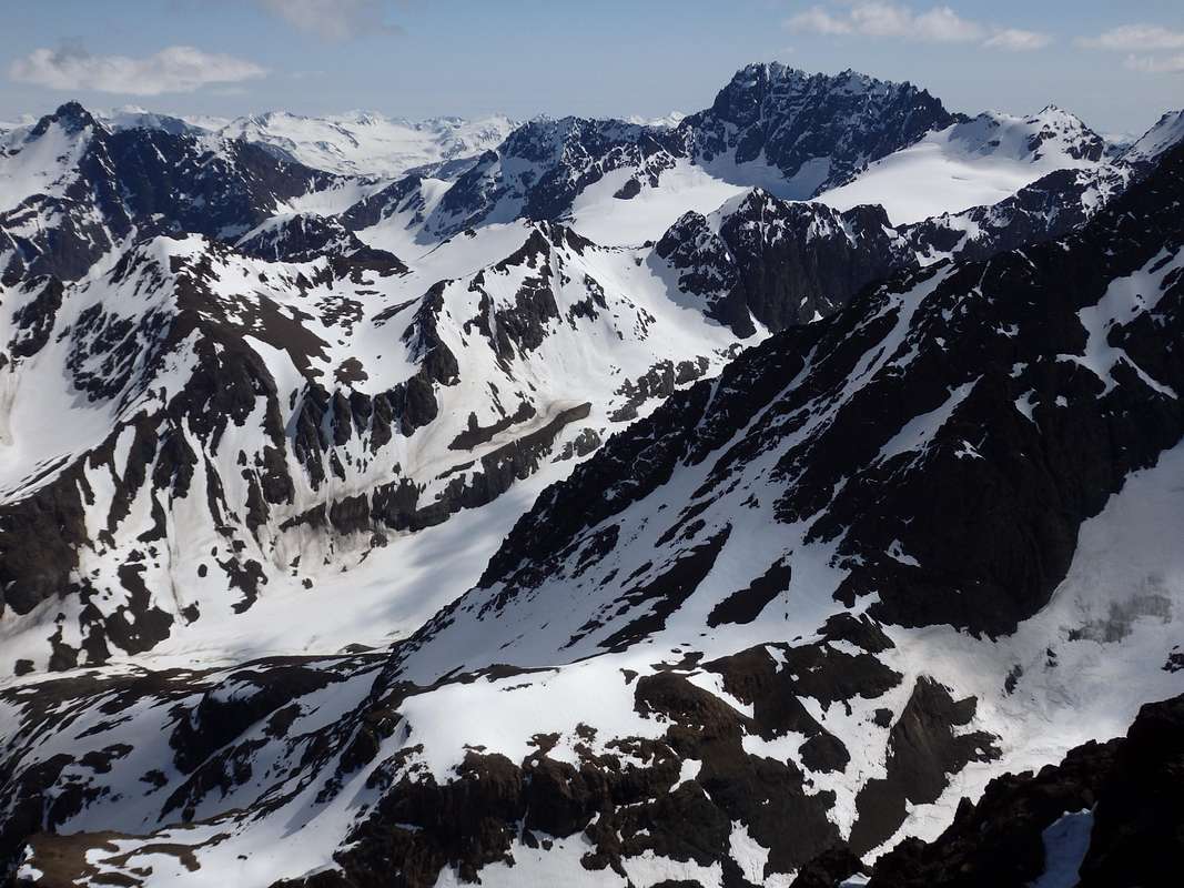 View to the southeast across Flute Glacier to Organ Mountain