
-
 14248 Hits
-
 84.27% Score
-
 18 Votes
|
|
Mountain/Rock |
|---|---|
|
|
37.71302°N / 119.60545°W |
|
|
Mariposa |
|
|
Hiking |
|
|
Spring, Summer, Fall |
|
|
7503 ft / 2287 m |
|
|
Overview
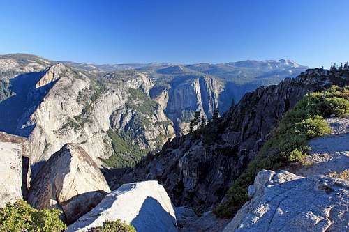
Yosemite Valley from Taft Point
The best time for this hike is around sunrise or sunset when the majestic features contained in the view reach their fullness. These include the Cathedral Spires and Rocks to the west, El Capitan, the Three Brothers, Yosemite Falls and Yosemite Point across the valley. Mt. Hoffman is also prominent high above the north rim off to the right.
Getting There
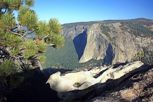
El Capitan from Taft Point
From Wowona go north on Hwy. 41 12 miles and turn right on the Glacier Point Road.
Red Tape
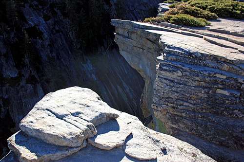
Fissure cliff
Camping
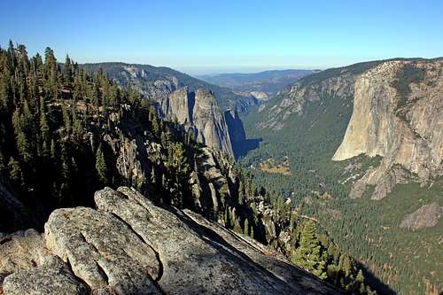
Cathedral Rocks and El Cap from off the Pohono Trail
There are no campgrounds in the Glacier Point area but there are plenty of places in Yosemite Valley. For camping info and reservations click here.
Current weather conditions in Yosemite
For current weather and 5 day forecast click here.Etymology
Taft Point Yosemite 15', Yosemite Valley 1:24,000Named by R.B. Marshall, USGS, for William Howard Taft (1857-1930), 27th president of the United States, 1909-1913, and chief justice of the Supreme Court, 1921-30. (Farquhar:Marshall.) Taft visited Yosemite National Park in the fall of 1909. (YNP)
Place Names of the Sierra Nevada - Peter Browning