Overview
Little-known Harp Mountain is the easiest 5000-footer in the Chugach, a place where a person with only a couple of hours to spare can get up and amongst the bigger peaks. Sun and wind patterns keep most of the regular route snow free most of the year, so this is an excellent choice for a spring warmup or a last hurrah in the fall. The top gives a grandstand view of some of the most exciting crags of Chugach State Park.

Summit Views
![Summit Weather Station]() Looking southeast from the summit (as of 2011, the summit weather station has been removed)
Looking southeast from the summit (as of 2011, the summit weather station has been removed)![Peeking Mountain and Raina Peak]() Northeastward to the peaks above Ram Valley, November. From left to right, the west summit of Peeking Mountain (6330'), the main summit of Peeking Mountain (6925'), and Raina Peak (6795').
Northeastward to the peaks above Ram Valley, November. From left to right, the west summit of Peeking Mountain (6330'), the main summit of Peeking Mountain (6925'), and Raina Peak (6795').![Tail Feather Peak]() Southward toward Tailfeather Peak and its rugged neigbors in Upper Ship Creek. The Kenai Mountains are on the horizon.
Southward toward Tailfeather Peak and its rugged neigbors in Upper Ship Creek. The Kenai Mountains are on the horizon.![Eastward View]() Korohusk, Kiliak, Nantina, and Yukla from the top of Harp Mountain. The hiking crest known as "Eagle River Overlook" is in the foreground.
Korohusk, Kiliak, Nantina, and Yukla from the top of Harp Mountain. The hiking crest known as "Eagle River Overlook" is in the foreground.Getting There
The most direct route up Harp Mountain uses a small trailhead on the east side of the South Fork Eagle River Valley. To reach it, take the Eagle River Loop Road exit from the Glenn Highway and then turn right onto Hiland Road. Follow Hiland Road several miles to its very end, where there is a turnaround. The trail begins from the turnaround circle, just to the left of 252 Hiland Road. In the last couple of years there has been a little sign by the trail indicating "State Park Access." Do not park in the circle; a proliferation of no parking signs will require you to park a short distance up the road.
(For the more circuitous Hanging Valley/southeast ridge access to the peak, use the South Fork Valley Trail trailhead. It's on the west side of the valley. The right turn to this trailhead from Hiland Road is signposted.)
Routes
![West Ridge]() Looking down the west ridge from the top
Looking down the west ridge from the top From the trailhead in the turnaround circle described above, follow a trail of use onto the nearest butress, being careful to avoid posted private land. Continue up the ridge crest to the top, crossing one small intermediate summit along the way. The total elevation gain is 2650 feet (800 meters) over a distance of about 1.8 miles (3 kilometers). There's an intermittent path all the way to the top and the footing is pretty solid; in good conditions, one or two hours will get you all the way to the summit. This route is mapped at the bottom of the page.
Other Routes: Harp Mountain can be hiked from any angle. A nice variant is to start on the
South Fork Valley Trail and make your way into
Hanging Valley, where the camping is magnificent; from there, you can gain the toe of the southeast ridge and follow it (trail at first, then class 2 scrambling) to the top. The south slopes directly above Hanging Valley are also class 2, but less pleasant. Finally, ski and glissade descents of the western bowl are pretty popular.
Camping
Harp Mountain can be part of a worthwhile camping trip when it is accessed by Hanging Valley, mentioned in "other routes" above. When hiking in by this route, it's about four miles from the South Fork Valley Trail trailhead to the best campsites. Campfires are not permitted and very large groups will need a permit.
![South Fork Approach]() Harp mountain in early fall, seen from the entrance to Hanging Valley.
Harp mountain in early fall, seen from the entrance to Hanging Valley.![Southeast Ridge]() The southeast ridge.
The southeast ridge.Red Tape and Cautions
The west ridge trail begins a little short of the park boundary, and uses a right of way. It's important to stay on the trail and in the right of way for the first couple of hundred yards. Adjacent landowners have helped you out with this by posting "Keep Out" signs.
Chugach State Park has few restrictions on hiking, camping, and climbing. As of early 2013 there are no parking fees in this area of the park.
In 2018, a hiker was killed by a grizzly bear on the south flank of Harp Mountain, although not on the exact trail described on this page. Take bear spray and make noise until you are well clear of the brush.
Weather
Weather in the South Fork Valley can be quite different from nearby Anchorage or Eagle River. In fall and winter, temperature inversions are common so that Harp Mountain may offer much warmer conditions than lower elevation hikes. In summer, it often protrudes above the low level marine cloud layer. For current South Fork Valley conditions, check
here. For conditions on a nearby summit (at about 4000 feet), check
here.
Orientation
![West Ridge Trail Map]() The regular west ridge route is shown in red
The regular west ridge route is shown in red![From the Trailhead]() The objective: The top of Harp Mountain as seen from the trailhead
The objective: The top of Harp Mountain as seen from the trailhead

 24065 Hits
 88.14% Score
 26 Votes
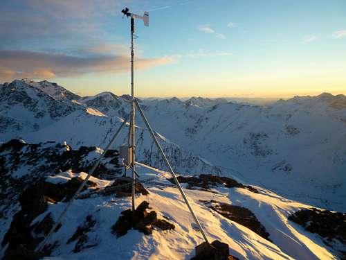 Looking southeast from the summit (as of 2011, the summit weather station has been removed)
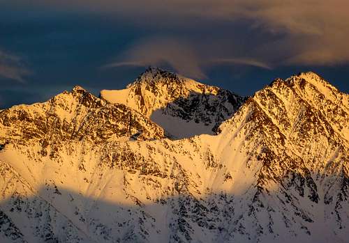 Northeastward to the peaks above Ram Valley, November. From left to right, the west summit of Peeking Mountain (6330'), the main summit of Peeking Mountain (6925'), and Raina Peak (6795').
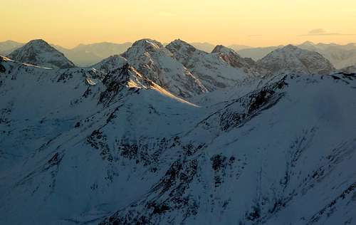 Southward toward Tailfeather Peak and its rugged neigbors in Upper Ship Creek. The Kenai Mountains are on the horizon.
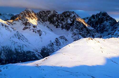 Korohusk, Kiliak, Nantina, and Yukla from the top of Harp Mountain. The hiking crest known as "Eagle River Overlook" is in the foreground.
 Looking down the west ridge from the top
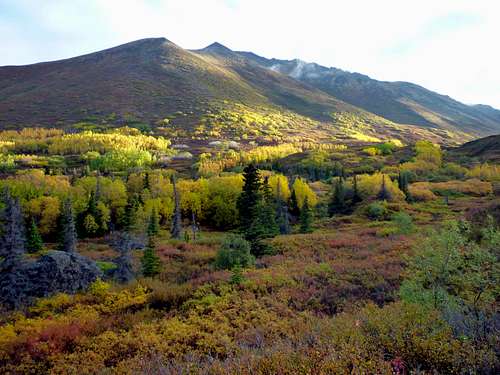 Harp mountain in early fall, seen from the entrance to Hanging Valley.
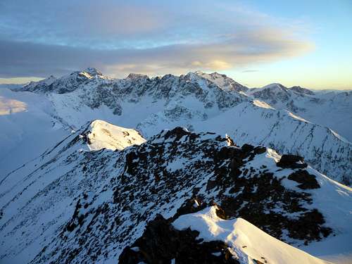 The southeast ridge.
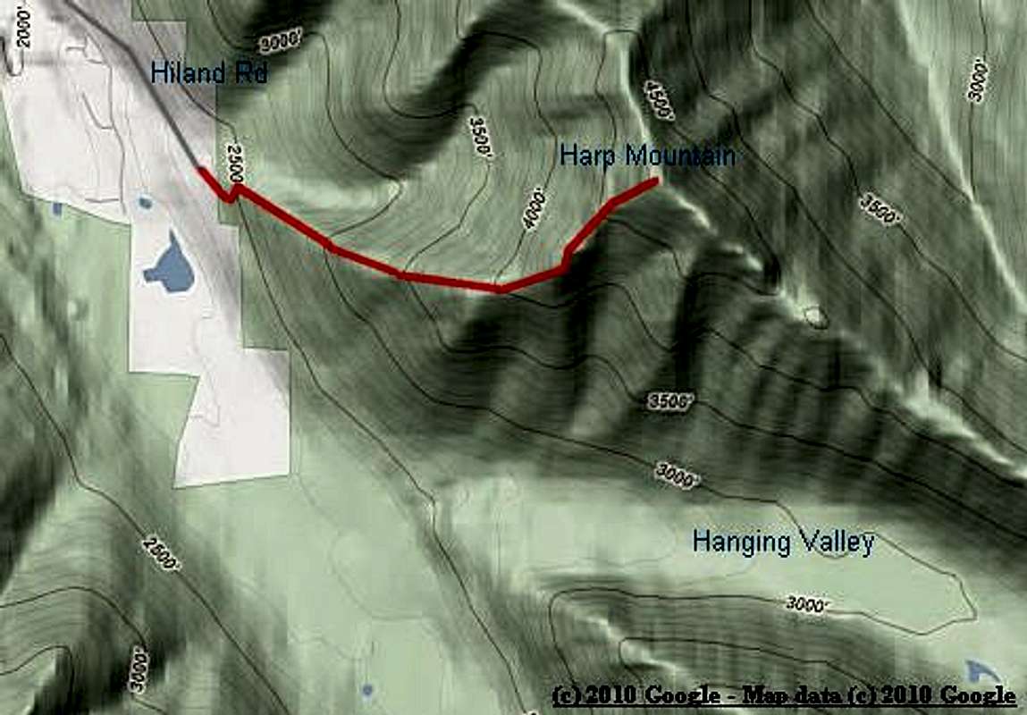 The regular west ridge route is shown in red
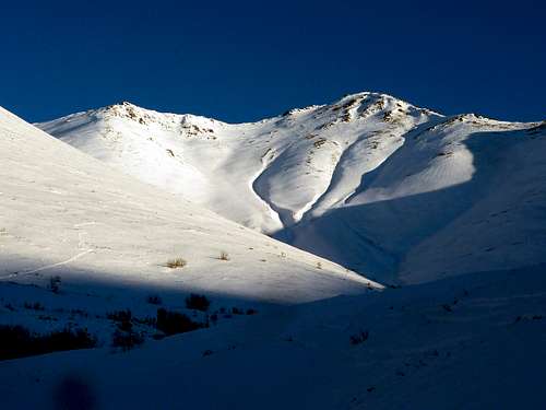 The objective: The top of Harp Mountain as seen from the trailhead
Steve Gruhn - Nov 22, 2010 2:52 pm - Voted 9/10
Nantina PointThe First Edition of the Imus Geographics map incorrectly called it Mantina Point. It is correctly known as Nantina Point.
chugach mtn boy - Nov 22, 2010 3:10 pm - Hasn't voted
Re: Nantina PointGood info, thanks. I've corrected the caption on the main page and various subpages, including this one http://www.summitpost.org/view_object.php?object_id=680262&confirm_post=7 which is the best look an Nantina I've ever gotten.